Category:Satellite pictures of rivers of Canada
Jump to navigation
Jump to search
Subcategories
This category has the following 4 subcategories, out of 4 total.
Media in category "Satellite pictures of rivers of Canada"
The following 6 files are in this category, out of 6 total.
-
 Chaudière River, Canada by Planet Labs.jpg 4,964 × 3,723; 5.93 MB
-
 Detroit mi satellite map.jpg 589 × 854; 367 KB
-
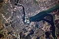
 ISS-63 Ottawa River with Rideau and Gatineau Rivers in Ottawa, Canada.jpg 5,568 × 3,712; 5.21 MB
-
 Niagara falls.jpg 3,060 × 2,036; 2.38 MB
-
 Sault Ste. Marie satellite.jpg 900 × 900; 735 KB
-
 Yukon River, Canada by Planet Labs.jpg 5,743 × 4,307; 5.82 MB


