Category:Satellite pictures of the Mackenzie River
Jump to navigation
Jump to search
Media in category "Satellite pictures of the Mackenzie River"
The following 10 files are in this category, out of 10 total.
-
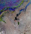
 Great Slave Lake, Landsat 8 2015 (cropped).jpg 5,904 × 5,582; 8.61 MB
-
 Great Slave Lake, Landsat 8 2015.jpg 9,000 × 9,000; 9.76 MB
-
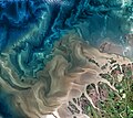
 Mackenzie river enters Beaufort sea.jpg 9,000 × 7,500; 64 MB
-
 Mackenzie River Outflow.jpg 7,600 × 6,800; 91.24 MB
-
 Mackenzie River, Canada ESA23484305.jpeg 6,577 × 7,294; 29.22 MB
-
 Mackenzie River, Canada ESA23484305.tiff 6,577 × 7,294; 137.27 MB
-
 Where Trucks Drive on the River.jpeg 5,356 × 3,571; 14.63 MB
-

-

-

.jpg)


.jpg)
.jpg)
.jpg)