Category:Satellite pictures of the Saint Lawrence River
Jump to navigation
Jump to search
Media in category "Satellite pictures of the Saint Lawrence River"
The following 19 files are in this category, out of 19 total.
-
 2182v1 20180122-StLawrenceB.png 1,920 × 965; 1.41 MB
-
 Ice on the St Lawrence River, Canada.jpg 2,400 × 1,800; 3.98 MB
-
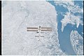
 ISS-27 HTV-2 Canadarm2 and Dextre.jpg 4,288 × 2,848; 1.26 MB
-
 ISS-36 Plankton bloom and Lake Ontario.jpg 2,832 × 4,256; 1.65 MB
-
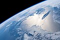 ISS-59 Canada, Gulf of St. Lawrence.jpg 5,568 × 3,712; 2.56 MB
-
 ISS-59 Canada, Saint Lawrence River and Gulf of St. Lawrence.jpg 5,568 × 3,712; 3.17 MB
-
 ISS-59 St. Lawrence River and the Manicouagan Crater, Canada.jpg 5,568 × 3,712; 4.66 MB
-
 ISS016-E-5595 - View of the Province of Quebec.jpg 3,032 × 2,008; 1.38 MB
-
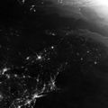
 Montreal at Night - NASA Earth Observatory.jpg 720 × 480; 191 KB
-
 Montreal, Canada - Flickr - NASA Goddard Photo and Video.jpg 1,440 × 960; 605 KB
-
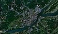 Quebec city-satellite image.jpg 1,920 × 1,154; 375 KB
-
 Quebec province ESA231785.jpg 1,909 × 1,936; 1.58 MB
-
 Quebec province ESA231785.tiff 1,909 × 1,936; 10.98 MB
-
 QuebecSatelliteNASA.jpg 800 × 481; 183 KB
-
 Saint Lawrence River and New England at night in summer 2013.jpg 2,000 × 2,000; 626 KB
-
 Saint Lawrence River SPOT 1298.jpg 500 × 500; 114 KB
-
 St Lawrence River, New Brunswick, Canada (MODIS 2017-04-28).jpg 2,729 × 2,161; 1.04 MB
-
-


.jpg)

