Category:Sandsting
Jump to navigation
Jump to search

civil parish on Mainland, Shetland Islands, Scotland, UK  | |||||
| Upload media | |||||
| Instance of | |||||
|---|---|---|---|---|---|
| Location |
| ||||
| Population |
| ||||
| Area |
| ||||
 | |||||
Subcategories
This category has the following 5 subcategories, out of 5 total.
Media in category "Sandsting"
The following 200 files are in this category, out of 732 total.
(previous page) (next page)-
 A house at Reawick - geograph.org.uk - 5012129.jpg 640 × 480; 132 KB
-
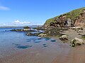
 A less accessible beach round the cliff from Redayre - geograph.org.uk - 6249737.jpg 4,000 × 3,000; 4.61 MB
-
 A Polietes fly, East-the-Voe, Aith - geograph.org.uk - 5048646.jpg 1,024 × 680; 130 KB
-
 A reef near Silwick - geograph.org.uk - 5011374.jpg 640 × 480; 174 KB
-

-
 A Small Quarry - geograph.org.uk - 4755596.jpg 1,600 × 892; 305 KB
-
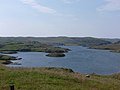
 A view across Sil Wick (bay) - geograph.org.uk - 5011390.jpg 640 × 480; 163 KB
-

-
 Aa Skerry - geograph.org.uk - 2606762.jpg 4,320 × 3,240; 5.27 MB
-
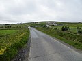
 Abandoned croft house at Westerwick - geograph.org.uk - 5155193.jpg 1,024 × 682; 181 KB
-
 Above Aith Voe - geograph.org.uk - 4010159.jpg 2,048 × 1,536; 1.61 MB
-
 Above the head of Garderhouse Voe - geograph.org.uk - 3473022.jpg 640 × 480; 69 KB
-
 Access Track To Ward of Reawick - geograph.org.uk - 3585288.jpg 2,560 × 1,920; 2.86 MB
-
 Aith Lifeboat Station - geograph.org.uk - 6186745.jpg 1,600 × 1,200; 219 KB
-
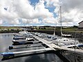 Aith Marina - geograph.org.uk - 5041576.jpg 3,648 × 2,736; 3.9 MB
-
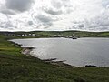 Aith Voe - geograph.org.uk - 5041625.jpg 3,648 × 2,736; 3.77 MB
-
 Another part of Wallacetown - geograph.org.uk - 4755585.jpg 3,688 × 2,256; 1.36 MB
-
 Approaching Stump Farm - geograph.org.uk - 5012134.jpg 640 × 480; 150 KB
-
 Ara Clett Chambered Cairn - geograph.org.uk - 5287753.jpg 1,600 × 1,200; 701 KB
-
 Ayre of Deepdale - geograph.org.uk - 2606591.jpg 4,320 × 3,240; 5.41 MB
-
 Ayre of Deepdale, Shetland - geograph.org.uk - 4991655.jpg 1,600 × 1,200; 619 KB
-
 Ayres of Corse - geograph.org.uk - 3798856.jpg 640 × 480; 232 KB
-
 Ayres of Selivoe - geograph.org.uk - 3471756.jpg 640 × 480; 75 KB
-
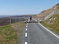
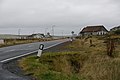
 B9071 - geograph.org.uk - 3833968.jpg 640 × 480; 290 KB
-
 B9071 looking south from Semblister - geograph.org.uk - 3539148.jpg 1,600 × 1,200; 270 KB
-
 B9071 looking towards Bixter - geograph.org.uk - 6141314.jpg 5,202 × 3,465; 2.05 MB
-
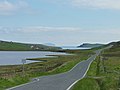
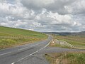 B9071 road - geograph.org.uk - 5041568.jpg 3,648 × 2,736; 4.05 MB
-
 B9071, Aith - geograph.org.uk - 3835552.jpg 640 × 480; 56 KB
-
 Beach and ruined buildings, Sandsound - geograph.org.uk - 4927951.jpg 1,024 × 682; 225 KB
-
 Beach at Punds - geograph.org.uk - 6186792.jpg 1,600 × 1,200; 333 KB
-
 Beach at Sand - geograph.org.uk - 6558507.jpg 2,048 × 1,536; 1.21 MB
-
 Bekka Hill Chambered Cairn - geograph.org.uk - 2612392.jpg 4,320 × 3,240; 4.33 MB
-
 Bekka Hill Spur - geograph.org.uk - 2612465.jpg 4,092 × 2,887; 3.69 MB
-
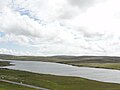
 Berarunies Loch - geograph.org.uk - 2275661.jpg 1,024 × 768; 168 KB
-
 Berarunies Loch SE bay. - geograph.org.uk - 2275649.jpg 1,024 × 768; 141 KB
-
 Berrgutters Summit - geograph.org.uk - 3555409.jpg 2,560 × 1,920; 2.54 MB
-
 Berryknowe - geograph.org.uk - 3795536.jpg 640 × 480; 248 KB
-
 Beside Tresta Voe - geograph.org.uk - 4737569.jpg 3,833 × 2,443; 2.85 MB
-
 Bixter Voe - geograph.org.uk - 5041640.jpg 3,648 × 2,736; 3.27 MB
-
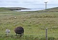 Black ewe with white lamb - geograph.org.uk - 6186027.jpg 1,600 × 1,102; 289 KB
-

-
 Blo Geo - geograph.org.uk - 2612590.jpg 4,320 × 3,240; 5.15 MB
-
 Boat in Olas Voe, near Hestinsetter - geograph.org.uk - 5155671.jpg 1,024 × 682; 127 KB
-
 Bog cotton on Skelda Ness - geograph.org.uk - 5007311.jpg 640 × 480; 186 KB
-
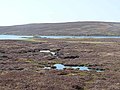
 Bog, Swart Houl - geograph.org.uk - 3795518.jpg 640 × 480; 297 KB
-
 Bog, Tresta - geograph.org.uk - 3798832.jpg 640 × 480; 280 KB
-
 Boggy ground at the head of Olas Voe - geograph.org.uk - 3471737.jpg 640 × 480; 79 KB
-
 Bogs of Burrafirth - geograph.org.uk - 3555140.jpg 640 × 480; 265 KB
-
 Boulderfield, Culswick - geograph.org.uk - 3838004.jpg 640 × 360; 246 KB
-
 Boulders on a hillside above Loch of Westerwick - geograph.org.uk - 5155213.jpg 1,024 × 682; 195 KB
-
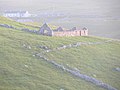
 Bowpund ruin - geograph.org.uk - 2606800.jpg 4,320 × 3,240; 5.46 MB
-
 Bowpund, Skelda Voe - geograph.org.uk - 2860660.jpg 800 × 532; 129 KB
-
 Brace Burn Brig - geograph.org.uk - 2330293.jpg 1,024 × 768; 188 KB
-
 Brattibreck, near Hestinsetter - geograph.org.uk - 5155644.jpg 1,024 × 682; 124 KB
-
 Bridge of Walls over Loch of Brouster Shetland - geograph.org.uk - 5843754.jpg 5,068 × 3,379; 6.15 MB
-
 Bridge over the Burn of Scrooie - geograph.org.uk - 3472692.jpg 640 × 480; 84 KB
-
 Brigalee, Culswick - geograph.org.uk - 5155649.jpg 1,024 × 682; 125 KB
-
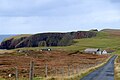
 Brindister Voe - geograph.org.uk - 3488567.jpg 640 × 480; 69 KB
-
 Brindister Voe - skerry - geograph.org.uk - 2610225.jpg 4,320 × 3,240; 5.58 MB
-
 Broch of Culswick - geograph.org.uk - 3837991.jpg 640 × 360; 231 KB
-
 Broch of Culswick - geograph.org.uk - 3837997.jpg 640 × 480; 305 KB
-
 Brough of Culwick - geograph.org.uk - 3837065.jpg 640 × 360; 210 KB
-
 Bruck from the Redd-up at Sandsound - geograph.org.uk - 4927937.jpg 1,024 × 682; 265 KB
-
 Buildings at Vementry, Shetland - geograph.org.uk - 6332829.jpg 1,997 × 1,497; 370 KB
-
 Burga Stacks - geograph.org.uk - 2046818.jpg 2,560 × 1,920; 1.78 MB
-
 Burga Stacks - geograph.org.uk - 3838002.jpg 640 × 360; 203 KB
-
 Burga Stacks - geograph.org.uk - 3838008.jpg 640 × 360; 232 KB
-
 Burial ground at Wester Skeld - geograph.org.uk - 6185885.jpg 1,600 × 1,200; 361 KB
-
 Burn draining Mill Loch - geograph.org.uk - 3488311.jpg 640 × 480; 93 KB
-
 Burn of Atlascord - geograph.org.uk - 2646970.jpg 600 × 800; 119 KB
-
 Burn of Fogrigarth - geograph.org.uk - 5057448.jpg 3,648 × 2,736; 3.95 MB
-
 Burn of Fogrigarth - geograph.org.uk - 5057454.jpg 3,648 × 2,736; 3.79 MB
-
 Burn of Houlland, Bixter - geograph.org.uk - 2130584.jpg 640 × 426; 57 KB
-
 Burn of Lomabak - geograph.org.uk - 5986856.jpg 1,024 × 576; 334 KB
-
 Burn of Lunklet - geograph.org.uk - 3555115.jpg 640 × 480; 259 KB
-
 Burn of Lunklet - geograph.org.uk - 3801904.jpg 640 × 480; 260 KB
-
 Burn of Lunklet - geograph.org.uk - 3801907.jpg 640 × 480; 280 KB
-
 Burn of Scrooie - geograph.org.uk - 3472683.jpg 640 × 480; 78 KB
-
 Burn of Scrooie - geograph.org.uk - 3555265.jpg 640 × 480; 254 KB
-
 Burn of Scrooie - geograph.org.uk - 6186073.jpg 1,600 × 1,200; 315 KB
-
 Burn of Scrooie from the bridge at Easter Skeld - geograph.org.uk - 6249885.jpg 4,000 × 3,000; 4.6 MB
-
 Burn of Sefmoor - geograph.org.uk - 2745340.jpg 800 × 532; 244 KB
-
 Burn of Selivoe - geograph.org.uk - 5993833.jpg 1,800 × 1,013; 997 KB
-
 Burn of Selivoe - geograph.org.uk - 6185950.jpg 1,600 × 1,200; 319 KB
-
 Burn of Skrooie just before entering Skelda Voe - geograph.org.uk - 5155128.jpg 1,024 × 682; 151 KB
-
 Burn of South Brigadale, East Burrafirth - geograph.org.uk - 6659079.jpg 1,600 × 740; 506 KB
-
 Burn of Truggles Water - geograph.org.uk - 2273266.jpg 2,136 × 2,848; 1.38 MB
-
 Burn of Tumblin. Bixter - geograph.org.uk - 2136907.jpg 800 × 533; 228 KB
-
 Burn of Twatt - geograph.org.uk - 5254359.jpg 1,024 × 681; 156 KB
-
 Burn of Twatt - geograph.org.uk - 6186112.jpg 1,600 × 1,088; 213 KB
-
 Burri Geo - geograph.org.uk - 3838041.jpg 640 × 360; 191 KB
-
 Burri Geo - geograph.org.uk - 3839103.jpg 640 × 360; 232 KB
-
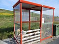 Bus shelter - geograph.org.uk - 3556655.jpg 640 × 480; 291 KB
-
 Bus stop between Easter and Wester Skeld - geograph.org.uk - 5011610.jpg 640 × 480; 170 KB
-
 By the Loch of Sotersta - geograph.org.uk - 2045329.jpg 2,560 × 1,920; 1.8 MB
-
 C. G. Williamson's shop, Bixter - geograph.org.uk - 2130572.jpg 800 × 534; 149 KB
-
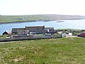
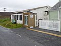 Cafe at East Burrafirth - geograph.org.uk - 6187595.jpg 1,600 × 1,200; 362 KB
-
 Callie Tang - geograph.org.uk - 2605073.jpg 4,320 × 3,240; 5.4 MB
-
 Camping Bod, Easter Skeld - geograph.org.uk - 5858915.jpg 5,184 × 3,456; 7.23 MB
-

-
 Catherine's Water - geograph.org.uk - 2649249.jpg 800 × 600; 132 KB
-

-
-
 Causeway Below Culswick Broch - geograph.org.uk - 2045357.jpg 2,560 × 1,920; 1.77 MB
-
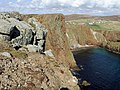 Cliffs at Westerwick - geograph.org.uk - 3931932.jpg 1,400 × 1,050; 642 KB
-
 Cliffs at Westerwick - geograph.org.uk - 5155210.jpg 1,024 × 682; 134 KB
-
 Cliffs on Skelda Ness - geograph.org.uk - 5011504.jpg 480 × 640; 218 KB
-
 Cliffs south west of Westerwick - geograph.org.uk - 6185450.jpg 1,600 × 1,183; 353 KB
-
 Clings Water - geograph.org.uk - 2674874.jpg 800 × 600; 130 KB
-
 Clousta - geograph.org.uk - 3835558.jpg 640 × 480; 49 KB
-
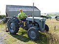 Clousta, a tractor-driving mannequin - geograph.org.uk - 2755419.jpg 640 × 480; 92 KB
-

-
 Clousta, the telephone box - geograph.org.uk - 2755410.jpg 640 × 480; 77 KB
-
 Clousta, Voe of Clousta - geograph.org.uk - 2755415.jpg 640 × 480; 48 KB
-
 Clousta, Voe of Setter - geograph.org.uk - 2755426.jpg 640 × 480; 57 KB
-
 Common Seals at Knoutsie, Skelda Voe - geograph.org.uk - 2860673.jpg 800 × 533; 175 KB
-
 Corklee Hill - geograph.org.uk - 3972529.jpg 2,048 × 1,536; 1.57 MB
-
 Cottage at Toogs - geograph.org.uk - 3472703.jpg 640 × 480; 59 KB
-
 Cotton grass near Stanydale - geograph.org.uk - 3556670.jpg 640 × 480; 272 KB
-
 Cottongrass and Foula - geograph.org.uk - 5011528.jpg 640 × 480; 137 KB
-
 Cottongrass at Scarvister - geograph.org.uk - 5011607.jpg 640 × 480; 205 KB
-
 Cottongrass at Sil Wick - geograph.org.uk - 5011397.jpg 640 × 480; 212 KB
-
 Cove Below Sotersta - geograph.org.uk - 2046828.jpg 2,560 × 1,920; 1.67 MB
-
 Craba Skerry and Reawick Beach - geograph.org.uk - 6249740.jpg 4,000 × 3,000; 4.77 MB
-
 Crags near Broch of Culswick - geograph.org.uk - 3838000.jpg 640 × 360; 223 KB
-
 Crags, The Nev - geograph.org.uk - 3838032.jpg 640 × 360; 234 KB
-
 Creative recycling at Brindister - geograph.org.uk - 3488600.jpg 640 × 480; 80 KB
-
 Creative recycling at Brindister - geograph.org.uk - 3488605.jpg 640 × 480; 78 KB
-
 Croag Lee Homestead - geograph.org.uk - 2612504.jpg 4,320 × 3,240; 5.31 MB
-
 Croft at Collaster - geograph.org.uk - 5987090.jpg 1,024 × 576; 169 KB
-
 Croftland, Stanydale - geograph.org.uk - 3556664.jpg 640 × 480; 255 KB
-
 Crofts overlooking East Burra Firth - geograph.org.uk - 6186796.jpg 1,600 × 1,027; 229 KB
-
 Crogran - geograph.org.uk - 3555286.jpg 640 × 430; 254 KB
-
 Crossroads, Gruting - geograph.org.uk - 3555097.jpg 640 × 480; 186 KB
-
 Crös of the Voil - geograph.org.uk - 5986888.jpg 1,024 × 576; 316 KB
-
 Crös of the Voil from east - geograph.org.uk - 5986899.jpg 1,024 × 576; 276 KB
-
 Da Gairdens o' Sand - geograph.org.uk - 5154563.jpg 1,024 × 682; 143 KB
-
 Da Gairdins i Sand - geograph.org.uk - 2612837.jpg 4,320 × 3,240; 5.29 MB
-
 Da Gairdins i Sand - geograph.org.uk - 3931945.jpg 1,400 × 1,050; 861 KB
-
 Da Wirlie, near Bridge of Walls - geograph.org.uk - 5155767.jpg 1,024 × 682; 173 KB
-
 Daa Skerry - geograph.org.uk - 2606480.jpg 4,320 × 3,240; 5.51 MB
-
 Daa Skerry - geograph.org.uk - 5837485.jpg 3,800 × 2,400; 2.07 MB
-
 Deep Dale ruins - geograph.org.uk - 2606528.jpg 4,320 × 3,240; 5.31 MB
-
 Derelict croft - geograph.org.uk - 6185946.jpg 1,600 × 1,093; 205 KB
-
 Derelict walls and buildings - geograph.org.uk - 6185121.jpg 1,600 × 1,200; 186 KB
-
 Descent from Fogrigarth - geograph.org.uk - 3487132.jpg 640 × 480; 91 KB
-
 Descent of Scalla Field - geograph.org.uk - 3555134.jpg 640 × 480; 241 KB
-
 Ditch at Semblister - geograph.org.uk - 3473033.jpg 640 × 480; 76 KB
-
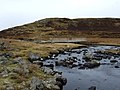
 Djuba Water - geograph.org.uk - 2675332.jpg 800 × 600; 158 KB
-
 Dry Stane Dykes, Sotersta - geograph.org.uk - 2046843.jpg 2,560 × 1,920; 1.75 MB
-
 Dry-stone wall and beach at Sil Wick - geograph.org.uk - 5011389.jpg 640 × 480; 202 KB
-
 Dry-stone wall on Skelda Ness - geograph.org.uk - 5011377.jpg 640 × 480; 203 KB
-
 Due South - geograph.org.uk - 2606745.jpg 4,320 × 3,240; 5.56 MB
-
 Dutch Ward - geograph.org.uk - 3553681.jpg 2,560 × 1,920; 2.8 MB
-
 Dwellings Around Garderhouse Voe - geograph.org.uk - 3585314.jpg 2,560 × 1,920; 3.02 MB
-
 East Burra Firth - geograph.org.uk - 4006780.jpg 2,048 × 1,536; 600 KB
-
 East Burrafirth - geograph.org.uk - 5057487.jpg 3,648 × 2,736; 4.02 MB
-

-
 East end of Hulma Water, west of Bixter - geograph.org.uk - 5155789.jpg 1,024 × 682; 170 KB
-
 East Hill of Burrafirth - geograph.org.uk - 3554327.jpg 2,560 × 1,920; 3.08 MB
-
 East-the-Voe, Aith - geograph.org.uk - 5045292.jpg 1,024 × 681; 184 KB
-
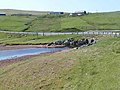
 Easter Skeld Marina - geograph.org.uk - 5011639.jpg 640 × 480; 194 KB
-
 Easter Skeld slipway - geograph.org.uk - 5837341.jpg 4,480 × 2,800; 2.2 MB
-

-
 Effirth - geograph.org.uk - 5012161.jpg 640 × 480; 194 KB
-
 Effirth Voe - geograph.org.uk - 6141312.jpg 5,202 × 3,465; 2.51 MB
-
 Effirth Voe looking southwards from B9071 - geograph.org.uk - 6141313.jpg 5,202 × 3,465; 2.85 MB
-
 Effirth, postbox № ZE2 58, Roadside - geograph.org.uk - 2551757.jpg 640 × 480; 68 KB
-
 Eid Community Co-operative Ltd, Aith - geograph.org.uk - 5045288.jpg 1,024 × 682; 137 KB
-
 Enigmatic cairn - geograph.org.uk - 4010129.jpg 1,536 × 2,048; 964 KB
-
 Entering Bixter - geograph.org.uk - 2130575.jpg 800 × 534; 155 KB
-
 Farm above Garderhouse Voe - geograph.org.uk - 3473001.jpg 640 × 480; 70 KB
-
 Farm road to Hockland - geograph.org.uk - 3472617.jpg 640 × 480; 82 KB
-
 Farm Shed Near Aith - geograph.org.uk - 3553725.jpg 2,560 × 1,920; 2.6 MB
-
 Farm track on the Hill of Gruting - geograph.org.uk - 3471762.jpg 640 × 480; 69 KB
-
 Farmland beside Aith Voe - geograph.org.uk - 3833981.jpg 640 × 480; 259 KB
-
 Fascinating fencing - geograph.org.uk - 2606696.jpg 4,320 × 3,240; 5.51 MB
-
 Fence on Ladie Hill, near Gruting - geograph.org.uk - 5155727.jpg 1,024 × 682; 164 KB
-
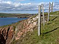
 Fence on Skelda Ness - geograph.org.uk - 5010542.jpg 640 × 480; 179 KB
-
 Fence, Loch of the Brough - geograph.org.uk - 3837089.jpg 640 × 360; 186 KB
-
 Fence, Ward of Browland - geograph.org.uk - 3556642.jpg 640 × 480; 297 KB
-
 Field at Laxaburn - geograph.org.uk - 3472954.jpg 640 × 480; 81 KB
-

-
 Fields beyond Haa of Sand - geograph.org.uk - 5154696.jpg 1,024 × 682; 147 KB
-
 Fields, Leeans - geograph.org.uk - 3795527.jpg 640 × 480; 247 KB
-

-
 Fish Farm - geograph.org.uk - 5041557.jpg 3,648 × 2,736; 3.7 MB
-
 Fish farm debris - geograph.org.uk - 2605453.jpg 4,320 × 3,240; 5.54 MB
-
 Fish farm in Bridister Voe - geograph.org.uk - 3488573.jpg 640 × 480; 60 KB
-
 Fishing boat in West Burra Firth - geograph.org.uk - 3487094.jpg 640 × 480; 83 KB
-
 Flae Geos, near Reawick, from the air - geograph.org.uk - 5763543.jpg 1,024 × 683; 193 KB
-
 Flat land beside Vemna Ward, near Skeld - geograph.org.uk - 2860631.jpg 800 × 532; 161 KB
-
 Football ground, Aith - geograph.org.uk - 3835550.jpg 640 × 480; 58 KB
-
 Fora Ness access gateway - geograph.org.uk - 2612557.jpg 4,320 × 3,240; 5.41 MB
-
 Fora Ness from the air - geograph.org.uk - 6323073.jpg 1,600 × 1,067; 366 KB
-
 Fora Ness Lochan - geograph.org.uk - 2612523.jpg 4,320 × 3,240; 5.2 MB
-
 Fora Ness looking out over Sand Voe - geograph.org.uk - 6558527.jpg 2,048 × 1,536; 965 KB
-
 Fora Ness stock wall - geograph.org.uk - 2612535.jpg 4,320 × 3,240; 5.68 MB
-
 Fora Ness, from the air - geograph.org.uk - 5763553.jpg 1,024 × 829; 171 KB
-
 Fore Holm - geograph.org.uk - 2614587.jpg 4,156 × 3,138; 4.55 MB


_-_geograph.org.uk_-_5011390.jpg)


