Category:Skeld
Jump to navigation
Jump to search
English: Skeld, (, Shield or shelter) are villages on the south side of the West Shetland Mainland. The main village is called to as Easter Skeld, while the western end of the settlement, about a mile away, is known as Wester Skeld. The council housing estate in Skeld is called Grindybrecks.
Polski: Skeld ( staronordyjski: Skjolðr=tarcza lub schron) jest to miasteczko na południowym krańcu części zachodniej głównej wyspy Szetlandów. Główne miasto jest również nazywane Wchodnim Skeldem, a zachodni koniec, oddalalony o ok. 1,5 km, Zachodnim Skeldem. Mieszkania kwaterunkowe są tu nazywane "Grindybrecks".
villages in the Shetland Islands, Scotland, UK  | |||||
| Upload media | |||||
| Instance of |
| ||||
|---|---|---|---|---|---|
| Location |
| ||||
 | |||||
Subcategories
This category has the following 2 subcategories, out of 2 total.
E
- Easter Skeld (11 F)
W
- Wester Skeld (18 F)
Media in category "Skeld"
The following 37 files are in this category, out of 37 total.
-

-
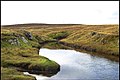 Burn Outlet - geograph.org.uk - 567879.jpg 640 × 429; 95 KB
-
 Colourful foreshore at Skeld - geograph.org.uk - 4311441.jpg 1,024 × 702; 165 KB
-
 Common Seals at Knoutsie, Skelda Voe - geograph.org.uk - 2860673.jpg 800 × 533; 175 KB
-
 Cutting peat - geograph.org.uk - 479809.jpg 640 × 480; 143 KB
-
 Geomorphology in miniature - geograph.org.uk - 578378.jpg 640 × 426; 61 KB
-
 Gossa Water - geograph.org.uk - 532981.jpg 640 × 480; 61 KB
-
 Head of Skelda Voe - geograph.org.uk - 2860645.jpg 800 × 532; 173 KB
-
 Hoga Ness from chambered cairn - geograph.org.uk - 1409691.jpg 640 × 480; 59 KB
-
 Hoganess road junction - geograph.org.uk - 532999.jpg 640 × 480; 60 KB
-
 Houses and gardens at Sand - geograph.org.uk - 578405.jpg 640 × 426; 71 KB
-
 Innersand - geograph.org.uk - 578399.jpg 426 × 640; 65 KB
-
 Lambigarth - geograph.org.uk - 479846.jpg 640 × 474; 159 KB
-
 Lunga Water - geograph.org.uk - 479843.jpg 640 × 488; 148 KB
-
 Mosshouse - geograph.org.uk - 578359.jpg 640 × 426; 45 KB
-
 Mouth of Skelda Voe - geograph.org.uk - 2860670.jpg 800 × 532; 137 KB
-

-
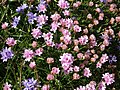 Pink and blue - geograph.org.uk - 479795.jpg 640 × 480; 193 KB
-
 Postbox at the Sand road junction - geograph.org.uk - 532780.jpg 640 × 480; 103 KB
-
 Road junction - geograph.org.uk - 479806.jpg 640 × 486; 158 KB
-
 Rock formation - geograph.org.uk - 538602.jpg 640 × 426; 76 KB
-
 Sand beach - geograph.org.uk - 578411.jpg 640 × 426; 57 KB
-
 Sheep on the road - geograph.org.uk - 479816.jpg 640 × 480; 137 KB
-
 Skeld - geograph.org.uk - 148364.jpg 640 × 392; 61 KB
-
 Skeld IMG 4220 (21790658476).jpg 4,103 × 2,178; 4.08 MB
-
 Skeld marina - geograph.org.uk - 2860667.jpg 800 × 532; 175 KB
-
 Skeld Marina from the school - geograph.org.uk - 2860648.jpg 800 × 532; 186 KB
-
 Skeld Marina IMG 4218 (21628654540).jpg 4,272 × 2,385; 3.9 MB
-
 Skeld Primary School - geograph.org.uk - 2860662.jpg 640 × 426; 60 KB
-
 Skeld Primary School - geograph.org.uk - 6186028.jpg 1,600 × 1,137; 320 KB
-
 Spume and walkers on Sand beach - geograph.org.uk - 578392.jpg 426 × 640; 46 KB
-
 Stanypunds - geograph.org.uk - 479772.jpg 640 × 488; 165 KB
-
 The harbour at Skeld - geograph.org.uk - 1061087.jpg 640 × 481; 63 KB
-
 The harbour at Skeld - geograph.org.uk - 1061094.jpg 640 × 481; 74 KB
-
 The marina at Easter Skeld - geograph.org.uk - 3472665.jpg 640 × 480; 77 KB
-
 The road to Easter Skeld - geograph.org.uk - 5011473.jpg 640 × 480; 143 KB
-
 Turn-off for Skeld Primary School - geograph.org.uk - 6186029.jpg 1,600 × 908; 197 KB


.jpg)


.jpg)


