Category:SVG maps of municipalities of Navarre
Jump to navigation
Jump to search
Autonomous communities of Spain: Balearic Islands · Cantabria · Catalonia · Community of Madrid · Navarre · Autonomous cities:
Provinces of Spain: Álava · Balearic Islands‡ · Cantabria‡ · Gipuzkoa · Guadalajara · Madrid‡ · Navarre‡ · Autonomous cities:
‡: uniprovincial autonomous communities.
‡: uniprovincial autonomous communities.
Media in category "SVG maps of municipalities of Navarre"
The following 194 files are in this category, out of 194 total.
-
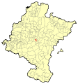
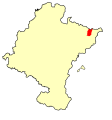
 Navarra - Mapa municipal.svg 744 × 797; 646 KB
-
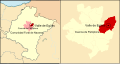
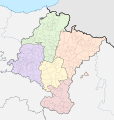 Navarra-merindades y municipios.svg 512 × 538; 447 KB
-
 Local elections navarre 2011.svg 744 × 797; 727 KB
-
 Local elections navarre 2015.svg 744 × 797; 727 KB
-
 Navarra - Mapa municipal Abaigar.svg 744 × 797; 740 KB
-
 Navarra - Mapa municipal Abarzuza.svg 744 × 797; 740 KB
-
 Navarra - Mapa municipal Abaurrea Alta.svg 744 × 797; 740 KB
-
 Navarra - Mapa municipal Abaurrea Baja.svg 744 × 797; 740 KB
-
 Navarra - Mapa municipal Aberin.svg 744 × 797; 740 KB
-
 Navarra - Mapa municipal Ablitas.svg 744 × 797; 740 KB
-
 Navarra - Mapa municipal Adios.svg 744 × 797; 740 KB
-
 Navarra - Mapa municipal Aguilar de Codes.svg 744 × 797; 740 KB
-
 Navarra - Mapa municipal Aibar.svg 744 × 797; 740 KB
-
 Navarra - Mapa municipal Allin.svg 744 × 797; 740 KB
-
 Navarra - Mapa municipal Allo.svg 744 × 797; 740 KB
-
 Alta+Baja Navarra - Mapa municipal.svg 744 × 927; 668 KB
-
 Navarra - Mapa municipal Alsasua.svg 744 × 797; 740 KB
-
 Navarra - Mapa municipal Amescoa Baja.svg 744 × 797; 740 KB
-
 Navarra - Mapa municipal Ancin.svg 744 × 797; 740 KB
-
 Navarra - Mapa municipal Andosilla.svg 744 × 797; 740 KB
-
 Navarra - Mapa municipal Añorbe.svg 744 × 797; 740 KB
-
 Navarra - Mapa municipal Ansoain.svg 744 × 797; 740 KB
-
 Navarra - Mapa municipal Ansoáin.svg 4,601 × 2,367; 1.15 MB
-
 Navarra - Mapa municipal Anue.svg 744 × 797; 740 KB
-
 Navarra - Mapa municipal Aoiz.svg 744 × 797; 645 KB
-
 Navarra - Mapa municipal Aoiz2.svg 4,598 × 2,363; 1.29 MB
-
 Navarra - Mapa municipal Araitz.svg 744 × 797; 645 KB
-
 Navarra - Mapa municipal Arakil.svg 744 × 797; 645 KB
-
 Navarra - Mapa municipal Aranarache.svg 744 × 797; 645 KB
-
 Navarra - Mapa municipal Aranguren.svg 744 × 797; 645 KB
-
 Navarra - Mapa municipal Valle de Aranguren.svg 1,659 × 888; 938 KB
-
 Navarra - Mapa municipal Arano.svg 744 × 797; 645 KB
-
 Navarra - Mapa municipal Aranaz.svg 744 × 797; 645 KB
-
 Navarra - Mapa municipal Arguedas.svg 744 × 797; 860 KB
-
 Navarra - Mapa municipal Artajona.svg 744 × 797; 740 KB
-
 Navarra - Mapa municipal Burguete.svg 744 × 797; 645 KB
-
 Navarra - Mapa municipal Azagra.svg 744 × 797; 645 KB
-
 Navarra - Mapa municipal Bakaiku.svg 744 × 797; 645 KB
-
 Navarra - Mapa municipal Barañáin.svg 744 × 797; 645 KB
-
 Navarra - Mapa municipal Barañáin2.svg 512 × 271; 1.33 MB
-
 Navarra - Mapa municipal Barasoain.svg 744 × 797; 729 KB
-
 Navarra - Mapa municipal Bargota.svg 744 × 797; 645 KB
-
 Navarra - Mapa municipal Baztan.svg 744 × 797; 740 KB
-
 Navarra-loc-Baztán.svg 512 × 538; 415 KB
-
 Navarra - Mapa municipal Beintza-Labaien.svg 744 × 797; 645 KB
-
 Navarra - Mapa municipal Bera.svg 744 × 797; 663 KB
-
 Navarra - Mapa municipal Beriáin.svg 1,659 × 888; 938 KB
-
 Navarra - Mapa municipal Berioplano.svg 1,659 × 888; 938 KB
-
 Navarra - Mapa municipal Berriozar.svg 1,659 × 888; 937 KB
-
 Navarra - Mapa municipal Bertizarana.svg 744 × 797; 645 KB
-
 Navarra - Mapa municipal Bidaurreta.svg 744 × 797; 860 KB
-
 Navarra - Mapa municipal Buñuel.svg 744 × 797; 860 KB
-
 Navarra - Mapa municipal Burgui.svg 744 × 797; 645 KB
-
 Navarra - Mapa municipal Burlada 2.svg 1,659 × 888; 938 KB
-
 Navarra - Mapa municipal Burlada.svg 744 × 797; 646 KB
-
 Navarra - Mapa municipal Caparroso.svg 744 × 797; 645 KB
-
 Navarra - Mapa municipal Cascante.svg 744 × 797; 860 KB
-
 Navarra - Mapa municipal Caseda.svg 744 × 797; 645 KB
-
 Navarra - Mapa municipal Castillonuevo.svg 744 × 797; 645 KB
-
 Navarra - Mapa municipal Cintruenigo.svg 744 × 797; 645 KB
-
 Navarra - Mapa municipal Ciriza.svg 744 × 797; 860 KB
-
 Cizur-loc.svg 512 × 428; 544 KB
-
 Navarra - Mapa municipal Cizur.svg 1,659 × 888; 940 KB
-
 Localización- Navarra Corella.svg 4,598 × 2,363; 1.13 MB
-
 Navarra - Mapa municipal Corella.svg 744 × 797; 645 KB
-
 Navarra - Mapa municipal Desojo.svg 744 × 797; 646 KB
-
 Navarra - Mapa municipal Dicastillo.svg 744 × 797; 646 KB
-
 Dicastillo-loc.svg 744 × 797; 654 KB
-
 Navarra - Mapa municipal Donamaria.svg 744 × 797; 646 KB
-
 Navarra - Mapa municipal Santesteban.svg 4,606 × 2,373; 1.35 MB
-
 Navarra - Mapa municipal Echarri.svg 744 × 797; 646 KB
-
 Navarra - Mapa municipal Elgorriaga.svg 744 × 797; 646 KB
-
 Navarra - Mapa municipal Eneriz.svg 744 × 797; 646 KB
-
 Navarra - Mapa municipal Eratsun.svg 744 × 797; 646 KB
-
 Navarra - Mapa municipal Ergoiena.svg 744 × 797; 646 KB
-
 Navarra - Mapa municipal Estella.svg 744 × 797; 645 KB
-
 Navarra - Mapa municipal Estella2.svg 4,605 × 2,366; 1.29 MB
-
 Navarra - Mapa municipal Etxalar.svg 744 × 797; 646 KB
-
 Navarra - Mapa municipal Etxarri.svg 744 × 797; 860 KB
-
 Navarra - Mapa municipal Etxarri-Aranatz.svg 744 × 797; 646 KB
-
 Navarra - Mapa municipal Etxauri.svg 1,659 × 888; 938 KB
-
 Navarra - Mapa municipal Eulate.svg 744 × 797; 860 KB
-
 Navarra - Mapa municipal Ezcabarte.svg 1,659 × 888; 938 KB
-
 Navarra - Mapa municipal Ezkurra.svg 744 × 797; 646 KB
-
 Navarra - Mapa municipal Falces.svg 744 × 797; 645 KB
-
 Navarra - Mapa municipal Fitero.svg 744 × 797; 860 KB
-
 Navarra - Mapa municipal Fontellas.svg 744 × 797; 645 KB
-
 Navarra - Mapa municipal Funes.svg 744 × 797; 860 KB
-
 Galar-loc.svg 512 × 623; 680 KB
-
 Navarra - Mapa municipal Galar.svg 1,659 × 888; 938 KB
-
 Navarra - Mapa municipal Gallipienzo.svg 4,598 × 2,363; 1.3 MB
-
 Navarra - Mapa municipal Garde.svg 744 × 797; 645 KB
-
 Navarra - Mapa municipal Garinoain.svg 744 × 797; 645 KB
-
 Navarra - Mapa municipal Garralda.svg 744 × 797; 645 KB
-
 Navarra - Mapa municipal Guirguillano.svg 744 × 797; 860 KB
-
 Navarra - Mapa municipal Huarte.svg 512 × 271; 1.32 MB
-
 Navarra - Mapa municipal Igantzi.svg 744 × 797; 646 KB
-
 Navarra - Mapa municipal Igúzquiza.svg 1,729 × 1,773; 1.02 MB
-
 Navarra - Mapa municipal Isaba.svg 744 × 797; 645 KB
-
 Navarra - Mapa municipal Iza.svg 744 × 797; 645 KB
-
 Navarra - Mapa municipal Juslapeña.svg 1,659 × 888; 938 KB
-
 Navarra - Mapa municipal Lana.svg 744 × 797; 860 KB
-
 Navarra - Mapa municipal Larraga.svg 744 × 797; 860 KB
-
 Navarra-loc-Larraún.svg 512 × 538; 415 KB
-
 Navarra - Mapa municipal Legarda.svg 744 × 797; 860 KB
-
 Navarra - Mapa municipal Leitza.svg 744 × 797; 860 KB
-
 Navarra - Mapa municipal Lekunberri.svg 744 × 797; 645 KB
-
 Navarra - Mapa municipal Leoz.svg 744 × 797; 740 KB
-
 Navarra - Mapa municipal Lesaka.svg 744 × 797; 646 KB
-
 Navarra - Mapa municipal Liédena.svg 744 × 797; 860 KB
-
 Local elections navarre 2019.svg 794 × 850; 519 KB
-
 Local elections navarre 2023.svg 794 × 850; 520 KB
-
 Localización del valle de la Burunda.svg 744 × 797; 860 KB
-
 Navarra - Mapa municipal Lónguida.svg 744 × 797; 860 KB
-
 Navarra - Mapa municipal Los Arcos.svg 744 × 797; 645 KB
-
 Navarra - Mapa municipal Luquin.svg 744 × 797; 645 KB
-
 Navarra - Mapa municipal Mañeru.svg 744 × 797; 755 KB
-
 Mapa Valdorba.svg 744 × 797; 681 KB
-
 Navarra - Mapa municipal Marañón.svg 744 × 797; 645 KB
-
 Navarra - Mapa municipal Mélida.svg 744 × 797; 755 KB
-
 Navarra - Mapa municipal Mendavia.svg 4,605 × 2,366; 1.28 MB
-
 Navarra - Mapa municipal Milagro.svg 744 × 797; 860 KB
-
 Milagro-loc.svg 744 × 797; 654 KB
-
 Navarra - Mapa municipal Mirafuentes.svg 744 × 797; 860 KB
-
 Navarra - Mapa municipal Miranda de Arga.svg 744 × 797; 645 KB
-
 Navarra - Mapa municipal Monreal.svg 744 × 797; 740 KB
-
 Monreal-loc.svg 744 × 797; 654 KB
-
 Navarra municipios Monteagudo.PNG 560 × 600; 105 KB
-
 Municipios de Navarra que mugan con Aragón.svg 512 × 538; 416 KB
-
 Navarra - Mapa municipal Murillo el Cuende.svg 4,607 × 2,375; 1.11 MB
-
 Navarra - Mapa municipal Murillo el Fruto.svg 744 × 797; 755 KB
-
 Muruzabal-loc.svg 744 × 797; 655 KB
-
 Navarra - Mapa municipal Facerías.svg 744 × 797; 653 KB
-
 Navarra - Mapa municipal Nazar.svg 744 × 797; 646 KB
-
 Navarra - Mapa municipal Noáin-Valle de Elorz.svg 1,659 × 888; 938 KB
-
 Obanos-loc.svg 744 × 797; 654 KB
-
 Navarra - Mapa municipal Olaibar.svg 1,659 × 888; 938 KB
-
 Navarra - Mapa municipal Olite.svg 744 × 797; 645 KB
-
 Navarra - Mapa municipal Olite2.svg 4,607 × 2,375; 1.1 MB
-
 Navarra - Mapa municipal Oloriz.svg 744 × 797; 740 KB
-
 Olóriz-loc.svg 512 × 423; 423 KB
-
 Navarra - Mapa municipal Olza.svg 1,659 × 888; 938 KB
-
 Navarra - Mapa municipal Orisoain.svg 744 × 797; 740 KB
-
 Navarra - Mapa municipal Orcoien.svg 1,659 × 888; 938 KB
-
 Navarra - Mapa municipal Roncesvalles.svg 375 × 404; 668 KB
-
 Navarra - Mapa municipal Oteiza.svg 744 × 797; 651 KB
-
 Loc pamplona.svg 4,601 × 2,367; 1.16 MB
-
 Navarra - Mapa municipal Pamplona.svg 1,659 × 888; 938 KB
-
 Navarra - Mapa municipal Peralta.svg 744 × 797; 645 KB
-
 Navarra - Mapa municipal Petilla de Aragón.svg 744 × 797; 645 KB
-
 Navarra - Mapa municipal Pitillas.svg 744 × 797; 860 KB
-
 Puente La Reina NAVARRA-loc.svg 744 × 797; 655 KB
-
 Navarra - Mapa municipal Puente la Reina.svg 744 × 797; 645 KB
-
 Navarra - Mapa municipal Pueyo.svg 744 × 797; 740 KB
-
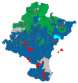 Regional election navarre 2007.svg 744 × 797; 758 KB
-
 Navarra - Mapa municipal Ribaforada.svg 744 × 797; 645 KB
-
 Navarra - Mapa municipal Romanzado.svg 744 × 797; 646 KB
-
 Navarra - Mapa municipal Roncal.svg 744 × 797; 740 KB
-
 Navarra - Mapa municipal San Adrián.svg 744 × 797; 860 KB
-
 Navarra - Mapa municipal San Martín de Unx.svg 744 × 797; 860 KB
-
 Navarra - Mapa municipal Sangüesa.svg 4,598 × 2,363; 1.32 MB
-
 Navarra - Mapa municipal Santacara.svg 744 × 797; 645 KB
-
 Navarra - Mapa municipal Sumbilla.svg 744 × 797; 860 KB
-
 Navarra - Mapa municipal Tafalla.svg 744 × 797; 646 KB
-
 Navarra - Mapa municipal Tafalla2.svg 4,607 × 2,375; 1.11 MB
-
 Navarra - Mapa municipal Tiebas-Muru Artederreta.svg 744 × 797; 646 KB
-
 Navarra - Mapa municipal Tiebas-Muruarte de Reta.svg 1,659 × 888; 938 KB
-
 Navarra - Mapa municipal Tirapu.svg 744 × 797; 860 KB
-
 Navarra - Mapa municipal Torralba del Río.svg 744 × 797; 860 KB
-
 Navarra - Mapa municipal Tudela.svg 744 × 797; 645 KB
-
 Navarra - Mapa municipal Tudela2.svg 4,598 × 2,363; 1.15 MB
-
 Navarra - Mapa municipal Unzue.svg 744 × 797; 740 KB
-
 Navarra - Mapa Urbasa.svg 744 × 797; 651 KB
-
 Navarra - Mapa municipal Urdiain.svg 744 × 797; 753 KB
-
 Navarra - Mapa municipal Uztárroz.svg 744 × 797; 860 KB
-
 Navarra - Mapa municipal Valcarlos.svg 744 × 797; 735 KB
-
 Navarra - Mapa municipal Valdorba.svg 744 × 797; 731 KB
-
 Navarra - Mapa municipal Egüés.svg 744 × 797; 646 KB
-
 Navarra - Mapa municipal Valle de Egüés.svg 512 × 271; 1.33 MB
-
 Valle de Egüés-loc.svg 512 × 456; 408 KB
-
 Navarra - Mapa municipal Valtierra.svg 744 × 797; 860 KB
-
 Localización-Navarra Viana.svg 4,605 × 2,366; 1.28 MB
-
 Navarra municipalities Viana.svg 744 × 797; 753 KB
-
 Navarra - Mapa municipal Villafranca.svg 744 × 797; 754 KB
-
 Villafranca-loc.svg 744 × 797; 654 KB
-
 Villamayor de Monjardín-loc.svg 744 × 797; 654 KB
-
 Navarra - Mapa municipal Villava.svg 1,659 × 888; 937 KB
-
 Navarra - Mapa municipal Yerri.svg 744 × 797; 645 KB
-
 Navarra - Mapa municipal Zabalza.svg 1,659 × 888; 938 KB
-
 Navarra (Ziordia).svg 744 × 797; 663 KB
-
 Navarra - Mapa municipal Zizur Mayor.svg 512 × 271; 1.32 MB
-
 Zubietaren kokapena Nafarroan.svg 744 × 797; 652 KB
-
 Navarra - Mapa municipal Zugarramurdi.svg 744 × 797; 860 KB
-
 Navarra (Zúñiga).svg 744 × 797; 663 KB


.svg)


.svg)