Category:SVG maps of Navarre
Jump to navigation
Jump to search
Autonomous communities of Spain: Andalusia · Aragon · Asturias · Balearic Islands · Basque Autonomous Community · Canary Islands · Cantabria · Castile and León · Castilla–La Mancha · Catalonia · Extremadura · Galicia · Community of Madrid · Region of Murcia · Navarre · La Rioja · Valencian Community · Autonomous cities: Ceuta · Melilla

Subcategories
This category has only the following subcategory.
M
Media in category "SVG maps of Navarre"
The following 57 files are in this category, out of 57 total.
-
 Navarra.svg 744 × 797; 23 KB
-
 Aezkoako mapa herrien izenekin.svg 650 × 870; 25 KB
-
 Aezkoaren kokapena Euskal Herrian eta mapa mutua.svg 1,144 × 927; 1.42 MB
-
 Carreteras de Navarra.svg 512 × 552; 2.48 MB
-
 Comarca de Tafalla.svg 223 × 191; 28 KB
-
 Comarca Rocal-Salazar.svg 471 × 515; 261 KB
-
 Comunidad bardenas reales.svg 744 × 797; 652 KB
-
 Conquista de Navarra cy.svg 598 × 482; 454 KB
-
 DO Navarra locator map.svg 800 × 1,000; 5.38 MB
-
 La conquista della Navarra (1563 - 1531).svg 512 × 512; 1.02 MB
-
 Localització de Navarra.svg 686 × 518; 501 KB
-
 Localizaciones de España y Navarra.svg 747 × 378; 1.43 MB
-
 Localización N-121-A.svg 745 × 1,120; 150 KB
-
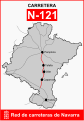 Localización N-121.svg 745 × 1,067; 126 KB
-
 Map Iberian Peninsula 910-bg.svg 818 × 569; 253 KB
-
 Mapa de municipios de Valle de Aezcoa.svg 650 × 870; 25 KB
-
 Mapa de Navarra dividido en comarcas Geográficas.svg 744 × 797; 914 KB
-
 Mapa físico de Navarra.svg 930 × 1,018; 7.56 MB
-
 Mapa Roncal Salazar.svg 744 × 797; 662 KB
-
 Mapa Sanitario de Navarra.svg 512 × 552; 2.77 MB
-
 Mapa Valdorba en Navarra.svg 744 × 797; 653 KB
-
 Merindad de Estella-Mapa municipal.svg 1,000 × 1,279; 1.01 MB
-
 Merindad de Estella-Mapa Valles.svg 1,000 × 1,279; 706 KB
-
 Merindad de Olite - Mapa municipal.svg 1,338 × 1,251; 431 KB
-
 Merindad de Pamplona - Mapa municipal.svg 903 × 1,000; 993 KB
-
 Merindad de Sangüesa - Mapa municipal.svg 1,302 × 1,082; 932 KB
-
 Merindad de Tudela - Mapa municipal.svg 1,317 × 1,002; 446 KB
-
 Nafarroa.svg 800 × 642; 1.77 MB
-
 Nafarroako 2000 zonifikazioa.svg 744 × 797; 857 KB
-
 Nafarroako mapa Eskualde Geografikoen arabera.svg 744 × 797; 734 KB
-
 Navarra-loc.svg 512 × 538; 415 KB
-
 Spain Navarre location map.svg 512 × 538; 571 KB
-
 Navarra - Mapa densidad euskera 2001.svg 744 × 797; 653 KB
-
 Navarra - Mapa merindades elecciones 1979.svg 744 × 797; 154 KB
-
 Navarra - Mapa municipal 5 Merindades.svg 744 × 797; 644 KB
-
 Navarra - Mapa municipal 6 Merindades.svg 744 × 927; 675 KB
-
 Navarra - Mapa municipal Comarcas Agrícolas.svg 744 × 797; 846 KB
-
 Navarra - Mapa municipal Merindades.svg 744 × 797; 985 KB
-
 Navarra - Mapa municipal Zonificacion 2000.svg 744 × 797; 645 KB
-
 Navarra - Nekazari-eskualdeen Nafarroako mapa.svg 744 × 797; 851 KB
-
 Navarra - Norte de Aralar.svg 744 × 797; 671 KB
-
 Navarra - Resultado municipal generales 2004.svg 744 × 797; 695 KB
-
 Navarra - Resultado municipal generales 2008.svg 744 × 797; 693 KB
-
 Navarra - Zonificacion 2000.svg 750 × 800; 846 KB
-
 Navarra - Zonificacion linguistica - 2017.svg 512 × 549; 218 KB
-
 Navarra - Zonificacion linguistica.svg 744 × 797; 650 KB
-
 Navarra-merindades y municipios.svg 512 × 538; 447 KB
-
 Navarre topographic map-fr.svg 930 × 1,018; 6.8 MB
-
 Provincias-ES-NA.svg 2,458 × 1,767; 15 KB
-
 Reino de Navarra Sancho VI el Sabio.svg 1,195 × 962; 270 KB
-
 Reino de Navarra Sancho VII el Fuerte-2-gl.svg 1,002 × 962; 238 KB
-
 Reino de Navarra Sancho VII el Fuerte-gl.svg 1,002 × 962; 238 KB
-
 Reino de Navarra Sancho VII el Fuerte.svg 1,002 × 962; 302 KB
-
 Reino de Pamplona Sancho III-an.svg 2,779 × 1,050; 488 KB
-
 Reino de Pamplona Sancho III.svg 2,779 × 1,050; 525 KB
-
-
 Spain Navarre relief location map.svg 904 × 918; 6.67 MB


.svg)


