Category:SVG maps of South Sulawesi
Jump to navigation
Jump to search
| NO WIKIDATA ID FOUND! Search for SVG maps of South Sulawesi on Wikidata | |
| Upload media |

Media in category "SVG maps of South Sulawesi"
The following 71 files are in this category, out of 71 total.
-
 73.00.00 SulawesiSelatan.svg 165 × 212; 865 KB
-
 73.01.00 SulawesiSelatan Kepulauan Selayar.svg 165 × 212; 865 KB
-
 73.02.00 SulawesiSelatan Bulukumba.svg 165 × 212; 865 KB
-
 73.03.00 SulawesiSelatan Bantaeng.svg 165 × 212; 865 KB
-
 73.04.00 SulawesiSelatan Jeneponto.svg 165 × 212; 865 KB
-
 73.05.00 SulawesiSelatan Takalar.svg 165 × 212; 865 KB
-
 73.06.00 SulawesiSelatan Gowa.svg 165 × 212; 865 KB
-
 73.07.00 SulawesiSelatan Sinjai.svg 165 × 212; 865 KB
-
 73.08.00 SulawesiSelatan Bone.svg 165 × 212; 865 KB
-
 73.09.00 SulawesiSelatan Maros.svg 165 × 212; 865 KB
-
 73.10.00 SulawesiSelatan Pangkajene Kepulauan.svg 165 × 212; 865 KB
-
 73.11.00 SulawesiSelatan Barru.svg 165 × 212; 865 KB
-
 73.12.00 SulawesiSelatan Soppeng.svg 165 × 212; 865 KB
-
 73.13.00 SulawesiSelatan Wajo.svg 165 × 212; 865 KB
-
 73.14.00 SulawesiSelatan Sidenreng Rappang.svg 165 × 212; 865 KB
-
 73.15.00 SulawesiSelatan Pinrang.svg 165 × 212; 865 KB
-
 73.16.00 SulawesiSelatan Enrekang.svg 165 × 212; 865 KB
-
 73.17.00 SulawesiSelatan Luwu.svg 165 × 212; 865 KB
-
 73.18.00 SulawesiSelatan Tana Toraja.svg 165 × 212; 865 KB
-
 73.22.00 SulawesiSelatan Luwu Utara.svg 165 × 212; 865 KB
-
 73.24.00 SulawesiSelatan Luwu Timur.svg 165 × 212; 865 KB
-
 73.26.00 SulawesiSelatan Toraja Utara.svg 165 × 212; 865 KB
-
 73.71.00 SulawesiSelatan Makassar.svg 165 × 212; 865 KB
-
 73.72.00 SulawesiSelatan Parepare.svg 165 × 212; 865 KB
-
 73.73.00 SulawesiSelatan Palopo.svg 165 × 212; 865 KB
-
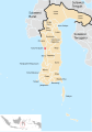
 Atlas SMP BIG - Sulawesi Selatan.svg 1,394 × 1,922; 7.69 MB
-
 Bioregion of Western Central Sulawesi - Forests Condition.svg 505 × 685; 295 KB
-
 Gowa Regency location map.svg 1,602 × 1,216; 4.65 MB
-
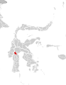
 Locator Bantaeng Regency.svg 971 × 1,309; 249 KB
-
 Locator Barru Regency.svg 971 × 1,309; 250 KB
-
 Locator Bone Regency.svg 971 × 1,309; 250 KB
-
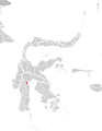
 Locator Bulukumba Regency.svg 971 × 1,309; 249 KB
-
 Locator Enrekang Regency.svg 971 × 1,309; 250 KB
-
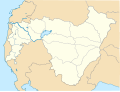
 Locator Gowa Regency.svg 971 × 1,309; 250 KB
-
 Locator Jeneponto Regency.svg 971 × 1,309; 249 KB
-
 Locator Luwu Regency.svg 971 × 1,309; 250 KB
-
 Locator Luwu Timur Regency.svg 971 × 1,309; 250 KB
-
 Locator Luwu Utara Regency.svg 971 × 1,309; 249 KB
-
 Locator Makassar City.svg 971 × 1,309; 250 KB
-
 Locator Maros Regency.svg 1,052 × 1,496; 250 KB
-
 Locator North Toraja Regency.svg 1,052 × 1,488; 250 KB
-
 Locator Palopo City.svg 1,057 × 1,487; 250 KB
-
 Locator Pangkajene Kepulauan Regency.svg 1,052 × 1,488; 250 KB
-
 Locator Parepare City.svg 1,050 × 1,492; 250 KB
-
 Locator Pinrang Regency.svg 1,052 × 1,488; 250 KB
-
 Locator Selayar Regency.svg 1,055 × 1,496; 250 KB
-
 Locator Sidenreng Rappang Regency.svg 1,055 × 1,491; 250 KB
-
 Locator Sinjai Regency.svg 1,052 × 1,488; 250 KB
-
 Locator Soppeng Regency.svg 1,052 × 1,488; 250 KB
-
 Locator South Sulawesi Province, Indonesia.svg 1,079 × 1,484; 250 KB
-
 Locator Takalar Regency.svg 1,052 × 1,488; 250 KB
-
 Locator Tana Toraja Regency.svg 1,052 × 1,488; 250 KB
-
 Locator Wajo Regency.svg 1,052 × 1,488; 250 KB
-
 Makassar location map.svg 1,520 × 1,920; 4.43 MB
-
 Makassarese and Makassaric locator map.svg 300 × 450; 1.29 MB
-
 Makassarese speaking region.svg 298 × 482; 1.49 MB
-
 Pallangga District location Map.svg 6,888 × 5,227; 2.74 MB
-
 Parangloe District location Map.svg 6,888 × 5,227; 2.73 MB
-
 Parigi District location Map.svg 6,888 × 5,227; 2.74 MB
-
 Pattallassang District location Map.svg 6,888 × 5,227; 2.74 MB
-
 Sidrap Regency location map.svg 2,060 × 1,840; 7.37 MB
-
 South Sulawesi (1590) ID.svg 268 × 465; 272 KB
-
 South Sulawesi circa 1600.svg 744 × 1,052; 207 KB
-
 South Sulawesi in Indonesia.svg 982 × 450; 792 KB
-
 South Sulawesi languages id.svg 737 × 875; 757 KB
-
 South Sulawesi languages.svg 737 × 875; 677 KB
-
 Spread of South Sulawesi languages id.svg 295 × 478; 1.49 MB
-
 Takalar Regency location map.svg 992 × 1,052; 1.89 MB
-
 Wajo in 1906.svg 480 × 480; 239 KB
-
 Wajo Regency location map.svg 2,160 × 2,160; 7.26 MB
-
 Wilayah Mamminasata.svg 3,409 × 4,814; 590 KB


_ID.svg)


