Category:SVG maps of Central Kalimantan
Jump to navigation
Jump to search
| NO WIKIDATA ID FOUND! Search for SVG maps of Central Kalimantan on Wikidata | |
| Upload media |

Media in category "SVG maps of Central Kalimantan"
The following 18 files are in this category, out of 18 total.
-
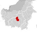
 62.00.00 KalimantanTengah.svg 179 × 158; 863 KB
-
 62.01.00 KalimantanTengah Kotawaringin Barat.svg 179 × 158; 863 KB
-
 62.02.00 KalimantanTengah Kotawaringin Timur.svg 179 × 158; 863 KB
-
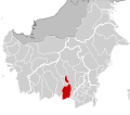
 62.03.00 KalimantanTengah Kapuas.svg 179 × 158; 863 KB
-
 62.04.00 KalimantanTengah Barito Selatan.svg 179 × 158; 863 KB
-
 62.05.00 KalimantanTengah Baritu Utara.svg 179 × 158; 863 KB
-
 62.06.00 KalimantanTengah Katingan.svg 179 × 158; 863 KB
-
 62.07.00 KalimantanTengah Seruyan.svg 179 × 158; 863 KB
-
 62.08.00 KalimantanTengah Sukamara.svg 179 × 158; 863 KB
-
 62.09.00 KalimantanTengah Lamandau.svg 179 × 158; 863 KB
-
 62.10.00 KalimantanTengah Gunung Mas.svg 179 × 158; 863 KB
-
 62.11.00 KalimantanTengah Pulang Pisau.svg 179 × 158; 863 KB
-
 62.12.00 KalimantanTengah Murung Raya.svg 179 × 158; 863 KB
-
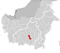
 62.13.00 KalimantanTengah Barito Timur.svg 179 × 158; 863 KB
-
 62.71.00 KalimantanTengah Palangka Raya.svg 179 × 158; 863 KB
-
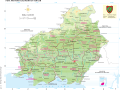 Atlas SMP BIG - Kalimantan Tengah.svg 1,882 × 1,405; 5.69 MB
-
 Atlas SMP BIG - Kalimantan Timur.svg 1,897 × 1,422; 8.78 MB
-
 Central Kalimantan in Indonesia.svg 982 × 450; 792 KB


