Category:SVG maps of North Maluku
Jump to navigation
Jump to search
| NO WIKIDATA ID FOUND! Search for SVG maps of North Maluku on Wikidata | |
| Upload media |

Media in category "SVG maps of North Maluku"
The following 16 files are in this category, out of 16 total.
-
 82.00.00 MalukuUtara.svg 184 × 191; 862 KB
-
 82.01.00 MalukuUtara Halmahera Barat.svg 184 × 191; 862 KB
-
 82.02.00 MalukuUtara Halmahera Tengah.svg 184 × 191; 862 KB
-
 82.03.00 MalukuUtara Halmahera Utara.svg 184 × 191; 862 KB
-
 82.04.00 MalukuUtara Halmahera Selatan.svg 184 × 191; 862 KB
-
 82.05.00 MalukuUtara Kepulauan Sula.svg 184 × 191; 862 KB
-
 82.06.00 MalukuUtara Halmahera Timur.svg 184 × 191; 862 KB
-
 82.07.00 MalukuUtara Morotai.svg 184 × 191; 862 KB
-
 82.08.00 MalukuUtara Taliabu.svg 184 × 191; 862 KB
-
 82.71.00 MalukuUtara Ternate.svg 184 × 191; 862 KB
-
 82.72.00 MalukuUtara Tidore Kepulauan.svg 184 × 191; 862 KB
-
 Atlas SMP BIG - Maluku Utara.svg 1,880 × 1,410; 15.32 MB
-
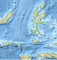
 Indonesia North Maluku adm location map.svg 530 × 546; 994 KB
-
 Indonesia North Maluku location.svg 1,128 × 1,230; 719 KB
-
 Indonesia North Maluku rel location map.svg 523 × 543; 1.32 MB
-
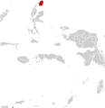
 North Maluku in Indonesia.svg 982 × 450; 792 KB


