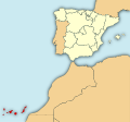
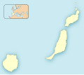
Category:SVG maps of the Canary Islands
Jump to navigation
Jump to search
Autonomous communities of Spain: Andalusia · Aragon · Asturias · Balearic Islands · Basque Autonomous Community · Canary Islands · Cantabria · Castile and León · Castilla–La Mancha · Catalonia · Extremadura · Galicia · Community of Madrid · Region of Murcia · Navarre · La Rioja · Valencian Community · Autonomous cities: Ceuta · Melilla
Subcategories
This category has only the following subcategory.
!
Media in category "SVG maps of the Canary Islands"
The following 20 files are in this category, out of 20 total.
-
Blank administrative map of the Canary Islands.svg 3,045 × 1,303; 53 KB
-
Blank Map-Canary Islands.svg 1,055 × 480; 23 KB
-
Blank topographic map of the Canary Islands.svg 3,045 × 1,303; 750 KB
-
Canarias-loc.svg 512 × 277; 3.09 MB
-
España-Canarias-loc.svg 512 × 462; 919 KB
-
Islas Canarias en 1800.svg 468 × 343; 473 KB
-
Las Palmas - Mapa municipal.svg 778 × 413; 50 KB
-
Localización de Canarias.svg 578 × 374; 407 KB
-
Localización de la Región de Canarias.svg 799 × 745; 638 KB
-
Mapa del cultivo de plátano en Canarias.svg 404 × 262; 327 KB
-
Mapa territorios España Canarias.svg 800 × 535; 996 KB
-
Las Palmas-Loc.svg 512 × 453; 95 KB
-
Provincia de Las Palmas1.svg 778 × 413; 246 KB
-
Provincia de Tenerife1.svg 778 × 413; 27 KB
-
Santa Cruz de Tenerife - Mapa municipal.svg 778 × 413; 60 KB
-
Santa Cruz de Tenerife-loc.svg 512 × 406; 1.78 MB
-
Spain Canary Islands location map.svg 1,475 × 655; 29 KB
-
Spain complete location map.svg 512 × 462; 1.04 MB
-
Teneriffa map-en.svg 2,306 × 1,871; 154 KB
-
Teneriffa map-es.svg 2,306 × 1,871; 154 KB


