Category:SVG maps of Hauts-de-France
Jump to navigation
Jump to search
Administrative regions and territorial collectivity of Metropolitan France (‡ since start of 2016):
Auvergne-Rhône-Alpes‡ · Bourgogne-Franche-Comté‡ · Brittany · Centre-Val de Loire · Corsica · Grand Est‡ · Hauts-de-France‡ · Île-de-France · Normandy‡ · Nouvelle-Aquitaine‡ · Occitania‡ · Pays de la Loire · Provence-Alpes-Côte d'Azur
Former administrative regions of Metropolitan France (until end of 2015):
Alsace · Aquitaine · Auvergne · Burgundy · Champagne-Ardenne · Franche-Comté · Languedoc-Roussillon · Limousin · Lorraine · Midi-Pyrénées · Nord-Pas-de-Calais · Lower Normandy · Upper Normandy · Picardy · Poitou-Charentes · Rhône-Alpes
Overseas departments and regions: Guadeloupe · Martinique · French Guiana · Réunion · Mayotte
Overseas collectivities: Saint Barthélemy · Saint-Martin · Saint Pierre and Miquelon · French Polynesia · Wallis and Futuna · French Southern and Antarctic Lands+
Sui generis territories: New Caledonia · Clipperton Island+

Subcategories
This category has the following 3 subcategories, out of 3 total.
- SVG maps of Somme (95 F)
~
- SVG maps of Nord-Pas-de-Calais (22 F)
Media in category "SVG maps of Hauts-de-France"
The following 9 files are in this category, out of 9 total.
-
 Carte régionale - NPCP.svg 1,000 × 960; 14 KB
-
 Députés sortants des Hauts-de-France en 2017.svg 846 × 990; 119 KB
-
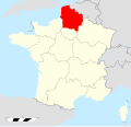
 Hauts-de-France in France 2016.svg 2,000 × 1,922; 1.03 MB
-
 Hauts-de-France region location map.svg 1,570 × 1,742; 3.9 MB
-
 Hauts-de-France region locator map.svg 2,000 × 1,922; 290 KB
-
 Hauts-de-France region map (DPJ-2020).svg 507 × 553; 42 KB
-
 Hauts-de-France.svg 1,417 × 1,509; 1.89 MB
-
 Nord-Pas-de-Calais-Picardie - Regionale 2015 - Premier tour.svg 1,417 × 1,509; 1.75 MB
-
 Réseau Express Grand Lille map-fr.svg 1,378 × 1,120; 3.96 MB


.svg)


