Category:SVG maps of Île-de-France
Jump to navigation
Jump to search
Administrative regions and territorial collectivity of Metropolitan France (‡ since start of 2016):
Auvergne-Rhône-Alpes‡ · Bourgogne-Franche-Comté‡ · Brittany · Centre-Val de Loire · Corsica · Grand Est‡ · Hauts-de-France‡ · Île-de-France · Normandy‡ · Nouvelle-Aquitaine‡ · Occitania‡ · Pays de la Loire · Provence-Alpes-Côte d'Azur
Former administrative regions of Metropolitan France (until end of 2015):
Alsace · Aquitaine · Auvergne · Burgundy · Champagne-Ardenne · Franche-Comté · Languedoc-Roussillon · Limousin · Lorraine · Midi-Pyrénées · Nord-Pas-de-Calais · Lower Normandy · Upper Normandy · Picardy · Poitou-Charentes · Rhône-Alpes
Overseas departments and regions: Guadeloupe · Martinique · French Guiana · Réunion · Mayotte
Overseas collectivities: Saint Barthélemy · Saint-Martin · Saint Pierre and Miquelon · French Polynesia · Wallis and Futuna · French Southern and Antarctic Lands+
Sui generis territories: New Caledonia · Clipperton Island+

Subcategories
This category has the following 3 subcategories, out of 3 total.
Media in category "SVG maps of Île-de-France"
The following 24 files are in this category, out of 24 total.
-
 Cantons d'Île-de-France.svg 1,548 × 1,251; 192 KB
-
 Carte régionale - idf.svg 1,000 × 960; 9 KB
-
 Carte Transilien RER schématique.svg 4,520 × 3,763; 667 KB
-
 Debaser-carte-paris.svg 1,700 × 700; 22 KB
-
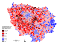
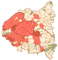
 Demograpĥic growth by municipality - Île-de-France - 1968-1975 - en.svg 1,472 × 1,103; 2.2 MB
-
 Demograpĥic growth by municipality - Île-de-France - 1968-1975 - fr.svg 1,472 × 1,103; 2.2 MB
-
 Députés sortants d'Ile de France en 2017.svg 5,239 × 4,217; 100 KB
-
 Foret de Rambouillet version SVG.svg 2,340 × 2,377; 354 KB
-
 Ile de France - fond.svg 777 × 581; 65 KB
-
 Ile de France.svg 777 × 581; 95 KB
-
 Ile-de-France region location map.svg 1,651 × 1,334; 944 KB
-
 Métropole du Grand Paris.svg 707 × 543; 69 KB
-
 Protected Areas in Paris, France.svg 2,000 × 900; 1.77 MB
-
 Régionales 1998 Île-de-France.svg 777 × 581; 64 KB
-
 Régionales 2015 Île-de-France T1.svg 777 × 581; 64 KB
-
 Régionales 2015 Île-de-France T2.svg 777 × 581; 64 KB
-
 Syndicat mixte Autolib map.svg 1,552 × 1,586; 541 KB
-
 Territoires de la Metropole du Grand Paris.svg 269 × 330; 39 KB
-
 Transilien and RER blank map without services.svg 4,481 × 4,263; 73 KB
-
 Transilien and RER blank map.svg 4,481 × 4,263; 88 KB
-
 Transilien blank map.svg 4,481 × 4,263; 82 KB
-
 Île-de-France region locator map.svg 2,000 × 1,922; 524 KB
-
 Île-de-France region locator map2.svg 2,000 × 1,922; 288 KB
-
 Île-de-France region map (DPJ-2020).svg 507 × 553; 42 KB


.svg)