Category:SVG maps of Alsace
Jump to navigation
Jump to search
Administrative regions and territorial collectivity of Metropolitan France (‡ since start of 2016):
Auvergne-Rhône-Alpes‡ · Bourgogne-Franche-Comté‡ · Brittany · Centre-Val de Loire · Corsica · Grand Est‡ · Hauts-de-France‡ · Île-de-France · Normandy‡ · Nouvelle-Aquitaine‡ · Occitania‡ · Pays de la Loire · Provence-Alpes-Côte d'Azur
Former administrative regions of Metropolitan France (until end of 2015):
Alsace · Aquitaine · Auvergne · Burgundy · Champagne-Ardenne · Franche-Comté · Languedoc-Roussillon · Limousin · Lorraine · Midi-Pyrénées · Nord-Pas-de-Calais · Lower Normandy · Upper Normandy · Picardy · Poitou-Charentes · Rhône-Alpes
Overseas departments and regions: Guadeloupe · Martinique · French Guiana · Réunion · Mayotte
Overseas collectivities: Saint Barthélemy · Saint-Martin · Saint Pierre and Miquelon · French Polynesia · Wallis and Futuna · French Southern and Antarctic Lands+
Sui generis territories: New Caledonia · Clipperton Island+

Media in category "SVG maps of Alsace"
The following 21 files are in this category, out of 21 total.
-
 Alsace region location map.svg 872 × 1,429; 434 KB
-
 Alsace region locator map.svg 2,000 × 1,922; 529 KB
-
 Alsace-hist-location.svg 686 × 774; 801 KB
-
 Bassin houiller Franche-Comté-Alsace-Crop.svg 1,086 × 953; 768 KB
-
 Canton haguenau location carte.svg 558 × 534; 58 KB
-
 Cantons d'Alsace 2021.svg 744 × 1,052; 185 KB
-
 Cantons de la Communauté Européenne d'Alsace en 2021.svg 512 × 1,023; 345 KB
-
 Carte Alsace autoroute A35.svg 414 × 896; 67 KB
-
 Carte Alsace autoroutes.svg 414 × 896; 69 KB
-
 Carte Alsace avec Alsacienne.svg 414 × 896; 122 KB
-
 Carte Alsace décapole FR.svg 403 × 880; 46 KB
-
 Carte Alsace décapole GSW.svg 403 × 880; 46 KB
-
 Carte Alsace.svg 414 × 896; 120 KB
-
 Carte AUBMHD.svg 389 × 667; 1.68 MB
-
 Hist-alsace-in-europe.svg 547 × 366; 715 KB
-
 Linguistic Map of Alsace.svg 1,100 × 2,200; 466 KB
-
 RC Strasbourg et clubs rivaux map-fr.svg 916 × 687; 89 KB
-
 Referendum Elsass 2013.svg 557 × 781; 486 KB
-
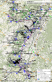 TER Alsace, carte du réseau.svg 1,237 × 1,931; 6.02 MB
-
 TER Alsace, fréquence de la desserte.svg 1,052 × 1,488; 307 KB
-
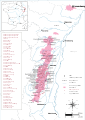 Vignobles alsace-fr.svg 744 × 1,052; 2.19 MB


