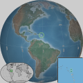
Category:SVG locator maps of Antigua and Barbuda
Jump to navigation
Jump to search
Countries of North America: Antigua and Barbuda · The Bahamas · Barbados · Belize · Canada · Costa Rica · Cuba · Dominica · Dominican Republic · El Salvador · Grenada · Guatemala · Haiti · Honduras · Jamaica · Mexico · Nicaragua · Panama · Saint Kitts and Nevis · Saint Lucia · Saint Vincent and the Grenadines · Trinidad and Tobago‡ · United States of America‡
Other territories: Anguilla · Cayman Islands · Greenland · Guadeloupe · Martinique · Puerto Rico · Saint Barthélemy · Turks and Caicos Islands
‡: partly located in North America
Other territories: Anguilla · Cayman Islands · Greenland · Guadeloupe · Martinique · Puerto Rico · Saint Barthélemy · Turks and Caicos Islands
‡: partly located in North America
Insular countries of the Caribbean: Antigua and Barbuda · The Bahamas · Barbados · Cuba · Dominica · Dominican Republic · Grenada · Haiti · Jamaica · Saint Kitts and Nevis · Saint Lucia · Saint Vincent and the Grenadines · Trinidad and Tobago
Continental countries: Belize · Colombia · Costa Rica · Guatemala · Guyana · Honduras · Mexico · Nicaragua · Panama · Suriname · Venezuela
Other territories: Anguilla · Aruba · Cayman Islands · Curaçao · French Guiana · Guadeloupe · Martinique · Caribbean Netherlands · Navassa Island · Puerto Rico · Saint Barthélemy · Sint Maarten · Turks and Caicos Islands
Subcategories
This category has only the following subcategory.
Media in category "SVG locator maps of Antigua and Barbuda"
The following 16 files are in this category, out of 16 total.
-
Antiguaandbarbuda w1 locator.svg 1,000 × 1,000; 108 KB
-
Antiguaandbarbuda w2 locator.svg 1,000 × 1,000; 215 KB
-
Barnes Hill in Saint George.svg 2,560 × 1,440; 275 KB
-
Christian Hill in Saint Paul.svg 2,560 × 1,440; 552 KB
-
Dieppe Bay in Saint Paul.svg 2,400 × 1,350; 1,020 KB
-
Dow Hill in Saint Paul.svg 2,560 × 1,440; 552 KB
-
Falmouth in Antigua.svg 2,560 × 1,440; 552 KB
-
Fitches Creek in Antigua.svg 2,560 × 1,440; 275 KB
-
Green Hill in Saint Paul.svg 2,560 × 1,440; 552 KB
-
Mill Reef in Saint Philip.svg 2,560 × 1,440; 443 KB
-
Old Road in Antigua.svg 2,560 × 1,440; 441 KB
-
Parham in Antigua.svg 2,560 × 1,440; 484 KB
-
St. Phillip's in Antigua.svg 2,560 × 1,440; 443 KB
-
Sugar Factory in Saint George.svg 2,560 × 1,440; 275 KB
-
Table Hill Gardens in Saint Paul.svg 2,560 × 1,440; 552 KB
-
Upper Lightfoot in Saint George.svg 2,560 × 1,440; 275 KB


