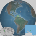
Category:SVG locator maps of Curaçao
Jump to navigation
Jump to search
Insular countries of the Caribbean: Antigua and Barbuda · The Bahamas · Barbados · Cuba · Dominica · Dominican Republic · Grenada · Haiti · Jamaica · Saint Kitts and Nevis · Saint Lucia · Saint Vincent and the Grenadines · Trinidad and Tobago
Continental countries: Belize · Colombia · Costa Rica · Guatemala · Guyana · Honduras · Mexico · Nicaragua · Panama · Suriname · Venezuela
Other territories: Anguilla · Aruba · Cayman Islands · Curaçao · French Guiana · Guadeloupe · Martinique · Caribbean Netherlands · Navassa Island · Puerto Rico · Saint Barthélemy · Sint Maarten · Turks and Caicos Islands
Provinces of the Netherlands:
Subcategories
This category has only the following subcategory.
Media in category "SVG locator maps of Curaçao"
The following 3 files are in this category, out of 3 total.
-
Curacao w1 locator.svg 1,000 × 1,000; 104 KB
-
Curacao w2 locator.svg 1,000 × 1,000; 209 KB
-
Curaçao - Caribbean.svg 3,690 × 2,323; 3.26 MB


