Category:Locator maps of Antigua and Barbuda
Jump to navigation
Jump to search
Subcategories
This category has the following 2 subcategories, out of 2 total.
!
B
Media in category "Locator maps of Antigua and Barbuda"
The following 24 files are in this category, out of 24 total.
-
 Airport ED in Antigua.png 702 × 550; 159 KB
-
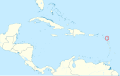 Antigua and Barbuda - Caribbean.svg 3,690 × 2,323; 3.26 MB
-
 Antigua and Barbuda - Location Map (2013) - ATG - UNOCHA.svg 254 × 254; 264 KB
-
 ATG orthographic.svg 600 × 600; 1.23 MB
-
 Bolans in Antigua.svg 2,560 × 1,440; 441 KB
-
 Caribbean - Antigua.PNG 929 × 606; 48 KB
-
 Caribbean - Barbuda.PNG 929 × 606; 48 KB
-
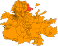
 Clark's Hill ED in Antigua.png 702 × 550; 159 KB
-
 Crabbs Hill in Antigua.svg 2,560 × 1,440; 441 KB
-
 Ebenezer in Antigua.png 702 × 550; 159 KB
-
 Ebenezer in Antigua.svg 2,560 × 1,440; 441 KB
-
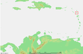
 Guadeloupe1.png 763 × 643; 13 KB
-
 Jennings in Antigua.svg 2,560 × 1,440; 441 KB
-
 John Hughes in Antigua.png 1,124 × 794; 337 KB
-
 John Hughes in Antigua.svg 2,560 × 1,440; 441 KB
-
 Johnsons Point in Antigua.svg 2,560 × 1,440; 441 KB
-
 Karibik Antigua und Barbuda Position.png 1,024 × 636; 14 KB
-
 LocationAntiguaAndBarbuda.png 250 × 115; 5 KB
-
 Mapa de Antígua e Barbuda (OCHA).svg 254 × 254; 329 KB
-
 Mill Reef in Antigua.png 1,205 × 746; 195 KB
-
 Renfrew in Antigua.png 1,205 × 746; 405 KB
-
 Upper Lightfoots in Antigua.png 1,205 × 746; 414 KB
-
 Urlings in Antigua.svg 2,560 × 1,440; 441 KB
-
 Yepton's ED in Antigua.png 702 × 550; 159 KB


_-_ATG_-_UNOCHA.svg)


.svg)


