Category:Road maps of U.S. Highways in Nevada
Jump to navigation
Jump to search
States of the United States: Alabama · Arizona · Colorado · Connecticut · Florida · Georgia · Idaho · Illinois · Indiana · Iowa · Kansas · Louisiana · Maine · Maryland · Michigan · Nevada · New Jersey · New Mexico · New York · North Carolina · Ohio · Pennsylvania · South Carolina · Texas · Utah · Virginia · Wisconsin · Wyoming
Media in category "Road maps of U.S. Highways in Nevada"
The following 9 files are in this category, out of 9 total.
-
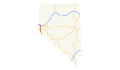 US 395 (NV) map.svg 1,475 × 860; 122 KB
-
 US 50 (NV) map.svg 800 × 860; 350 KB
-
 US 50 Alt (NV) map.svg 1,475 × 860; 122 KB
-
 US 6 (NV) map.svg 1,475 × 860; 121 KB
-
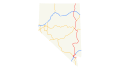 US 93 (NV) map.svg 1,475 × 860; 117 KB
-
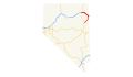 US 93 Alt (NV) map.svg 1,475 × 860; 143 KB
-
 US 95 (NV) map.png 926 × 580; 154 KB
-
 US 95 (NV) map.svg 1,475 × 860; 132 KB
-
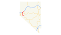 US 95 Alt (NV) map.svg 1,475 × 860; 116 KB
_map.svg)
_map.svg)
_map.svg)
_map.svg)
_map.svg)
_map.svg)
_map.png)
_map.svg)
_map.svg)