Category:Road maps of U.S. Highways in Connecticut
Jump to navigation
Jump to search
States of the United States: Alabama · Arizona · Colorado · Connecticut · Florida · Georgia · Idaho · Illinois · Indiana · Iowa · Kansas · Louisiana · Maine · Maryland · Michigan · Nevada · New Jersey · New Mexico · New York · North Carolina · Ohio · Pennsylvania · South Carolina · Texas · Utah · Virginia · Wisconsin · Wyoming
Media in category "Road maps of U.S. Highways in Connecticut"
The following 10 files are in this category, out of 10 total.
-
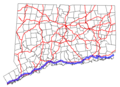
 US 1 (CT) map.svg 1,180 × 688; 303 KB
-
 CT-1 map.png 613 × 445; 17 KB
-
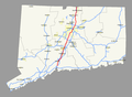
 CT-5 map.png 600 × 430; 17 KB
-
 CT-6 map.png 608 × 436; 17 KB
-
 US 202 (CT) map.svg 1,180 × 688; 295 KB
-
 US 44 (CT) map.svg 1,180 × 688; 298 KB
-
 US 5 (CT) map.svg 1,180 × 688; 289 KB
-
 US 5 map (CT).png 1,141 × 836; 40 KB
-
 US 6 (CT) map.svg 1,180 × 688; 295 KB
-
 US 7 (CT) map.svg 1,180 × 688; 292 KB
_map.svg)


_map.svg)
_map.svg)
_map.svg)
.png)
_map.svg)
_map.svg)