Category:Rail transport maps of Massachusetts
Jump to navigation
Jump to search
States of the United States: Alabama · Alaska · Arizona · Arkansas · California · Colorado · Connecticut · Delaware · Florida · Georgia · Idaho · Illinois · Indiana · Iowa · Kansas · Kentucky · Louisiana · Maine · Maryland · Massachusetts · Michigan · Minnesota · Mississippi · Missouri · Montana · Nevada · New Hampshire · New Jersey · New Mexico · New York · North Carolina · North Dakota · Ohio · Oklahoma · Oregon · Pennsylvania · Rhode Island · South Carolina · Tennessee · Texas · Utah · Vermont · Virginia · Washington · West Virginia · Wisconsin · Wyoming – Washington, D.C.
Subcategories
This category has the following 12 subcategories, out of 12 total.
1
C
- CapeFLYER maps (4 F)
M
- Maps of Amtrak Downeaster (4 F)
- Maps of the Old Colony Railroad (16 F)
R
T
Media in category "Rail transport maps of Massachusetts"
The following 140 files are in this category, out of 140 total.
-
 1828 Boston and Providence Railroad survey.jpg 12,928 × 2,416; 7.44 MB
-
 1836 Eastern Railroad plan.jpg 19,856 × 4,320; 21.2 MB
-
 1837 Western Railroad map, Springfield to State Line.jpg 13,398 × 9,994; 21.45 MB
-
 1837 Western Railroad map, Worcester to Springfield.jpg 13,348 × 10,263; 19.91 MB
-
 1838 Southern New England railroad map.jpg 7,204 × 6,096; 39.17 MB
-
 Map of the railroads of Massachusetts running west from Boston (3855707941).jpg 2,000 × 1,059; 1.96 MB
-

-

-
 1847 proposed Boston and Woonsocket railroad routes.jpg 4,992 × 4,176; 4.86 MB
-
 1848 railroad map of the Boston area (14738224386).jpg 3,994 × 3,378; 2.46 MB
-

-

-
 1849 Railroad Map of New England & Eastern New York.jpg 7,882 × 9,884; 19.41 MB
-
-
-

-
-
 1850 Railroads Northeast of Boston map.jpg 6,384 × 5,392; 6.83 MB
-
 1851 Medford and Stoneham Branch Railroad map.jpg 9,526 × 3,639; 4.5 MB
-
 1852 Middlesex Canal (Massachusetts) map.jpg 2,310 × 3,365; 9.03 MB
-
 1854 Rail Road Map of the New England States.jpg 10,752 × 9,328; 29.53 MB
-
 1854 Telegraph and Rail Road Map of the New England States.jpg 8,192 × 7,841; 20.52 MB
-
 1855 Boston and Lowell Railroad map.jpg 4,660 × 8,562; 12.77 MB
-
 1855 Telegraph and Rail Road Map of the New England States.jpg 10,147 × 9,760; 21.05 MB
-
 1860 Shore Line.jpg 11,328 × 9,184; 20.38 MB
-
 1865 West Barnstable to Woods Hole rail line map.jpg 10,760 × 3,959; 3.99 MB
-
 1867 New Haven, Middletown and Boston Railroad map.jpg 8,479 × 7,920; 16.44 MB
-
 1868 Vineyard Sound Railroad profile map.jpg 10,315 × 4,044; 4.83 MB
-
 Massachusetts Central Railroad 1871 Map.jpg 5,967 × 4,028; 3.96 MB
-
 1871 Connecticut & Western.jpg 8,432 × 4,258; 8.36 MB
-
 1871 New England railroad map.jpg 4,772 × 6,252; 6.68 MB
-
 1874 Lowell and Andover Railroad map.jpg 14,482 × 4,576; 8.11 MB
-
 1874 plan of Worcester and Shrewsbury Railroad.jpg 12,098 × 4,098; 7.14 MB
-
 1874 Springfield, Athol and Northeastern Railroad extension map.jpg 12,230 × 3,738; 5.62 MB
-
 Junction detail on 1876 Walpole map.png 526 × 403; 466 KB
-
-
 1879 Railroad Map Massachusetts.jpg 9,872 × 6,416; 22.35 MB
-
 1881 Boston and Maine Railroad map.png 3,500 × 2,957; 13.86 MB
-
 1884 Massachusetts railroad map (14574236209).jpg 3,702 × 2,764; 1.8 MB
-
 1885 Massachusetts railroad map (14759298805).jpg 3,704 × 2,794; 1.82 MB
-
 1886 Boston & Lowell RR map.jpg 4,448 × 5,408; 8.99 MB
-
 1886 Map of the Connecticut River Line and connections.jpg 7,848 × 9,517; 9.75 MB
-

-
 1887 Massachusetts railroads (North Reading Branch).jpg 1,050 × 684; 400 KB
-
 1887 Massachusetts railroads map.jpg 9,760 × 7,992; 24.82 MB
-
 1887 railroad map with Saugus Branch highlighted.png 415 × 418; 336 KB
-
 1888 Sharon Heights and Massapoag Pond map.jpg 409 × 532; 52 KB
-
 1889 Ayer map, station detail.png 1,353 × 838; 2.11 MB
-

-
 1893 Nantucket Railroad map.jpg 1,488 × 724; 371 KB
-
 1893 Sectional Map of New York, New Haven and Hartford Railroad, Eastern District, Cape Cod.jpg 4,670 × 3,036; 17.25 MB
-
 1894 New York, New Haven and Hartford Railroad map.jpg 5,761 × 4,560; 3.01 MB
-
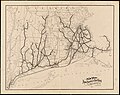
 1895 Connecticut railroad map.jpg 10,157 × 7,340; 9.12 MB
-
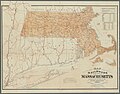
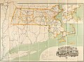
 1895 Massachusetts railroad map.png 4,692 × 3,500; 20.45 MB
-
 1898 Boston and Maine Railroad.jpg 9,232 × 6,832; 15.69 MB
-
 1899 Massachusetts railroads map.jpg 9,384 × 7,128; 19.48 MB
-
 1900 Boston and Maine Railroad map.png 3,500 × 2,635; 16.75 MB
-
 1900 Map of the City of Lynn.jpg 1,108 × 1,518; 290 KB
-

-
 1901 Massachusetts railroad map (14757664421).jpg 3,672 × 2,800; 1.88 MB
-
 Boston and Maine Railroad 1901 system map.png 3,500 × 2,577; 15.32 MB
-
 1901 CNE map.jpg 1,024 × 1,028; 250 KB
-
 1903 Boston suburban railroads map.jpg 4,131 × 3,180; 4.47 MB
-
 1906 plan for Somerville grade crossing eliminations.jpg 5,009 × 1,542; 794 KB
-
 1906 New York, New Haven and Hartford Railroad map.png 2,048 × 1,342; 3.75 MB
-
 1907 Central New England Railway map.jpg 1,412 × 727; 265 KB
-

-
 1909 New York, New Haven and Hartford Railroad map.png 3,000 × 1,610; 5.29 MB
-
 Sectional map of N. Y. N. H. & H. R.R. Berkshire Hills Route.jpg 1,746 × 3,666; 1.23 MB
-
 1910 map of Salem tunnel proposal.jpg 2,674 × 573; 374 KB
-
 1911 Massachusetts railroad map (14574205009).jpg 3,652 × 2,708; 2.02 MB
-
 1911 Hampden Railroad plans.png 47,360 × 8,704; 4.1 MB
-
 Sectional map of the N.Y. N.H. and H. Berkshire Hills Route.png 1,808 × 4,528; 3.1 MB
-
 1912 Massachusetts railroads map.png 3,500 × 2,625; 13.89 MB
-
 Map and profile of Lynn grade crossing elimination.jpg 3,860 × 2,239; 1.03 MB
-
 1915 Boston and Maine Railroad and connecting lines map.png 6,229 × 6,481; 59.83 MB
-
-
 1917 Boston and Maine Railroad system map.png 2,543 × 3,534; 6.63 MB
-
 1923 New York, New Haven and Hartford Railroad map.png 1,500 × 913; 1.22 MB
-
 Fitchburg Cutoff rail map.svg 1,850 × 1,150; 45 KB
-
 1936 Central Vermont Railway map.jpg 910 × 1,054; 364 KB
-
 New Haven Railroad 1940 system map.jpg 3,107 × 1,752; 1.07 MB
-
 1946 Boston and Maine Railroad system map.jpg 3,084 × 1,741; 3.28 MB
-
 1955 Boston and Maine Railroad system map.png 4,704 × 2,588; 10.17 MB
-
 Boston and Maine Railroad 1956 system map.jpg 3,034 × 1,742; 976 KB
-
 1956 New Haven railroad MA RI track map.jpg 1,422 × 1,600; 1.2 MB
-
 1969 New Haven region map from Penn Central.jpg 1,841 × 1,024; 632 KB
-
 1970 NYNH&H map.png 6,772 × 5,508; 1.84 MB
-
 1977 map of North Station yards.jpg 1,592 × 1,194; 208 KB
-
 Annual report of the Board of Railroad Commissioners (1882) (14574659707).jpg 3,702 × 2,855; 1.74 MB
-
 Annual report of the Board of Railroad Commissioners (1909) (14574420677).jpg 3,634 × 2,690; 2.02 MB
-

-
 Ayer railroads.svg 880 × 524; 13 KB
-
 Beacon Hill.svg 1,800 × 1,350; 86 KB
-
 Boston and Lowell Railroad 1887.png 3,452 × 2,268; 250 KB
-

-
 Cape Cod Central Railroad Map.jpg 572 × 413; 126 KB
-
 Cape Codder map.png 1,674 × 1,089; 171 KB
-
 Central Corridor Rail Line.svg 1,900 × 1,800; 141 KB
-
 Corridor nne.jpg 512 × 383; 22 KB
-
 Dedham train stations.png 679 × 587; 131 KB
-
 Fairhaven Rail Yard Track Plan.png 1,285 × 485; 436 KB
-
 Fitchburg Railroad with its branches and connections. LOC 86692426.jpg 3,588 × 1,054; 666 KB
-
 Fitchburg Railroad with its branches and connections. LOC 86692426.tif 3,588 × 1,054; 10.82 MB
-
 Framingham Center interlocking diagram, August 1908.jpg 3,180 × 1,710; 1.05 MB
-
 Framingham stations map.svg 1,550 × 1,550; 24 KB
-
 Granite Railway map section.png 461 × 510; 65 KB
-
 Granite Railway map.png 8,184 × 6,590; 1.03 MB
-
 Littleton stations.svg 1,380 × 1,350; 18 KB
-
 Lynn stations map.svg 957 × 537; 46 KB
-
-

-

-

-

-

-
 Medfield Junction interlocking diagram, February 1911.jpg 1,024 × 554; 364 KB
-
 Middleborough and Taunton railroads.svg 960 × 640; 10 KB
-
 Middleborough stations.svg 960 × 640; 18 KB
-
 New Haven Map.png 2,439 × 1,466; 1.16 MB
-
 New Haven Map1.png 2,439 × 1,466; 1.14 MB
-
 NorthernNewEnglandCorridor.jpg 512 × 568; 40 KB
-
 NYNH&H on US map cropped.png 445 × 367; 26 KB
-

-
 Rail road map of New England and eastern New York (10839204275).jpg 6,429 × 7,706; 11.37 MB
-

-

-
-

-

-

-
-
-

-

-
 Salem stations and lines map.svg 800 × 750; 44 KB
-
 SNE triple crossing.jpg 733 × 461; 190 KB
-
 South Framingham railroads map.svg 750 × 450; 14 KB
-
 TAUNTON BRANCH RR.gif 637 × 561; 16 KB
-
 Walpole interlocking diagram, January 1911.jpg 3,192 × 1,752; 1.36 MB


.jpg)


.jpg)


_Map_of_the_(proposed)_rail_road_from_Boston_to_Stanstead,_by_J._H._Bufford_%26_Co,_from_the_Digital_Commonwealth_-_commonwealth_cj82kn44h.jpg)


_map.jpg)


.jpg)
.jpg)


.jpg)
.jpg)


.jpg)


.jpg)


_(14574659707).jpg)
_(14574420677).jpg)
_(14760957855).jpg)


.jpg)


.jpg)
.jpg)
.jpg)
.jpg)
.jpg)
.jpg)


_the_line_as_chartered_and_the_line_as_located_(9472266423).jpg)
.jpg)
.jpg)
.jpg)
.jpg)
.jpg)
.jpg)
.jpg)


.jpg)
.jpg)
.jpg)
.jpg)