Category:Rail transport maps of California
Jump to navigation
Jump to search
States of the United States: Alabama · Alaska · Arizona · Arkansas · California · Colorado · Connecticut · Delaware · Florida · Georgia · Idaho · Illinois · Indiana · Iowa · Kansas · Kentucky · Louisiana · Maine · Maryland · Massachusetts · Michigan · Minnesota · Mississippi · Missouri · Montana · Nevada · New Hampshire · New Jersey · New Mexico · New York · North Carolina · North Dakota · Ohio · Oklahoma · Oregon · Pennsylvania · Rhode Island · South Carolina · Tennessee · Texas · Utah · Vermont · Virginia · Washington · West Virginia · Wisconsin · Wyoming – Washington, D.C.
Subcategories
This category has the following 6 subcategories, out of 6 total.
Media in category "Rail transport maps of California"
The following 86 files are in this category, out of 86 total.
-
Sacramento Valley Railroad 1854.jpg 841 × 534; 138 KB
-
1870s map of the California Pacific Railroad.jpg 6,516 × 8,102; 8.17 MB
-
Map of railroad connections to Benicia and the San Francisco Bay area 1885.jpg 2,188 × 1,456; 1.06 MB
-
1891 Poor's Southern Pacific Company Pacific System.jpg 2,704 × 4,204; 2.39 MB
-
1903 Poor's Southern Pacific Company Pacific System.jpg 2,118 × 3,362; 1.71 MB
-
Map of Northern Electric Railway Connections c 1912.png 1,430 × 1,966; 1.63 MB
-
1916 ICC RG134 NWP map.png 7,168 × 12,353; 96.93 MB
-
315 of 'In Search of a Climate ... With ... illustrations, etc' (11305787956).jpg 1,952 × 1,090; 320 KB
-
ACE map 2.png 2,353 × 1,664; 539 KB
-
ACE map plain.svg 1,416 × 998; 90 KB
-
ACE Map small.png 400 × 283; 52 KB
-
Alameda Corridor map.svg 86 × 114; 30 KB
-
Alameda Corridor.jpg 988 × 2,632; 1.39 MB
-
Amtrak California map.svg 2,668 × 3,176; 353 KB
-
Amtrak California simplified map.svg 2,880 × 3,176; 214 KB
-
Arcata & Mad River Railroad - System Index Map.jpg 3,292 × 5,100; 5.29 MB
-
AT & Sta Fe California Southern Railroad - Ripley Branch.jpg 1,606 × 1,361; 720 KB
-
Bay Point & Clayton Railway - System Index Map.jpg 3,292 × 5,100; 3.83 MB
-
CAHSR location map.svg 580 × 744; 8.69 MB
-
California Central Railway - Santa Fe 1888 map.jpg 1,500 × 1,972; 512 KB
-
California Central Railway map.jpg 1,632 × 2,148; 524 KB
-
California Southern Railroad route map.png 648 × 760; 50 KB
-
Cement, Tolenas & Tidewater Railroad - System Index Map.jpg 3,292 × 5,100; 3.52 MB
-
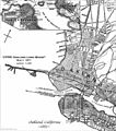
CPRR Oakland Long Wharf.jpg 735 × 830; 252 KB
-
Eel River and Eureka RR Map1896.jpg 512 × 798; 195 KB
-
Hanford & Summit Lake Railway - System Index Map.jpg 3,292 × 5,100; 4.98 MB
-
Harbor Subdivision map.svg 86 × 114; 30 KB
-
Indian Valley Railroad.jpg 829 × 1,159; 389 KB
-
LA terminal Rwy map.jpg 390 × 646; 149 KB
-
Rail line map of the Los Angeles and San Gabriel Valley Railroad.jpg 400 × 300; 16 KB
-
Map of rail and stage route to Big Tree Groves and Yosemite (13981984341).jpg 2,000 × 1,549; 3.33 MB
-
Map of Rail and Stage Routes to the Yosemite 1885.jpg 1,691 × 1,125; 876 KB
-
Map of the Los Angeles-Pacific R.R (uclamss 294 b96 1).jpg 7,728 × 6,303; 14.65 MB
-
Map of the Venice-Inglewood.jpg 4,587 × 2,243; 3.84 MB
-
Map of the Western Division of the Central Pacific Railroad Company - NARA - 84785984.jpg 18,556 × 5,440; 10.37 MB
-
Map Trona Railway.png 1,192 × 656; 933 KB
-
McCloud Railway - System Index Map.jpg 3,296 × 5,100; 2.35 MB
-
Metrolink May 14 2018.pdf 1,668 × 1,295; 502 KB
-
Metrolink system diagram.svg 2,020 × 1,420; 1,007 KB
-
Metrolink.png 1,272 × 1,041; 168 KB
-
Monterey County Rail Extension map.svg 400 × 550; 358 KB
-
Mount Tamalpais and Muir Woods Railway map, unknown date.JPG 3,740 × 2,662; 1.98 MB
-
NCO Map.png 251 × 289; 7 KB
-
Northwestern Pacific 1939 map.png 245 × 343; 146 KB
-
Northwestern Pacific Interurban Lines Map.png 974 × 1,394; 2.83 MB
-
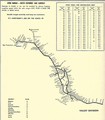
Northwestern Pacific Railroad Route 1931.jpg 1,324 × 3,283; 1.21 MB
-
Ocean Shore Railroad map.jpg 1,371 × 3,364; 1 MB
-
Peninsular Railway - System Index Map.jpg 3,292 × 5,100; 3.87 MB
-
Penn RR 1906 sheet2.jpg 7,821 × 3,949; 5.3 MB
-
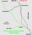
Petaluma&SantaRosaRailroadMap.png 1,387 × 1,532; 140 KB
-
Porterville & Northeastern - System Index Map.jpg 3,292 × 5,100; 4.92 MB
-
Railnetwork NCTD.svg 407 × 178; 252 KB
-
Sac RT Light Rail Map.gif 6,067 × 3,414; 503 KB
-
Sacramento RT Green Line extension.png 390 × 485; 150 KB
-
Sacramento RT light rail map.png 1,001 × 667; 41 KB
-
Sacramento RT System Map.png 6,066 × 3,189; 1.49 MB
-
Sacramento Valley Station track relocation map.gif 613 × 269; 6 KB
-
San Diego & Arizona Railway - System Index Map 2.jpg 3,292 × 5,100; 3.46 MB
-
San Diego & Arizona Railway - System Index Map.jpg 3,292 × 5,100; 3.04 MB
-
San Diego commuter rail map.png 683 × 1,049; 123 KB
-
San Joaquin & Eastern Railroad - System Index Map.jpg 3,292 × 5,100; 4.46 MB
-
Santa Fe Railroad Barge Route Map.jpg 1,734 × 1,118; 270 KB
-
Santa Fe Valley Map 1980.png 812 × 929; 692 KB
-
Santa Maria Valley Railroad - System Index Map.jpg 3,292 × 5,100; 6.55 MB
-
Shipyard Railway routemap.svg 700 × 1,000; 4.13 MB
-
Skunk train map2.png 493 × 276; 11 KB
-
Sonoma-Marin Area Rail Transit.png 482 × 932; 267 KB
-
Southern Pacific LA access.png 1,650 × 950; 1.09 MB
-
Southern Pacific Railroad - System Index Map 001 (Valuation Index).jpg 3,033 × 1,848; 810 KB
-
Southern Pacific Railroad - System Index Map 003 (Central California).jpg 3,292 × 5,100; 3.58 MB
-
Southern Pacific Railroad - System Index Map 004 (Central California).jpg 3,292 × 5,100; 3.06 MB
-
Southern Pacific Railroad - System Index Map 005 (Southern California).jpg 3,728 × 2,441; 1.98 MB
-
Southern Pacific Railroad - System Index Map 006 (Nevada).jpg 5,100 × 3,292; 3.04 MB
-
Southern Pacific Railroad - System Index Map 007 (Northern California).jpg 2,522 × 3,650; 1.91 MB
-
Southern Pacific Railroad - System Index Map 010 (San Francisco, Los Angeles).jpg 3,292 × 5,100; 4.07 MB
-
Stockton platform reconfiguration.gif 360 × 284; 5 KB
-
Stockton stations map by Hikki Nagasaki.gif 511 × 364; 10 KB
-
The Santa Fe magazine (1911) (14737149506).jpg 3,039 × 4,635; 1.06 MB
-
Tidewater and Southern Railway 1931.jpg 1,055 × 1,119; 410 KB
-
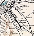
Tidewater Southern Railway electrification map.gif 560 × 747; 40 KB
-
Tonopah & Goldfield Railroad - System Index Map.jpg 3,292 × 5,100; 1.15 MB
-
Wfm caltrain.png 2,364 × 2,305; 687 KB


