Category:Maps of the Old Colony Railroad
Jump to navigation
Jump to search
Media in category "Maps of the Old Colony Railroad"
The following 16 files are in this category, out of 16 total.
-
1846 Map OCRR-FRRR.jpg 5,940 × 9,460; 3.57 MB
-
1850 Old Colony Railroad map.jpg 6,080 × 8,538; 11.39 MB
-
1875 OCRR.png 4,800 × 5,160; 937 KB
-
1888 OCRR.gif 597 × 694; 111 KB
-
1888 OCRR.PNG 597 × 694; 114 KB
-
1888 Old Colony Railroad Cape Cod map.png 3,500 × 2,436; 18.69 MB
-
1888 Old Colony Railroad Marthas Vineyard map.png 2,296 × 3,500; 17.88 MB
-
1888 Old Colony Railroad South Shore map.png 2,384 × 3,975; 20.2 MB
-
1893 New Haven Railroad South Shore map.png 2,106 × 3,500; 13.43 MB
-
1893 Sectional Map of New York, New Haven and Hartford Railroad, Eastern District, Cape Cod.jpg 4,670 × 3,036; 17.25 MB
-
Middleborough and Taunton railroads.svg 960 × 640; 10 KB
-
OC1893.jpg 7,000 × 6,840; 5.18 MB
-
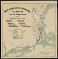
Old Colony and Newport Railroad map.png 3,200 × 3,251; 14.83 MB


