Category:Rail transport maps of Africa
Jump to navigation
Jump to search
Countries of Africa: Algeria · Angola · Benin · Botswana · Burkina Faso · Burundi · Cameroon · Cape Verde · the Central African Republic ≈ Central African Republic · Chad · the Comoros ≈ Comoros · the Democratic Republic of the Congo ≈ Democratic Republic of the Congo · the Republic of the Congo ≈ Republic of the Congo · Djibouti · Egypt‡ · Equatorial Guinea · Eritrea · Eswatini · Ethiopia · Gabon · the Gambia ≈ Gambia · Ghana · Guinea · Guinea-Bissau · Ivory Coast · Kenya · Lesotho · Liberia · Libya · Madagascar · Malawi · Mali · Mauritania · Mauritius · Morocco · Mozambique · Namibia · Niger · Nigeria · Rwanda · São Tomé and Príncipe · Senegal · the Seychelles ≈ Seychelles · Sierra Leone · Somalia · South Africa · South Sudan · Sudan · Tanzania · Togo · Tunisia · Uganda · Zambia · Zimbabwe
Limited recognition: Ambazonia · Azawad · Puntland · the Sahrawi Arab Democratic Republic ≈ Sahrawi Arab Democratic Republic · Somaliland – Other areas: Bir Tawil · the Canary Islands ≈ Canary Islands · Ceuta · Madeira · Mayotte · Melilla · Réunion · Saint Helena, Ascension and Tristan da Cunha · the Scattered Islands in the Indian Ocean ≈ Scattered Islands in the Indian Ocean · Western Sahara
‡: partly located in Africa
Subcategories
This category has the following 26 subcategories, out of 26 total.
A
B
- Rail transport maps of Benin (3 F)
D
E
- Rail transport maps of Ethiopia (15 F)
G
- Rail transport maps of Ghana (5 F)
I
K
L
- Rail transport maps of Libya (2 F)
M
N
- Rail transport maps of Namibia (11 F)
S
T
- Rail transport maps of Togo (2 F)
Media in category "Rail transport maps of Africa"
The following 39 files are in this category, out of 39 total.
-
-
 AFR V2 D053 Projected railways across West Africa.jpg 1,759 × 2,096; 462 KB
-
 Africa HSR 2063 (1).svg 512 × 523; 820 KB
-
 Africa railway map gauge.jpg 1,472 × 1,413; 220 KB
-
 Belgian Congo Railway Network pre-1960.svg 671 × 559; 870 KB
-
 Botswana rail network map.svg 986 × 1,014; 167 KB
-
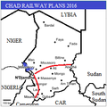 Chad Railways Plans2016.png 254 × 254; 17 KB
-
 Dakar-Niger railway map-zh-hans.png 498 × 430; 39 KB
-
 Dakar-Niger railway map-zh-tw.png 498 × 430; 39 KB
-

-
 East African Rail.png 2,516 × 2,247; 10.33 MB
-
 Eswatini rail network map.svg 655 × 764; 171 KB
-

-
 Futur projet cfco.jpg 590 × 700; 125 KB
-
 Karte Schienennetz Simbabwe.svg 832 × 754; 271 KB
-
 Kenyan railway network.png 777 × 882; 29 KB
-
 Les chemins de fer africains en 1913 par Salesses.jpg 1,024 × 1,360; 285 KB
-
 Map of railways in Africa 1899.jpg 3,872 × 3,300; 2.11 MB
-
 Mapa dos caminhos de ferro em Portugal 1895.jpg 2,382 × 3,892; 8.51 MB
-

-
 Railroads of Tropical Africa, 1950 - DPLA - 1aec33959ad96b168b9dae9aaa348aa2.jpg 8,192 × 6,266; 3.64 MB
-
 Railways in Benin.svg 600 × 600; 23 KB
-
 Railways in Congo.svg 350 × 250; 22 KB
-
 Railways in Gabon.svg 350 × 250; 28 KB
-
 Railways in Ghana.svg 350 × 250; 14 KB
-
 Railways in Guinea.svg 350 × 250; 30 KB
-
 Railways in Sierra Leone.svg 600 × 600; 25 KB
-
 Railways in Southern Sudan.svg 600 × 330; 173 KB
-
 Railways in Sudan.svg 600 × 510; 126 KB
-
 Railways in Tanzania.svg 600 × 600; 45 KB
-
 Railways in West Africa-blank.png 498 × 430; 34 KB
-
 Sierra Leone Railway.png 668 × 468; 278 KB
-
 SNNC.png 330 × 355; 99 KB
-
 Southwest Africa Boundaries-Railroads - DPLA - 14ce8552f9268aefe3155a4eafc76fff.jpg 7,810 × 7,678; 5.74 MB
-
 Tracé des lignes du CFCO.jpg 1,024 × 678; 177 KB
-
 Tracé train urbain d'Abidjan.jpg 450 × 783; 251 KB
-
 Train rdc-ar.svg 671 × 559; 332 KB
-
 Train rdc.svg 671 × 559; 124 KB
-
 Europas Kolonien. 1 1885 (150828037).jpg 3,461 × 5,001; 11.47 MB
.jpg)

.svg)


_(14757845361).jpg)


_;_J._Hansen_-_btv1b530703227.jpg)


.jpg)