Category:Transport maps of Africa
Jump to navigation
Jump to search
Subcategories
This category has the following 5 subcategories, out of 5 total.
*
D
K
Media in category "Transport maps of Africa"
The following 15 files are in this category, out of 15 total.
-
 524 of 'Afrika. Eine allgemeine Landeskunde, etc' (11212309593).jpg 2,784 × 1,759; 1.4 MB
-
 Abuja Rail Mass Transit.svg 730 × 552; 163 KB
-
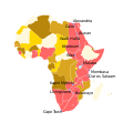
 Africa transport.png 792 × 764; 57 KB
-
 Cairo-Dakar Highway map 2016.png 639 × 397; 90 KB
-
 Cape to Cairo.svg 720 × 780; 65 KB
-
 East African Rail.svg 512 × 425; 339 KB
-
 Fina Regional OR TAMBO.svg 1,052 × 744; 95 KB
-
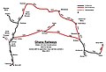 GhanaRailwayMap.jpg 1,000 × 684; 77 KB
-
 GhanaRailwayMap1.jpg 2,389 × 1,634; 274 KB
-
 Kariba Ferry Route.png 1,136 × 744; 62 KB
-
 Map of Southern Rhodesia c1927.jpg 1,400 × 828; 252 KB
-
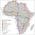
 Map of Trans-African Highways 2023.png 832 × 832; 211 KB
-
 Map of Trans-African Highways.PNG 832 × 832; 211 KB
-
 Railroads of Tropical Africa, 1950 - DPLA - 1aec33959ad96b168b9dae9aaa348aa2.jpg 8,192 × 6,266; 3.64 MB
-
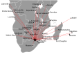
 Regional Flights from johannesburg.svg 504 × 299; 33 KB
.jpg)


