Category:Public transport maps of Japan
Jump to navigation
Jump to search
Subcategories
This category has the following 5 subcategories, out of 5 total.
Media in category "Public transport maps of Japan"
The following 26 files are in this category, out of 26 total.
-
 1922年大正11年の山手線路線図.png 1,166 × 738; 2.23 MB
-
-
 ALWEGGleisplanHaneda2018.png 2,025 × 6,468; 599 KB
-
 ALWEGGleisplanTama2018.png 1,608 × 6,720; 441 KB
-
 Gleis-undOBusleitungsplanKurobeTateyama2018.png 15,017 × 11,686; 2.06 MB
-
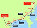 Hakone Ekiden Course Map en.jpg 3,072 × 2,304; 839 KB
-
 Hakone Ekiden Course Map jp.jpg 3,072 × 2,304; 860 KB
-
 Hankyu Linemap Romaji.svg 2,533 × 1,725; 1.72 MB
-
 JR Areas New.JPG 550 × 385; 29 KB
-
 Keio Line Map 2013.svg 512 × 127; 577 KB
-
 Keio-Stationmap.svg 3,991 × 1,166; 611 KB
-
 Keisei map.svg 512 × 225; 445 KB
-
 Kosai City Bus Route Map (2011-04).png 3,441 × 2,322; 360 KB
-
 Ligne JR Kobe.png 1,920 × 436; 75 KB
-
 Map japan minakami2.gif 698 × 657; 52 KB
-
 Meitetsu Nagoya Main Line Route Map (1988,Inbound).svg 985 × 817; 473 KB
-
 Meitetsu Nagoya Main Line Route Map (1988,Outbound).svg 985 × 817; 475 KB
-
 NittoBus RouteMap 1944.png 1,746 × 2,329; 661 KB
-
 R-Bahn-undOBusNetzentwicklungKurobeTateyama.png 11,396 × 8,764; 1.53 MB
-
 SchemaShonan.PNG 700 × 1,500; 85 KB
-
 Seikan ferry route map.svg 570 × 722; 11 KB
-
 ShonanMonorail Linemap en.svg 567 × 567; 221 KB
-
 ShonanMonorail Linemap.svg 567 × 567; 191 KB
-
 Toyobusmap.jpg 1,600 × 1,200; 866 KB
-
 Toyobusmapkey.jpg 1,200 × 1,600; 801 KB
-
 Wakayamashi network.png 1,163 × 560; 72 KB


.png)

.svg)
.svg)


