Category:Public transport maps of Hamburg
Jump to navigation
Jump to search
Federal states of Germany:
Subcategories
This category has the following 5 subcategories, out of 5 total.
A
- AKN Maps (6 F)
H
- HADAG Maps (1 F)
S
- S-Bahn maps of Hamburg (21 F)
T
- Tram maps of Hamburg (7 F)
U
- U-Bahn maps of Hamburg (39 F)
Media in category "Public transport maps of Hamburg"
The following 18 files are in this category, out of 18 total.
-
 PPN74210656X Verkehrsplan der Hamburger Hochbahn-Aktiengesellschaft (1939).jpg 10,571 × 6,342; 10.51 MB
-
 PPN74210656X Verkehrsplan der Hamburger Hochbahn-Aktiengesellschaft (1939).tif 10,730 × 7,174; 23.85 MB
-
 BahnlinienSH-2018-01-24.svg 512 × 365; 3.22 MB
-
 Hamburg public transport system map (with stations).png 14,670 × 13,115; 66.05 MB
-
 Old railway stations of Hamburg.svg 680 × 750; 4 KB
-
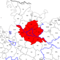 Hamburger VV-Gebiet 2007-12.png 600 × 600; 110 KB
-
 Bahnlinien im HVV.png 6,387 × 4,527; 1.54 MB
-
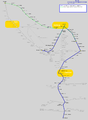 Metronom-Netz.png 1,168 × 1,596; 204 KB
-
 NBE-Gesamtnetz 2014.png 1,066 × 781; 87 KB
-
 NBE-Gesamtnetz 2015.png 1,066 × 781; 41 KB
-
 NBE-Gesamtnetz 2015.svg 1,697 × 1,435; 1.46 MB
-
 Planskizze Bhf. Hamburg-Kornweg.jpg 2,000 × 2,500; 678 KB
-
 Planskizze Bhf. Hoheneichen.jpg 2,000 × 2,500; 648 KB
-
 Straßenbahn-undOBusNetzentwicklungHarburg.png 2,413 × 4,007; 454 KB
-
 Tarifbroschuere SH-Tarif Allgemein.svg 794 × 794; 1.05 MB
-
 U-Straßenbahn-undOBusNetzentwicklungHamburg.png 10,662 × 10,592; 5.42 MB
-
 UBahnGleisplanHamburg2019.png 10,902 × 13,479; 3.07 MB
-
 Zentralbahn7.jpg 1,317 × 637; 718 KB
.jpg)


.png)