Category:Public transport maps of Germany
Jump to navigation
Jump to search
Federal states of Germany:
This Category is for public transport maps of Germany. If you're looking for
- Aviation maps: refer to Category:Aviation maps of Germany
- Railway maps: refer to Category:Rail transport maps of Germany
Subcategories
This category has the following 5 subcategories, out of 5 total.
B
- Bus maps of Germany (3 F)
T
Media in category "Public transport maps of Germany"
The following 32 files are in this category, out of 32 total.
-
 2011-03-05-eisenbahnmuseum-nuernberg-by-RalfR-39.jpg 1,294 × 1,979; 883 KB
-
 2011-03-05-eisenbahnmuseum-nuernberg-by-RalfR-41.jpg 1,347 × 1,431; 781 KB
-
 2015-07-18 FahrradmitnahmeDeutschland.jpg 2,238 × 3,381; 3.07 MB
-
 BAG Aufgabenträger 11-11-2014.jpg 3,311 × 4,681; 2.4 MB
-
 Dtl sbahn.svg 987 × 1,255; 153 KB
-
 Interconnex1-28-05-2006.gif 610 × 360; 9 KB
-
 Karte der Aufgabenträger des Schienenpersonennahverkehrs (SPNV) in Deutschland.png 1,721 × 1,471; 621 KB
-
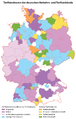
 Karte der Verkehrsverbünde und Tarifverbünde in Deutschland (inkl. Legende).png 2,923 × 1,982; 2.06 MB
-
 Karte der Verkehrsverbünde und Tarifverbünde in Deutschland, Österreich und der Schweiz.png 2,956 × 2,404; 1.75 MB
-
 Karte der Verkehrsverbünde und Tarifverbünde in Deutschland.png 1,432 × 2,248; 1.2 MB
-
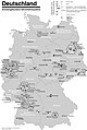
 Karte der ÖPNV-Systeme in Deutschland 2008.png 1,535 × 2,257; 456 KB
-
 Karte Metro-, Tram- und Obussysteme.svg 1,736 × 2,326; 4.65 MB
-
 Karte NordWestBahn 2012.svg 1,232 × 1,326; 4.92 MB
-
 Karte NordWestBahn 2014.svg 1,232 × 1,326; 4.88 MB
-
 Karte NordWestBahn 2016.svg 1,232 × 1,326; 4.86 MB
-
 Karte NordWestBahn 2022.svg 1,232 × 1,326; 4.84 MB
-
 Karte S-Bahnnetze in Deutschland.svg 1,726 × 2,416; 1.63 MB
-
 Karte ÖPNV-Netze Deutschland.svg 1,736 × 2,326; 4.64 MB
-
 Kostenlose Hundemitnahme im ÖPNV in Deutschland.svg 958 × 1,504; 1.35 MB
-
 Linienband HAGESTRA544.JPG 2,560 × 1,920; 1,007 KB
-
 Liniennetz Stadtbus Sondershausen.png 1,497 × 1,058; 324 KB
-
 LokalbahnNetzentwicklungBadenweiler.png 2,915 × 752; 87 KB
-
 OePNVSystemeDeutschland.png 1,172 × 1,700; 322 KB
-
 OePNVSystemeDeutschlandJanuar2003.jpg 1,260 × 1,877; 205 KB
-
 Straßenbahn-undOBusNetzentwicklungWeimar.png 1,660 × 2,908; 279 KB
-
 StraßenbahnNetzentwicklungBadSchandau.png 3,610 × 1,477; 154 KB
-
 StraßenbahnNetzentwicklungDöbeln.png 1,229 × 1,029; 106 KB
-
 StraßenbahnNetzentwicklungOelsnitz.png 1,627 × 4,292; 196 KB
-
 Tarifverbünde in Deutschland.svg 958 × 1,504; 1.56 MB
-
 Verkehrsverbünde (Deutschland) Stand 01.06.2006.png 500 × 646; 23 KB
-
 Verkehrsverbünde (Deutschland).png 500 × 646; 31 KB
-
 ÖPNV-Tarifsysteme in Deutschland.png 1,432 × 2,246; 523 KB


_in_Deutschland.png)
.png)


_Stand_01.06.2006.png)
.png)
