Category:Political maps of New York (state)
Jump to navigation
Jump to search
States of the United States: Alabama · Alaska · Arizona · Arkansas · California · Colorado · Connecticut · Delaware · Florida · Georgia · Hawaii · Idaho · Illinois · Indiana · Iowa · Kansas · Kentucky · Louisiana · Maine · Maryland · Massachusetts · Michigan · Minnesota · Mississippi · Missouri · Montana · Nebraska · Nevada · New Hampshire · New Jersey · New Mexico · New York · North Carolina · North Dakota · Ohio · Oklahoma · Oregon · Pennsylvania · Rhode Island · South Carolina · Tennessee · Texas · Utah · Vermont · Virginia · Washington · West Virginia · Wisconsin · Wyoming – Washington, D.C.
American Samoa · Northern Mariana Islands · United States Virgin Islands
American Samoa · Northern Mariana Islands · United States Virgin Islands
Subcategories
This category has the following 4 subcategories, out of 4 total.
E
N
Media in category "Political maps of New York (state)"
The following 13 files are in this category, out of 13 total.
-
 Civics for New York State (1901) (14594099050).jpg 3,024 × 1,868; 1 MB
-
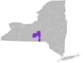 New York Senate District 52.png 2,755 × 2,084; 325 KB
-
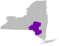
 New York's 52nd Senate District.png 2,301 × 1,740; 241 KB
-
 NY Senate District 50.png 2,869 × 2,240; 350 KB
-
 NY Senate District 51.png 2,869 × 2,240; 355 KB
-
 NYSen1920.svg 800 × 600; 2.83 MB
-
 NYSen1926.svg 800 × 600; 2.83 MB
-
 NYSen1928.svg 800 × 600; 2.83 MB
-
 NYSen1932.svg 800 × 600; 2.83 MB
-
 NYSen1934.svg 800 × 600; 2.83 MB
-
 NYSen1938.svg 800 × 600; 2.83 MB
-
 NYSen1940.svg 800 × 600; 2.83 MB
-
 NYSen1944.svg 800 × 600; 2.83 MB
_(14594099050).jpg)


