Category:Political maps of California
Jump to navigation
Jump to search
States of the United States: Alabama · Alaska · Arizona · Arkansas · California · Colorado · Connecticut · Delaware · Florida · Georgia · Hawaii · Idaho · Illinois · Indiana · Iowa · Kansas · Kentucky · Louisiana · Maine · Maryland · Massachusetts · Michigan · Minnesota · Mississippi · Missouri · Montana · Nebraska · Nevada · New Hampshire · New Jersey · New Mexico · New York · North Carolina · North Dakota · Ohio · Oklahoma · Oregon · Pennsylvania · Rhode Island · South Carolina · Tennessee · Texas · Utah · Vermont · Virginia · Washington · West Virginia · Wisconsin · Wyoming – Washington, D.C.
American Samoa · Northern Mariana Islands · United States Virgin Islands
American Samoa · Northern Mariana Islands · United States Virgin Islands
drawing electoral boundaries, esp. for the U.S. House of Representatives, in California | |||||
| Upload media | |||||
| Subclass of |
| ||||
|---|---|---|---|---|---|
| Facet of | |||||
| |||||
Subcategories
This category has the following 3 subcategories, out of 3 total.
E
Media in category "Political maps of California"
The following 29 files are in this category, out of 29 total.
-
 2010 CA Judges.svg 621 × 733; 345 KB
-

-

-
 CA CCW Counties Fall 2020.png 1,000 × 1,333; 446 KB
-
 CA CCW Counties JAN 2018V3.1.png 1,000 × 1,333; 921 KB
-
 CA CCW Counties JAN 2018V3.png 1,000 × 1,333; 921 KB
-
 CA CCW Good Cause Jan 2017.png 1,000 × 1,333; 985 KB
-
 CA Prop64 2016.png 596 × 676; 35 KB
-
 CA40.png 500 × 837; 90 KB
-
 CA46.png 439 × 480; 17 KB
-
 CACCWCounties Fall2020.png 1,000 × 1,333; 449 KB
-
 CACCWCounties.png 1,200 × 1,600; 1.45 MB
-
 CACCWCountiesJan2018.jpg 600 × 800; 133 KB
-
 CACCWCountiesJuly2017.jpg 800 × 1,067; 557 KB
-
 Cal3 map.svg 621 × 733; 255 KB
-
 California 1970 gov.png 6,900 × 4,275; 384 KB
-
 California 4way secession proposal.svg 621 × 733; 259 KB
-
 California Board of Equalization Districts from 2023.svg 800 × 929; 4.13 MB
-
 California CCW Issuance Map.png 1,000 × 1,333; 440 KB
-
 California CCW Map.png 596 × 676; 25 KB
-
 CaliFOURnia map.svg 621 × 733; 255 KB
-
 Condados Rep California 2008.png 372 × 347; 20 KB
-
 Los Angeles County Supervisorial districts.svg 1,056 × 1,056; 80 KB
-
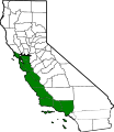 Map of California highlighting 2009 Maze CoastWest.svg 9,164 × 10,536; 241 KB
-
 New California map.svg 641 × 753; 272 KB
-
 Six Californias.png 596 × 676; 13 KB
-
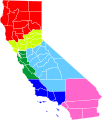 Six Californias.svg 621 × 733; 255 KB
-
 South California proposal (vector).svg 9,164 × 10,536; 241 KB
-
 South California proposal.png 521 × 599; 49 KB


.svg)
