Category:Political maps of Massachusetts
Jump to navigation
Jump to search
States of the United States: Alabama · Alaska · Arizona · Arkansas · California · Colorado · Connecticut · Delaware · Florida · Georgia · Hawaii · Idaho · Illinois · Indiana · Iowa · Kansas · Kentucky · Louisiana · Maine · Maryland · Massachusetts · Michigan · Minnesota · Mississippi · Missouri · Montana · Nebraska · Nevada · New Hampshire · New Jersey · New Mexico · New York · North Carolina · North Dakota · Ohio · Oklahoma · Oregon · Pennsylvania · Rhode Island · South Carolina · Tennessee · Texas · Utah · Vermont · Virginia · Washington · West Virginia · Wisconsin · Wyoming – Washington, D.C.
American Samoa · Northern Mariana Islands · United States Virgin Islands
American Samoa · Northern Mariana Islands · United States Virgin Islands
Subcategories
This category has the following 4 subcategories, out of 4 total.
E
Media in category "Political maps of Massachusetts"
The following 35 files are in this category, out of 35 total.
-
 10-29-2018 MA Cannabis Bans and Moratoriums.png 2,400 × 1,492; 195 KB
-
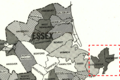
 1876 1st Essex senate district map Massachusetts.jpg 3,200 × 1,949; 1.09 MB
-
 1876 2nd Middlesex senate district map Massachusetts.jpg 3,200 × 1,949; 1.09 MB
-
 1876 2nd Worcester senate district map Massachusetts.jpg 3,200 × 1,949; 1.1 MB
-
 1876 3rd Essex senate district map Massachusetts.jpg 3,200 × 1,949; 1.09 MB
-
 1876 4th Middlesex senate district map Massachusetts.jpg 3,200 × 1,949; 1.1 MB
-
 1876 5th Middlesex senate district map Massachusetts US.jpg 3,200 × 1,949; 1.1 MB
-
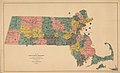
 1876 Massachusetts state senate district map.jpg 3,200 × 1,949; 1.04 MB
-
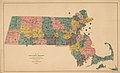
 1886 Massachusetts state senate district map.jpg 3,200 × 1,954; 1.16 MB
-
 1906 Massachusetts state senate district map.jpg 3,200 × 2,015; 1.22 MB
-
 190th MA-House composition.png 788 × 467; 28 KB
-
 1916 Massachusetts state senate district map.jpg 3,200 × 2,012; 1.14 MB
-
 1973 1st Essex district Massachusetts House of Representatives.png 863 × 572; 836 KB
-
 1973 Massachusetts state House of Representatives district map.jpg 3,200 × 2,384; 1.68 MB
-
 1977 Massachusetts state senate district map.jpg 3,200 × 2,085; 1.4 MB
-
 1987 Massachusetts state senate district map.jpg 3,200 × 2,143; 1.46 MB
-
 1993 Massachusetts state House of Representatives district map.jpg 3,200 × 2,358; 1.83 MB
-
 1993 Massachusetts state senate district map.jpg 3,200 × 2,449; 1.84 MB
-
 2001 Massachusetts state House of Representatives district map.jpg 3,200 × 2,114; 1.1 MB
-
 2001 Massachusetts state senate district map.jpg 3,200 × 2,006; 876 KB
-
 2004 1st Essex district Massachusetts House of Representatives US.png 945 × 789; 631 KB
-
 2004 map Suffolk districts Massachusetts House of Representatives.jpg 1,522 × 1,354; 1.15 MB
-
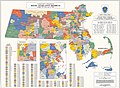
 2004 Massachusetts state House of Representatives district map.jpg 4,500 × 3,362; 1.36 MB
-
 2011 map Suffolk districts Massachusetts House of Representatives.jpg 1,591 × 1,456; 1.46 MB
-
 2011 Massachusetts state House of Representatives district map US.jpg 4,500 × 3,352; 1.52 MB
-
 6 21 2018 MA Cannabis Bans and Moratoriums.png 2,400 × 1,492; 196 KB
-
 MA 2014 3rd Parties only.png 2,400 × 1,492; 91 KB
-
 MA Q4 2016.png 2,400 × 1,492; 186 KB
-
 Map of Boston, showing the new wards (3856484788).jpg 1,841 × 2,000; 2.8 MB
-
 Massachusetts Councillor Districts 2007.jpg 800 × 490; 386 KB
-
 Massachusetts Councillor Districts 2012.png 844 × 514; 120 KB
-
 Massachusetts Democratic gubernatorial primary results by municipality, 2014.svg 2,100 × 1,300; 1.55 MB
-
 Massachusetts judicial district map.png 2,000 × 1,228; 358 KB
-
 Massachusetts Municipal Map.png 2,280 × 1,444; 69 KB
-
 Massachusetts State Senate January 2021.svg 6,000 × 4,471; 68 KB


.jpg)


