Category:OpenStreetMap maps of Karnataka
Jump to navigation
Jump to search
States of India: Andhra Pradesh · Gujarat · Karnataka · Kerala · Maharashtra · Punjab · Rajasthan · Tamil Nadu · Telangana · West Bengal
Union territories: Delhi ·
Former states of India:
Former union territories:
Union territories: Delhi ·
Former states of India:
Former union territories:
Subcategories
This category has only the following subcategory.
B
- OpenStreetMap maps of Bangalore (11 F)
Media in category "OpenStreetMap maps of Karnataka"
The following 13 files are in this category, out of 13 total.
-
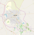 Dharwar city map.png 6,003 × 6,112; 10.92 MB
-
 Dharwar Map.svg 2,456 × 2,498; 8.55 MB
-
 Gokarna Beaches and Temples Map.png 750 × 750; 315 KB
-
 Hampi Vijayanagara in early 16th century, South India.jpg 1,292 × 1,122; 277 KB
-
 Hassan map kannada.svg 631 × 586; 1.18 MB
-
 Trees planted by Salumarada Thimmakka mapped on OSM.png 483 × 768; 72 KB
-
 ಕಲಬುರ್ಗಿ.svg 1,052 × 744; 2.64 MB
-
 ಕಾವೇರಿ ನದಿ.png 744 × 683; 232 KB
-
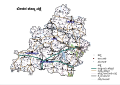 ಬೀದರ ಜಿಲ್ಲಾ ನಕ್ಷೆ.svg 1,052 × 744; 3.8 MB
-
 ಬೀದರ ನಕ್ಷೆ.svg 1,052 × 744; 1.64 MB
-
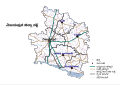
 ಯಾದಗಿರಿ ಜಿಲ್ಲೆ.svg 1,052 × 744; 3.51 MB
-
 ಯಾದಗಿರಿ ನಕ್ಷೆ.svg 1,052 × 744; 1.2 MB
-
 ವಿಜಯಪುರ.svg 1,052 × 744; 1.82 MB


