Category:OpenStreetMap maps of Andhra Pradesh
Jump to navigation
Jump to search
Media in category "OpenStreetMap maps of Andhra Pradesh"
The following 15 files are in this category, out of 15 total.
-
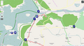
 Alluri Sitharama Raju.png 1,618 × 833; 1.26 MB
-
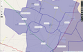
 Andhra Pradesh Mandals-Telugu.png 1,920 × 1,046; 1.84 MB
-
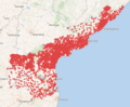
 Andhra Pradesh villages with coords on Wikidata.png 1,850 × 1,053; 1.61 MB
-
 AP villages with coordinates (Closeup around Guntur) 2024-06-01.png 1,850 × 1,053; 1.64 MB
-
 AP villages with coordinates 2024-06-01.png 807 × 683; 321 KB
-
 AP villages with coordinates on wikidata.png 807 × 663; 404 KB
-
 India Andhra Pradesh NH network.png 774 × 679; 580 KB
-
 India Andhra Pradesh Rail network.png 784 × 684; 429 KB
-
 Nagarajunasagar tourist attractions.png 1,311 × 716; 287 KB
-
 Prakasam district places.png 859 × 652; 306 KB
-
 Sample village paynchats in a Sub District(Mandal).png 1,340 × 834; 344 KB
-
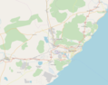
 Satish Dhawan Space Centre.jpg 1,108 × 927; 63 KB
-
 Visakhapatnam City Area Map.png 1,176 × 1,070; 235 KB
-
 Visakhapatnam street map.png 1,468 × 1,155; 495 KB
-
 కోటప్ప కొండ శిఖరాలు.png 832 × 601; 305 KB


_2024-06-01.png)


.png)


