Category:Old maps of the Ottoman Empire
Jump to navigation
Jump to search
Austrian Empire · Austria-Hungary · Great Britain · British Empire · Byzantine Empire · Carolingian Empire · Republic of Genoa · Habsburg Monarchy · Holy Roman Empire · Polish-Lithuanian Commonwealth · Ottoman Empire · Prussia · Grand Duchy of Moscow · Tsardom of Russia · Russian Empire · Soviet Union · Spanish Empire ·
| Category Old maps of the Ottoman Empire on sister projects: | |||||||||
|---|---|---|---|---|---|---|---|---|---|
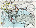
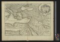
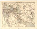
Old maps of the Ottoman Empire.
This category is for old maps showing all or a large part of the Ottoman Empire. See subcategories for smaller areas.
- "Old maps" means maps made over seventy (70) years ago.
| Where to categorize or find maps of the Ottoman Empire made in the last 70 years: |
|---|
| Category:Maps of the Ottoman Empire or its subcategories |
Subcategories
This category has the following 12 subcategories, out of 12 total.
Media in category "Old maps of the Ottoman Empire"
The following 165 files are in this category, out of 165 total.
-
 12 of 'Narrative of a tour through some parts of the Turkish Empire' (11007657956).jpg 6,575 × 4,871; 4.61 MB
-
 A Mapp of the Citie and Port of Tripoli in Barbary - by John Seller 1675.JPG 6,079 × 4,891; 11.56 MB
-
 Map of Northern Koordistan (1870).jpg 3,781 × 2,029; 4 MB
-
 FIELD(1885) p008 THE HISTORICAL LANDSCAPES OF THE CENTRAL OTTOMAN EMPIRE.jpg 1,323 × 2,052; 871 KB
-
 FIELD(1885) p195 TURKEY IN EUROPE, BEFORE THE WAR WITH RUSSIA.jpg 2,100 × 1,373; 1.57 MB
-
 FIELD(1885) p224 TURKEY IN EUROPE, AFTER THE WAR WITH RUSSIA.jpg 2,095 × 1,373; 1.58 MB
-
 18th century map of the Black Sea and the adjacent parts of Russia and Turkey.jpg 7,311 × 6,663; 29.4 MB
-

-
 28 of 'Étude sur les Valaques de l'Empire Ottoman. (With a map.)' (11229184565).jpg 1,373 × 2,643; 701 KB
-
 29 of 'Étude sur les Valaques de l'Empire Ottoman. (With a map.)' (11228268794).jpg 1,407 × 2,643; 688 KB
-

-

-

-

-
 A harom reszre szakadt Magyar allam terkepe (1567).JPG 2,730 × 1,675; 986 KB
-
 A Short History of the World, p0297.jpg 1,155 × 913; 274 KB
-

-
 Adrianopel - 44-42.jpg 3,773 × 4,991; 3.55 MB
-
 Asia minor 1712.jpg 1,581 × 1,200; 1.48 MB
-
 Aut-hong-emp-ott-grece.JPG 1,761 × 1,809; 1 MB
-
 Autonomous Armenia Ottoman proposal 1919,after WWI.jpg 720 × 1,454; 758 KB
-
 Balkan peninsula and Ottoman Empire until 1699.jpg 2,764 × 4,418; 3.72 MB
-
 Balkans War Theatre.jpg 4,088 × 3,323; 5.41 MB
-
 Bg-tr-dogovor-1915.jpg 1,560 × 1,587; 901 KB
-
 Bohtan principality.png 749 × 444; 864 KB
-
 Bosnia-Herzegovina and Sanjak of Novibazar.JPG 5,696 × 5,200; 16.94 MB
-
 Brockhaus and Efron Encyclopedic Dictionary b59 288-3.jpg 2,426 × 1,656; 950 KB
-
 Burgas - 45-42.jpg 3,778 × 4,993; 3.14 MB
-
 Busza-1648.jpg 400 × 292; 26 KB
-
 C. 1355 Southeastern Europe.jpg 1,690 × 1,335; 1.37 MB
-
 C. 1400 Southeastern Europe.jpg 1,862 × 1,390; 2.75 MB
-
 C. 1481 Southeastern Europe Ottoman Empire.jpg 1,408 × 1,344; 1.01 MB
-
 C. 1650 Ottoman Empire.jpg 1,520 × 1,081; 1.7 MB
-
 C. 1893 Southeastern Europe and Asia Minor (1683-1893).jpg 2,123 × 1,368; 1.81 MB
-
 C. 1897 Ottoman Empire (1356-1897).jpg 3,138 × 4,063; 4.72 MB
-
 CarlSaxET1877.jpg 3,100 × 2,968; 7.57 MB
-
-

-

-
 Christian Schools in Macedonia early 20th.jpg 2,000 × 1,538; 557 KB
-
 D535- N° 406. Plus grande Turquie. - liv3-ch14.png 1,436 × 1,754; 524 KB
-
 Die Gartenlaube (1853) b 467.jpg 2,444 × 2,622; 2.77 MB
-
 Dimotika - 44-41.jpg 3,835 × 4,971; 2.92 MB
-

-
 Durazzo - 37-41.jpg 3,809 × 5,001; 2.26 MB
-
 Dzumaja - 41-42.jpg 3,748 × 4,998; 3.14 MB
-
 Egri Palanka - 40-42.jpg 3,740 × 5,020; 3.14 MB
-
 Elbasan - 38-41.jpg 3,835 × 4,996; 3.11 MB
-
 Estats de l'empire dv Grand Seignevr.jpg 1,793 × 1,304; 670 KB
-
 Europaeische Türkey Und Griechenland nebst den Ionischen Inseln.jpg 4,502 × 5,452; 7.47 MB
-
 Frontier defined by the Bulgarian–Ottoman Convention of 1915.png 1,500 × 3,000; 586 KB
-
 Gallipoli - 44-40.jpg 3,928 × 5,037; 1.79 MB
-

-

-
 General-Karte von der Europäischen Türkei 01.jpg 8,255 × 5,993; 18.81 MB
-
 General-Karte von der Europäischen Türkei 09.jpg 8,294 × 6,003; 18.24 MB
-
 General-Karte von der Europäischen Türkei 10.jpg 8,223 × 6,019; 16.65 MB
-
 General-Karte von der Europäischen Türkei 11.jpg 8,219 × 6,019; 18.98 MB
-
-
 Generalkarte von Mitteleuropa Scutari - 37-42 (Zadrima).jpg 1,135 × 1,677; 580 KB
-
 Gottlieb Schumacher. Karte des Ostjordanlandes Blatt I. 1900.jpg 1,024 × 1,200; 249 KB
-
 Halkiziki - 41-40.jpg 3,862 × 4,992; 2.43 MB
-

-

-
 Janina - 39-40.jpg 3,862 × 4,997; 2.54 MB
-
 Kars1828.jpg 709 × 614; 187 KB
-
 Karte bosporus.jpg 357 × 596; 84 KB
-
 Karte des Ostjordanlandes.jpg 22,772 × 20,864; 364.37 MB
-
 Kavala - 42-41.jpg 3,837 × 4,965; 2.86 MB
-
 Korfu - 38-40.jpg 3,869 × 5,033; 2.85 MB
-
 KR 24 Estats de l'Empire du grand seigneur dit sultan et Ottomans empereur.jpg 2,280 × 1,659; 447 KB
-
 Larisa - 40-40.jpg 3,867 × 5,028; 2.36 MB
-
 Map - Special Collections University of Amsterdam - OTM- HB-KZL 32.03.13.tif 7,344 × 6,330; 133 MB
-
 Map - Special Collections University of Amsterdam - OTM- HB-KZL 32.03.25.tif 7,377 × 6,214; 131.15 MB
-
 Map - Special Collections University of Amsterdam - OTM- HB-KZL 32.03.26.tif 7,457 × 6,130; 130.78 MB
-
 Map - Special Collections University of Amsterdam - OTM- HB-KZL 32.03.28.tif 7,285 × 5,998; 125.01 MB
-
 Map - Special Collections University of Amsterdam - OTM- HB-KZL 33.06.14.tif 7,527 × 6,382; 137.44 MB
-
 Map - Special Collections University of Amsterdam - OTM- HB-KZL 34.13.10.tif 9,052 × 6,939; 179.71 MB
-
 Map - Special Collections University of Amsterdam - OTM- HB-KZL 34.19.25.tif 10,577 × 5,871; 177.66 MB
-
 Map of hazari detailed.jpg 2,777 × 1,976; 996 KB
-
 Map of hazari.jpg 2,080 × 1,502; 668 KB
-
 Map of Imperium Turcicum.JPG 3,072 × 2,304; 1.23 MB
-
 Map of Persia, Turkey in Asia - Afghanistan, Beloochistan. LOC 2013593018.jpg 4,636 × 3,630; 2.67 MB
-
 Map of Persia, Turkey in Asia - Afghanistan, Beloochistan. LOC 2013593018.tif 4,636 × 3,630; 48.15 MB
-

-

-

-
 Map The Ottoman Empire- Touring Club Italiano CART-TRC-45 01.jpg 4,877 × 3,317; 1.94 MB
-
 Marc-Antoine-Laugier-Histoire-des-négociations-pour-la-paix-conclue-à-Belgrade MG 0662.tif 5,274 × 3,282; 49.56 MB
-
 Monastir - 39-41.jpg 3,801 × 4,988; 2.88 MB
-
 Mutasarrifiyya de monte libano 1893.png 768 × 434; 740 KB
-
-

-
 Novipazar - 38-43.jpg 3,701 × 4,997; 3.11 MB
-
 Ottoman conquests.jpg 4,792 × 3,384; 6.65 MB
-
 Ottoman Empire 1870.jpg 2,224 × 1,713; 940 KB
-
 Ottoman Empire 699-726 AH.jpg 7,057 × 5,395; 6.17 MB
-
 Ottoman Empire In 1402.jpg 5,402 × 7,017; 6.13 MB
-
 Ottoman Empire in Asia since 1792.jpg 1,665 × 1,104; 513 KB
-
 Ottoman Provinces.jpg 1,984 × 803; 659 KB
-
 Ottoman-map-Africa.jpg 657 × 571; 113 KB
-
 Ottoman.jpg 776 × 651; 167 KB
-
 OttomanEmpire1801.jpg 1,638 × 1,296; 605 KB
-

-

-

-

-
 Pristina - 39-43.jpg 3,674 × 4,969; 4.09 MB
-
 Prizren - 38-42.jpg 3,733 × 5,017; 2.99 MB
-
 Reilly Karte von dem Oschmanischen Reiche in Europa.jpg 734 × 588; 124 KB
-
 Rodosto - 45-41.jpg 4,026 × 5,185; 2.66 MB
-
 SeptinsularRepublic1801.jpg 416 × 424; 265 KB
-
 Siege of Kars 1855.jpg 709 × 890; 208 KB
-
 Skoplje - 39-42.jpg 3,760 × 5,008; 2.92 MB
-

-

-
-
 South-eastern Europe 1354-1358.jpg 1,131 × 861; 390 KB
-
 South-eastern Europe 1401.jpg 1,142 × 879; 328 KB
-
 South-eastern Europe 1444.jpg 1,140 × 873; 302 KB
-
 South-eastern Europe 1464.jpg 1,143 × 876; 381 KB
-
 South-eastern Europe 1672.jpg 1,140 × 867; 339 KB
-
 South-eastern Europe 1700.jpg 1,126 × 859; 372 KB
-
 South-eastern Europe 1727.jpg 1,129 × 862; 355 KB
-
 South-eastern Europe 1861.jpg 1,122 × 859; 359 KB
-
 South-eastern Europe 1881.jpg 1,126 × 863; 357 KB
-
 Stara Zagora - 43-42.jpg 3,793 × 4,990; 3.54 MB
-
 The collapse of the Ottoman Empire.jpg 1,317 × 831; 675 KB
-

-

-
 The Times history of the war (1914) (14578037907).jpg 2,066 × 1,508; 333 KB
-
 Thrace Territory cession TurkeyBulgaria Oct1915.gif 500 × 657; 14 KB
-
 Towns in Hungary.png 405 × 576; 256 KB
-
 TripartiteAgreement1920.jpg 2,513 × 1,688; 1.04 MB
-
 Turcici imperii tabula Ottoman Empire.jpg 4,417 × 3,742; 8 MB
-
 Turcici Imperii, Ortelius (Samsun).jpg 457 × 429; 228 KB
-
 Turcici Imperii, Ortelius.jpg 7,979 × 6,052; 37.56 MB
-
 Turcicum imperium (8342747309).jpg 7,011 × 5,773; 39.01 MB
-
 Turcicum Imperium.jpg 2,972 × 2,480; 3.07 MB
-
 Turky in Asia LOC 2017586290.jpg 2,500 × 3,765; 1.38 MB
-
 Turky in Asia LOC 2017586290.tif 2,500 × 3,765; 26.93 MB
-
 Türkei und Schutzstaaten 1699-1877.jpg 356 × 470; 153 KB
-

-
 UBBasel Map 1661 Kartenslg Mappe 251-38 Natolia.tiff 9,839 × 6,852, 2 pages; 385.7 MB
-
 UBBasel Map 1670 Kartenslg Mappe 251-39 Asie.tiff 11,056 × 7,548, 2 pages; 238.78 MB
-
 UBBasel Map 1677 Kartenslg Mappe 250-2 Empire des Turcs.tiff 11,080 × 7,712, 2 pages; 244.5 MB
-
 UBBasel Map Balkanhalbinsel Italien Osmanisches Reich Südosteuropa 1686-1715 Kartenslg Mappe 250-10.tif 11,163 × 8,542, 2 pages; 272.84 MB
-
 UBBasel Map Rumänien Bulgarien Walachei Moldau 1584 Kartenslg Mappe 250-21.tif 9,926 × 7,005, 2 pages; 376.25 MB
-
 Vodena - 40-41.jpg 3,813 × 4,973; 2.96 MB
-
 Vorder-Asien. LOC 2013593006.jpg 7,120 × 5,707; 5.56 MB
-
 Vorder-Asien. LOC 2013593006.tif 7,120 × 5,707; 116.25 MB
-
 With the conquered Turk (1913).png 674 × 895; 175 KB
-
 WMK - Osmanischer Plan Wien 1683 1.jpg 2,564 × 2,564; 3.54 MB
-
 WMK - Osmanischer Plan Wien 1683 2.jpg 4,000 × 3,000; 5.51 MB
-
 Xanthi - 43-41.jpg 3,853 × 4,994; 2.6 MB
-
 «Armenian Hearth» proposal.Lausanne conference1924.jpg 703 × 1,103; 217 KB
-
 Берекетли Ѓол на карта.jpg 950 × 755; 109 KB
-
 Гурия и Аджария в 1873 г.jpg 3,133 × 3,615; 3.74 MB
-

-

-
 Маличкото Езеро на карта.jpg 951 × 1,239; 203 KB
-
 افغانستان بلوچستان بوهره ۱۸۹۱.jpg 699 × 1,081; 247 KB
-
 الشرارات في الخرائط العثمانية1.jpg 913 × 751; 516 KB
-
 ایران افغانستان بلوچستان بوهره خیوه ۱۸۹۱.jpg 699 × 1,197; 332 KB
-
 ایران افغانستان بلوچستان بوهره ۱۸۹۱.jpg 924 × 539; 182 KB
.jpg)

.jpg)
_p008_THE_HISTORICAL_LANDSCAPES_OF_THE_CENTRAL_OTTOMAN_EMPIRE.jpg)
_p195_TURKEY_IN_EUROPE,_BEFORE_THE_WAR_WITH_RUSSIA.jpg)
_p224_TURKEY_IN_EUROPE,_AFTER_THE_WAR_WITH_RUSSIA.jpg)

.jpg)
%27_(11229184565).jpg)
%27_(11228268794).jpg)
.jpg)
.jpg)
.jpg)
_(14782081432).jpg)
.JPG)

.jpg)


.jpg)
.jpg)


,_NG-501-47.jpg)


_b_467.jpg)

.jpg)


_Colton,_G.W._Turkey_In_Asia_And_The_Caucasian_Provinces_Of_Russia._1856_(croppe).jpg)


.jpg)


.jpg)


._Turkish_Empire,_Greece._1843.F.jpg)
._Turkish_Empire,_Greece._1843.FC.jpg)
._Turkish_Empire,_Greece._1843.G.jpg)


_(14578037907).jpg)


.jpg)

.jpg)


.png)


.jpg)
.jpg)


