Category:Old maps of Western Pomerania
Jump to navigation
Jump to search
Use the appropriate category for maps showing all or a large part of Western Pomerania. See subcategories for smaller areas:
| If the map shows | Category to use |
|---|---|
| Western Pomerania on a recently created map | Category:Maps of Western Pomerania or its subcategories |
| Western Pomerania on a map created more than 70 years ago | Category:Old maps of Western Pomerania or its subcategories |
| the history of Western Pomerania on a recently created map | Category:Maps of the history of Western Pomerania or its subcategories |
| the history of Western Pomerania on a map created more than 70 years ago | Category:Old maps of the history of Western Pomerania or its subcategories |
Subcategories
This category has the following 5 subcategories, out of 5 total.
G
- Old maps of Greifswald (12 F)
S
- Old maps of Stralsund (43 F)
Media in category "Old maps of Western Pomerania"
The following 44 files are in this category, out of 44 total.
-
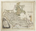
 Blaeu 1645 - Rugia Insula ac Ducatus.jpg 3,720 × 3,120; 1.19 MB
-
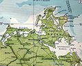
 Ausschnitt Pommern 1690.jpg 1,151 × 1,069; 253 KB
-

-
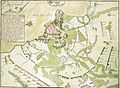
 Battle of Neuensund.jpg 637 × 663; 104 KB
-
 Blaeu 1645 - Pomeraniæ Ducatus tabula.jpg 3,607 × 3,023; 4.29 MB
-
 Blaeu 1645 - Pomeraniæ Ducatus tabula.png 2,913 × 2,261; 16.08 MB
-
 Central europe 1648 sheperd Hither Pomerania.jpg 378 × 378; 136 KB
-
 Central Europe, 919-1125, snippet North.PNG 1,354 × 681; 1.92 MB
-
 Del av nordöstra Tyskland med ön Rügen - Skoklosters slott - 98040.tif 4,171 × 3,534, 2 pages; 42.19 MB
-
 Eilhard Lubinus map of Pomerania - detail 1.png 1,600 × 1,200; 3.58 MB
-
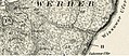
 Kreis Greifenhagen 1794.jpg 745 × 808; 361 KB
-
 Karte des Deutschen Reiches von 1893 (122) Wollin 5820122c.jpg 10,743 × 9,331; 16.94 MB
-
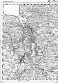
 Karte Pommern - westlicher Teil 1918.jpg 1,435 × 1,275; 508 KB
-

-
 Landung auf Rügen-1715.jpg 1,523 × 2,000; 1.82 MB
-
 Lange diercke sachsen deutsche landschaften boddenkueste.jpg 1,227 × 993; 551 KB
-
 Meßtischblatt 260 261 Sagard 1920 Ausschnitt Stubnitz.jpg 786 × 342; 282 KB
-
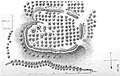 Schlosswall bei Werder 1868.jpg 947 × 604; 403 KB
-

-
 Belagerung von Stralsund 1715.JPG 2,162 × 1,586; 920 KB
-
 Karte Greifswalder Bahnen.png 256 × 211; 119 KB
-
 RB Stralsund.jpg 1,519 × 1,295; 447 KB
-
 Sundische Wiese. Landaufnahme 1835.jpg 2,460 × 1,782; 1.31 MB
-
 Tophographischen Special Karte von Reymann - 44 Szczecin 1.jpg 2,160 × 3,072; 1.95 MB
-
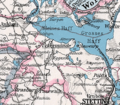 Pommern Kr Ueckermünde.png 388 × 338; 86 KB
-
 Der neue Prospekt des See-, Sol- und Moorbades Kolberg 1913 (90009933).jpg 14,263 × 9,902; 18.25 MB
-
 Der neue Prospekt des See-, Sol- und Moorbades Kolberg 1913 (90009959).jpg 14,687 × 9,858; 22.95 MB
-
 Der neue Prospekt des See-, Sol- und Moorbades Kolberg 1914. 1914 (23218304).jpg 1,728 × 2,587; 1.29 MB
-
 Der neue Prospekt des See-, Sol- und Moorbades Kolberg 1914. 1914 (23218305).jpg 6,306 × 4,832; 5.81 MB
-
 Der neue Prospekt des See-, Sol- und Moorbades Kolberg 1914. 1914 (23218306).jpg 6,392 × 4,815; 5.32 MB
-

-
-

-

-

-
-
 Kolberg - Sol-, Moor- und Seebad. 1923 (77784796).jpg 3,583 × 2,306; 1.62 MB
-
 Neuester illustrierter Fuhrer durch Bad Kolberg und Henkenhagen 1902 (90455184).jpg 5,804 × 5,062; 6.05 MB
-
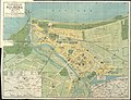
 Pharus-Plan Swinemunde ca 1912 (33073419).jpg 11,258 × 9,499; 22.06 MB
-
 Pharus-Plan Swinemunde ca 1914 (33073417).jpg 11,244 × 9,365; 20.05 MB
-
 Plan der Festung Colberg im Jahre 1807. 1851 (30036890).jpg 13,776 × 11,065; 28.12 MB
-
 Plan von Kolberg - mit nachster Umgebung. 18 (29709331).jpg 15,359 × 11,559; 31.02 MB
-
 Plan zur Geschichte der Belagerung Colbergs 1761. 1841 (24215701).jpg 13,070 × 8,680; 23.15 MB
-
 Ubersichtsplan der Stadt Swinemunde 1940 (33073425).jpg 20,239 × 23,950; 67.78 MB


%27_(11287276203).jpg)


_Wollin_5820122c.jpg)


.jpg)
.jpg)
.jpg)
.jpg)
.jpg)
.jpg)
.jpg)
.jpg)
.jpg)
.jpg)
.jpg)
.jpg)
.jpg)
.jpg)
.jpg)
.jpg)
.jpg)
.jpg)
.jpg)