Category:Old maps of South America
Jump to navigation
Jump to search
Temperate regions: North America · South America · Africa · Europe · Asia · Oceania – Polar regions: Antarctica · Arctic – Other regions: Eurasia
Use the appropriate category for maps showing all or a large part of South America. See subcategories for smaller areas:
| If the map shows | Category to use |
|---|---|
| South America on a recently created map | Category:Maps of South America or its subcategories |
| South America on a map created more than 70 years ago | Category:Old maps of South America or its subcategories |
| the history of South America on a recently created map | Category:Maps of the history of South America or its subcategories |
| the history of South America on a map created more than 70 years ago | Category:Old maps of the history of South America or its subcategories |

Subcategories
This category has the following 24 subcategories, out of 24 total.
Media in category "Old maps of South America"
The following 120 files are in this category, out of 120 total.
-
 172 of '(Travelling About over New and Old Ground, etc.)' (11283535883).jpg 1,225 × 1,657; 431 KB
-
 172 of 'Travelling About over New and Old Ground, etc' (11247521636).jpg 1,268 × 1,650; 457 KB
-
 Map of South America Wellcome L0051066.jpg 4,944 × 5,852; 8.06 MB
-
 1894 Map of South America.jpg 2,932 × 3,552; 2.32 MB
-
 NSRW South America.png 2,781 × 3,766; 16.02 MB
-
 199 of 'Travels in search of new trade products' (11222318836).jpg 1,192 × 1,924; 455 KB
-

-

-
 269 of 'Le Continent austral. Hypothèses et découvertes' (11302973116).jpg 1,459 × 1,265; 257 KB
-

-

-

-

-

-
 53 of 'Atlas' (11188398673).jpg 3,912 × 4,446; 3.59 MB
-

-

-

-

-

-
 A history of South America, 1854-1904 (1905) (14594940347).jpg 4,562 × 2,434; 2.35 MB
-
 A history of South America, 1854-1904 (1905) (14781447665).jpg 2,448 × 2,988; 811 KB
-

-

-
 Admiralty Chart Catalogue 1967 Page 100 Index S.jpg 8,568 × 6,812; 7.92 MB
-
 Admiralty Chart No 527 A general chart of South America, Published 1824.jpg 10,213 × 12,618; 14.05 MB
-
 Admiralty Chart No 786 Cape Horn to Cape Corrientes, Published 1876, New Edition 1922.jpg 11,430 × 20,177; 67.92 MB
-
-
 America Meridonalis.jpg 4,168 × 2,631; 3.29 MB
-

-
 Annual reports of the boards to the General Assembly (1877) (14778338712).jpg 1,586 × 2,378; 745 KB
-
 Around and about South America (1895) (14796715713).jpg 3,008 × 3,914; 3.17 MB
-
 A map of Caracas (NYPL b15376638-1404015).jpg 6,299 × 5,248; 6.94 MB
-
 Brazil2.png 930 × 1,020; 766 KB
-
 Brockhaus and Efron Encyclopedic Dictionary b2 604-2.jpg 2,552 × 3,531; 3.38 MB
-
 Brockhaus and Efron Encyclopedic Dictionary b2 604-4.jpg 2,552 × 3,472; 3.65 MB
-
 Brockhaus and Efron Jewish Encyclopedia e2 255-0.jpg 1,890 × 2,362; 1.02 MB
-
 Bulletin (1946) (20433258021).jpg 1,844 × 3,484; 1.08 MB
-

-

-
 CD2 33-Equator-Expedition.png 2,942 × 4,725; 245 KB
-
 Chart of South America JRGSL Volume I.jpg 4,627 × 6,300; 1.69 MB
-
 Chilleurs-aux-Bois - château de Chamerolles, promenade des parfums 40.jpg 5,472 × 3,648; 9.58 MB
-
 Como - Collegio Gallio 1045.JPG 4,000 × 6,000; 10.43 MB
-

-
 Early-tactile-map.jpg 1,370 × 1,716; 508 KB
-
 EB1911 South America - Geology.jpg 1,063 × 1,512; 346 KB
-
 EB1911 South America.jpg 3,307 × 4,634; 4.25 MB
-
 ETH-BIB-Südamerika, Karte-Dia 247-06028.tif 3,042 × 3,521; 30.74 MB
-
 George Catlin's travels in South America, 1852-1858.jpg 2,316 × 3,189; 3.68 MB
-
 Identificación fundamental Paul Gallez.jpg 800 × 470; 69 KB
-
 Itaú Cultural 2018 015.jpg 3,456 × 5,184; 18.7 MB
-
 Itaú Cultural 2018 016.jpg 5,184 × 3,456; 13.47 MB
-
 J. H. Colton's School Atlas, 1860 - DPLA - 9afa4d40de861bb7b2a7e024bba61c0e (page 27).jpg 4,093 × 4,828; 1.91 MB
-

-

-

-
 Karte von den Central-Regionem Süd-Amerika's (34202396980).jpg 1,200 × 659; 443 KB
-
 Karte von Süd-Amerika zur Übersicht der Unebenheiten des Bodens.jpg 5,723 × 4,660; 7.13 MB
-
 La-Roché-Island-Longitude.png 2,805 × 4,053; 32.58 MB
-
 Map - Special Collections University of Amsterdam - OTM- HB-KZL 104-01-32.jpg 2,500 × 3,251; 3.57 MB
-
 Map of Patagonia, Argentina.jpg 600 × 800; 119 KB
-
 Map of Southern portion of South America Wellcome L0051077.jpg 5,314 × 4,926; 4.35 MB
-
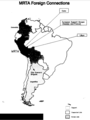 Mapa de conexiones extranjeras del MRTA.png 440 × 587; 51 KB
-

-
 Mapa del Chaco Boreal.jpg 479 × 436; 122 KB
-
 Mapa geográfico de América Meridional, Juan de la Cruz Cano y Olmedilla, 1775 (láminas juntas).jpg 14,672 × 18,635; 185.39 MB
-
 Mapa geográfico de América Meridional, Juan de la Cruz Cano y Olmedilla.jpg 15,300 × 21,000; 46.14 MB
-
 Mapa histórico de América del Sur (1912) (3386187586).jpg 2,544 × 2,359; 1.37 MB
-

-

-
 Peru, Chili and Magellanica (NYPL b14428893-1503456).jpg 4,178 × 5,248; 4.77 MB
-
 Peru, Chili and Magellanica (NYPL b14428893-1503456).tiff 4,178 × 5,248; 62.75 MB
-

-
-
 Map of South America .. (NYPL b15369994-1630436).jpg 6,695 × 4,185; 33.57 MB
-
 Chili, Paraguay, Bresil, Amazones et Perou (NYPL Hades-1761765-1621540).jpg 6,936 × 4,790; 34.65 MB
-
 Old civilizations of Inca land (1924) (20654410605).jpg 2,060 × 3,008; 522 KB
-
 Pascaerte van Nova Hispania, Chili, Peru, en Guatimala (7537871500).jpg 2,000 × 1,705; 3.37 MB
-

-

-

-
 Patagonia2.jpg 800 × 1,067; 174 KB
-
 Piri reis harita.jpg 511 × 668; 380 KB
-
 Piri Reis map interpretation RG.jpg 800 × 645; 187 KB
-
 Piri Reis map interpretation.jpg 800 × 800; 221 KB
-

-
 Pérou et Brésil (34423196561).jpg 7,254 × 5,673; 25.47 MB
-

-
 Relacion historica del viage a la America meridional (37940442794).jpg 8,673 × 5,405; 19.82 MB
-

-
 South America (4586558327).jpg 2,000 × 1,674; 3.3 MB
-
 South America (PSF).png 1,629 × 2,108; 975 KB
-
 South America Map Luis Feuillet.jpg 548 × 384; 35 KB
-
 South America NYPL1584667.tiff 5,428 × 6,720; 104.36 MB
-
 South America, 1808 - Laurie & Whittle.jpg 1,339 × 1,855; 2.28 MB
-

-
 Süd-America - von C. G. Reichard - btv1b530890197.jpg 8,517 × 10,209; 16.19 MB
-

-
 Süd-America. 1-15.000.000 - Gezeichnet v. H. Kiepert - btv1b53025390d.jpg 6,917 × 8,055; 8.63 MB
-
 Süd-America. 1-15.000.000 - Gezeichnet v. H. Kiepert - btv1b53088924g.jpg 7,418 × 8,596; 10.06 MB
-
 Süd-Amerika - Gezeichnet vom Königl. preuss. Lieutenant von Sydow - btv1b530275256.jpg 9,788 × 13,115; 20.01 MB
-
 Süd-Amerika.jpg 2,227 × 2,668; 1.4 MB
-
 Südliche Oberflaeche der Erde.jpg 6,928 × 5,502; 9.33 MB
-
 Terra Firma and the Caribbé Islands &c. (6093636207).jpg 1,321 × 2,000; 2.59 MB
-

-

-
 The Andes and the Amazon BHL33484415.jpg 1,584 × 2,295; 323 KB
-
 The Andes and the Amazon BHL33484416.jpg 2,686 × 1,295; 416 KB
-
 The Andes and the Amazon BHL33484417.jpg 1,985 × 1,302; 253 KB
-

-
 The Chinchona Region of South America, Map Wellcome L0025458.jpg 1,068 × 1,810; 589 KB
-
 The earth and its inhabitants (1893) (21117728372).jpg 1,832 × 1,320; 455 KB
-

-

-

-
 To Argentina by rail, 1919.jpg 1,528 × 1,820; 387 KB
-
 Archives of American Art - Guy Maccoy - 2252.jpg 2,865 × 4,169; 5.91 MB
-

-
 Ûžnaâ Amerika. Fizičeskaâ karta - btv1b53195338z.jpg 16,455 × 21,925; 49.94 MB
%27_(11283535883).jpg)
.jpg)


.jpg)
.jpg)
.jpg)
.jpg)
.jpg)
.jpg)
.jpg)
.jpg)
.jpg)
.jpg)
.jpg)
.jpg)
_(14594940347).jpg)
_(14781447665).jpg)
_(52453791420).jpg)


_(14594829609).jpg)
_(14778338712).jpg)
_(14796715713).jpg)
.jpg)


_(20433258021).jpg)
_(1886)_(20614112585).jpg)


_(14781078772).jpg)


.jpg)
.jpg)
,_BI-B-FM-090-7.jpg)
_Les_Indes_Orientales_et_Occidentales_et_autr,_BI-1972-1043-6.jpg)
.jpg)


.jpg)

_(3386187586).jpg)
_(14775721771).jpg)
_(14798742593).jpg)
.jpg)
.jpg)
.jpg)
.jpg)
_(20654410605).jpg)
.jpg)
.jpg)
.jpg)
.jpg)


.jpg)
.jpg)
.jpg)
_(14750178766).jpg)
.jpg)
.png)


_(14776529214).jpg)


.jpg)
.jpg)
.jpg)


;_an_international_work_of_reference_on_the_constitution,_doctrine,_discipline_and_history_of_the_Catholic_Church_(1907)_(14577165300).jpg)

_(21117728372).jpg)
.jpg)


.jpg)

_Illustrated_with_engravings_..._drawn_by_E._Riou,_and.._maps,_printed_in_colours,_etc.)%27_(11109868053).jpg)
_Illustrated_with_engravings_..._drawn_by_E._Riou,_and.._maps,_printed_in_colours,_etc.)%27_(11108606164).jpg)
%27_(11003425586).jpg)