Category:Old maps of Venezuela
Jump to navigation
Jump to search
Subcategories
This category has the following 13 subcategories, out of 13 total.
- 16th-century maps of Venezuela (10 F)
- 17th-century maps of Venezuela (46 F)
*
A
- Atlas de Colombia, 1827 (13 F)
C
H
O
- Old maps of Pomeroon (1 F)
- Old maps of Spanish Guiana (7 F)
S
Media in category "Old maps of Venezuela"
The following 5 files are in this category, out of 5 total.
-
 AMH-8033-KB Map of the northern part of South America.jpg 2,400 × 1,701; 874 KB
-
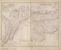 South American States. New Granada & Venezuela. (IA bp 33154).pdf 3,327 × 2,752; 2.81 MB
-

-

-
 The birds of the Leeward islands, Caribbean sea BHL2654116.jpg 3,520 × 2,244; 363 KB


