Category:Old maps of Africa
Jump to navigation
Jump to search
Temperate regions: North America · South America · Africa · Europe · Asia · Oceania – Polar regions: Antarctica · Arctic – Other regions: Eurasia
Old maps of Africa.
Use the appropriate category for maps showing all or a large part of Africa. See subcategories for smaller areas:
| If the map shows | Category to use |
|---|---|
| Africa on a recently created map | Category:Maps of Africa or its subcategories |
| Africa on a map created more than 70 years ago | Category:Old maps of Africa or its subcategories |
| the history of Africa on a recently created map | Category:Maps of the history of Africa or its subcategories |
| the history of Africa on a map created more than 70 years ago | Category:Old maps of the history of Africa or its subcategories |

Subcategories
This category has the following 32 subcategories, out of 32 total.
- 7th-century maps of Africa (1 F)
- 10th-century maps of Africa (1 F)
*
-
- Old maps of the Sahara (27 F)
.
D
- Details of old maps of Africa (51 F)
O
P
R
U
°
Media in category "Old maps of Africa"
The following 136 files are in this category, out of 136 total.
-

-

-
 577 of '(With eleven maps.)' (11100142465).jpg 3,456 × 6,911; 3.7 MB
-
 63 of 'Atlas' (11188132916).jpg 6,285 × 3,230; 4.53 MB
-
 65 of 'Deutsche Colonialgeschichte' (11288317226).jpg 1,128 × 1,315; 251 KB
-

-

-

-

-

-

-

-

-
-

-
 A naturalist in Mid-Africa BHL36984053.jpg 2,486 × 3,585; 1.73 MB
-
 A naturalist in Mid-Africa BHL36984057.jpg 1,840 × 2,189; 586 KB
-
 A naturalist in Mid-Africa BHL36984061.jpg 2,096 × 2,293; 714 KB
-
-
 A new chart of the coast of ORIXA and GALCONDA NYPL1640641.tiff 7,230 × 5,428; 112.28 MB
-

-
 Africa Map-Konkani Vishwakosh.jpg 430 × 446; 62 KB
-
 Africaantiqua.jpg 3,287 × 2,051; 1.82 MB
-
 Afrique connue des Anciens... - btv1b84587485.jpg 9,139 × 7,930; 9.9 MB
-
 Afrique équatoriale française. LOC 2012593359.jpg 6,463 × 8,151; 6.17 MB
-
 Afrique équatoriale française. LOC 2012593359.tif 6,463 × 8,151; 150.72 MB
-
 AfriqueOuest1880.jpg 1,341 × 660; 140 KB
-
 Age of Exploration-map.jpg 424 × 544; 40 KB
-
 AMH-6328-KB Map of a stretch of the West African coast.jpg 2,400 × 1,961; 761 KB
-

-
 Ancient africa map2.jpg 362 × 336; 51 KB
-

-
 Arab Caliphate.jpg 888 × 674; 220 KB
-
 Arab Caliphate.svg 350 × 334; 1.04 MB
-
 Archives de zoologie expérimentale et générale (1909) (20138409338).jpg 3,130 × 1,950; 1.13 MB
-
 Archives des missions scientifiques et littéraires (1883) (19565331858).jpg 1,916 × 2,944; 1.13 MB
-

-

-

-
-
 Baedekers reseguide over Egypten, 1898 - Hallwylska museet - 100664.tif 5,616 × 3,744, 2 pages; 60.17 MB
-
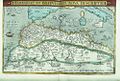
 Barbaria1590.jpg 800 × 600; 170 KB
-
 Barbaria1598.jpg 800 × 600; 145 KB
-
 Bodleian Libraries, Barbariae et Biledvlgerid, nova descriptio.jpg 1,000 × 675; 182 KB
-
 Bouillet - Atlas universel, Carte 81.png 2,698 × 3,425; 6.8 MB
-
 Bouillet - Atlas universel, Carte 82.png 2,695 × 1,725; 3.9 MB
-
 Bouillet - Atlas universel, Carte 83.png 2,674 × 1,691; 3.9 MB
-
 Bulletin - United States National Museum (1930) (19886183234).jpg 1,688 × 1,880; 630 KB
-
 Carte de l'Afrique à l'échelle (...)Régnauld de btv1b59697438.jpg 1,313 × 1,053; 310 KB
-
 Catalogue of a collection of birds from British East Africa BHL2643604.jpg 3,488 × 2,198; 487 KB
-

-
 Central-Afrika nach den neuesten Forschungen bearbeitet von Dr. Joseph Chavanne. LOC 98687117.tif 9,290 × 6,416; 170.53 MB
-
 Cinq Semaines en ballon 079.png 2,837 × 2,379; 1.19 MB
-
 Congo-Mubangi-1908.jpg 472 × 760; 89 KB
-
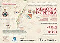 Convite para a apresentação de Memória em Pedra - 2022-06-24 - Image 217850.jpg 1,582 × 1,130; 1.87 MB
-
 Convite para a apresentação de Memória em Pedra - 2022-11-02 - Image 218065.jpg 1,241 × 886; 1.25 MB
-
 D206- Planche VI - partie gauche - liv3-ch09.png 2,362 × 3,390; 3.85 MB
-
 Die Gartenlaube (1895) 772.jpg 2,949 × 4,208; 1.68 MB
-
 Dr James Johnston's thin red line across Africa 1891 to 1892.jpg 1,366 × 768; 515 KB
-
 Eastern Hemisphere 1300 BC.png 3,240 × 1,903; 8.1 MB
-
 Embouchure du Kongo-1747.jpg 2,048 × 2,555; 2.72 MB
-
 Emin pasha relief expedition map 1890.png 1,002 × 722; 1.41 MB
-
 Erdglobus aus Salem img05.jpg 4,288 × 2,848; 6.72 MB
-
 Europe since 1815 (1910) (14578376507).jpg 3,072 × 1,796; 586 KB
-
 Europe since 1815 (1910) (14784704053).jpg 3,184 × 1,820; 766 KB
-
 Five Weeks in a Balloon.jpg 1,200 × 541; 163 KB
-
 Gambia River (1732).jpg 1,200 × 824; 199 KB
-

-

-

-
-
 Icones ornithopterorum (Plate III C. map) (7704027828).jpg 1,572 × 2,145; 450 KB
-
 Ilemi triangle maps.JPG 668 × 558; 76 KB
-

-
 Jansson map of West Africa c.1670.jpg 3,578 × 2,997; 5.94 MB
-

-

-

-

-
 Lange diercke sachsen afrika bab el mandeb.jpg 722 × 702; 251 KB
-
 Lange diercke sachsen afrika oase siwa.jpg 718 × 700; 242 KB
-
 Large areas of Warri map.jpg 750 × 852; 110 KB
-
 Le Tour du monde-04-p404.jpg 1,332 × 865; 294 KB
-
 Le Tour du monde-05-p176.jpg 1,250 × 835; 214 KB
-
 Mao Kun map - India, Africa.JPG 425 × 605; 334 KB
-
 Map of Aweri (Now Warri in 1580-1700).jpg 1,242 × 2,150; 674 KB
-
 Map of Awerri (Now Warri in 1580-1700).jpg 1,200 × 1,300; 501 KB
-
 Map of iwere.png 800 × 500; 797 KB
-
 Map of Northern Africa with a picture of African people Wellcome V0049910.jpg 4,061 × 1,813; 2.7 MB
-
 Map of St. Helena, 1685.jpg 613 × 900; 430 KB
-
 Map of St. Helena, 1719.jpg 851 × 1,021; 185 KB
-
 Map of St. Thomas, 1683.jpg 725 × 1,078; 194 KB
-
 Map of St. Thomas, 1685.jpg 639 × 900; 479 KB
-
 Map of the Abyssinian empire, 1683.jpg 725 × 1,078; 156 KB
-
 Map of the Abyssinian empire, 1719.jpg 858 × 1,022; 170 KB
-
 Map of the Congo, 1683.jpg 725 × 1,078; 175 KB
-
 Map of the Congo, 1719.jpg 851 × 1,021; 179 KB
-
 Map of Tunis and Carthage, 1683.jpg 725 × 1,078; 184 KB
-
 Map of Tunis and Carthage, 1719.jpg 839 × 1,022; 198 KB
-
 Mapa norte de áfrica de gerardus Mercator.jpg 679 × 474; 70 KB
-
 Martin Luther-Eine Heer-Predigt wider den Türcken.jpg 3,338 × 2,173; 1.82 MB
-
 Mediaeval and modern history (1905) (14801328543).jpg 1,988 × 3,304; 553 KB
-
-

-
 Nouae Africae delineatio (2675601948).jpg 2,000 × 1,872; 3.54 MB
-
 Übersichtskarte der Nilländer.. (NYPL b14291191-37502).tiff 5,040 × 6,299; 90.85 MB
-
 Guinea & Nigrita (NYPL b14428893-1503447).jpg 6,299 × 5,248; 7.16 MB
-
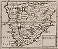 Monomotapa (NYPL b14428893-1503448) (cropped).jpg 3,436 × 2,881; 2.76 MB
-
 Monomotapa (NYPL b14428893-1503448).jpg 6,299 × 5,248; 6.87 MB
-
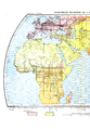
 Ottoman-map-Africa.jpg 657 × 571; 113 KB
-

-
 Paskaart van de kust van Equatoriaal-Guinea, Gabon en Kameroen.jpeg 2,500 × 2,165; 914 KB
-
 Route der Expedition der Handelshochschule.jpg 680 × 458; 223 KB
-
 Révai nagy lexikona; az ismeretek enciklopédiája (1911) (14579806509).jpg 3,216 × 1,855; 1.31 MB
-
 Révai nagy lexikona; az ismeretek enciklopédiája (1911) (14743444326).jpg 3,248 × 1,794; 1.31 MB
-
 CostaAOE1896g.jpg 5,185 × 7,751; 5.32 MB
-

-
 Südliche Oberflaeche der Erde.jpg 6,928 × 5,502; 9.33 MB
-
 TabulaPeutingeriana-ModernMap.jpg 968 × 1,920; 1.93 MB
-
 The American Museum journal (c1900-(1918)) (17971406538).jpg 1,238 × 1,370; 351 KB
-
 The making of Northern Nigeria (1911) (14596577448).jpg 4,357 × 2,441; 1.02 MB
-
 The Sea of Uniamesi - Erhardt and Rehman.png 542 × 441; 125 KB
-

-

-
-

-

-

-
 UBBasel Map Afrika 1578 Kartenslg AA 114.tif 13,102 × 8,954, 2 pages; 335.66 MB
-
 Van Keulen-Nieuwe Pascaert van Oost Indien-1680-1735-2.png 4,769 × 4,162; 3.48 MB
-
 Verne, Jules - Cinq semaines en ballon, pages 180-181.png 2,407 × 1,959; 11.2 MB
-
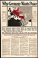 Why Germany wants peace. LOC 2017585602.jpg 5,875 × 8,897; 8.69 MB
-
 Why Germany wants peace. LOC 2017585602.tif 5,875 × 8,897; 149.55 MB
-
 Wild game in Zambezia (1914) (14751214795).jpg 2,264 × 1,676; 501 KB
-
 Sur les chevaux orientaux et provenants des races orientales. T. 3 (5596693).jpg 13,500 × 8,640; 26.97 MB
-
 Sur les chevaux orientaux et provenants des races orientales. T. 3 (5596708).jpg 8,352 × 10,920; 19.33 MB
.jpg)
.jpg)
%27_(11100142465).jpg)
.jpg)
.jpg)
%27_(11100890333).jpg)
.jpg)
%27_(11202061033).jpg)
%27_(11202197303).jpg)
%27_(11128231683).jpg)
%27_(11128696065).jpg)
.jpg)
.jpg)


_(14782787175).jpg)
_;_Dedicated_to_his..._-_btv1b531431881.jpg)


_(14776080505).jpg)

_(17812131714).jpg)


_(20138409338).jpg)
_(19565331858).jpg)


.jpg)


_(19886183234).jpg)
R%C3%A9gnauld_de_btv1b59697438.jpg)


_772.jpg)


_(14578376507).jpg)
_(14784704053).jpg)

.jpg)
_(14803813763).jpg)
.jpg)
_(14744462196).jpg)
_(14594096717).jpg)
_(7704027828).jpg)

_(14770578532).jpg)

_Les_Indes_Orientales_et_Occidentales_et_autres_lieux_(serietite,_BI-1972-1043-5.jpg)
.jpg)


.jpg)
.jpg)


_(14801328543).jpg)
_(14577360658).jpg)
_(14779877414).jpg)
.jpg)
.jpg)
_(cropped).jpg)
.jpg)

,_RP-P-1896-A-19368-3110X.jpg)


_(14579806509).jpg)
_(14743444326).jpg)


)_(17971406538).jpg)
_(14596577448).jpg)

.jpg)
_(14582488388).jpg)
_(14773705634).jpg)
_(14592536737).jpg)
_(14756073616).jpg)
_(14783868003).jpg)


_(14751214795).jpg)
.jpg)
.jpg)