Category:Old maps of Scandinavia
Jump to navigation
Jump to search
See also: w:Scandinavia
Use the appropriate category for maps showing all or a large part of Scandinavia. See subcategories for smaller areas:
| If the map shows | Category to use |
|---|---|
| Scandinavia on a recently created map | Category:Maps of Scandinavia or its subcategories |
| Scandinavia on a map created more than 70 years ago | Category:Old maps of Scandinavia or its subcategories |
| the history of Scandinavia on a recently created map | Category:Maps of the history of Scandinavia or its subcategories |
| the history of Scandinavia on a map created more than 70 years ago | Category:Old maps of the history of Scandinavia or its subcategories |
Subcategories
This category has the following 20 subcategories, out of 20 total.
- 19th-century maps of Scandinavia (76 F)
D
- Denmark and Sweden (Moll) (4 F)
E
F
G
I
N
O
S
- Sweden and Norway (Moll) (3 F)
Z
Media in category "Old maps of Scandinavia"
The following 83 files are in this category, out of 83 total.
-
 Arosia.jpg 525 × 350; 54 KB
-
 1598 map of the Polar Regions by Willem Barentsz.jpg 13,719 × 10,160; 30.66 MB
-

-
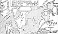 1925 Route Map of Scandinavia and the Baltic States.jpg 1,260 × 746; 338 KB
-

-
 337 of 'Illustreret Norges historie. (With plates.)' (11176004453).jpg 1,605 × 2,330; 1,005 KB
-
 34 of 'The History of Norway. (With maps.)' (11184806384).jpg 2,256 × 2,953; 1.06 MB
-

-
 468 of '(The Great Ice Age and its relation to the antiquity of man.)' (11118679764).jpg 2,561 × 2,408; 1.1 MB
-

-
 A-3-37-53-Scandinavia.jpg 3,000 × 2,289; 766 KB
-
 Arbuckle Bros. Coffee Co. (3092982305).jpg 799 × 481; 334 KB
-
 Atlas Maior, Blau. Karta över Skandinavien.PB hist.288 - Skoklosters slott - 87580.tif 4,870 × 3,590; 100.11 MB
-

-

-
-
 Barents third voyage.jpg 2,000 × 1,511; 965 KB
-
 Barentskartet, 1598 (12068020364).jpg 2,842 × 2,091; 3.85 MB
-
 Barentsz Full Map.jpg 1,000 × 742; 258 KB
-
 Bouillet - Atlas universel, Carte 61.png 2,760 × 3,425; 10.55 MB
-
 Caerte van Oostlant 4MB.jpg 7,040 × 5,300; 3.84 MB
-
 Carta de navegar - faksimile - no-nb krt 00669.jpg 6,471 × 4,685; 6.52 MB
-
 Carta marina.gif 1,200 × 800; 92 KB
-

-

-

-
-
 Charta öfwer Swerige med tilgränsande länder - Kungliga Biblioteket - 11692091-thumb.png 11,753 × 9,824; 539.43 MB
-
 Charta öfwer Swerige med tilgränsande länder - Kungliga Biblioteket - 11692091.tif 11,753 × 9,824, 2 pages; 660.71 MB
-
 Charta öfwer södra delen af Swerige - Kungliga Biblioteket - 10294581-thumb.png 9,344 × 11,702; 512.8 MB
-
 Charta öfwer södra delen af Swerige - Kungliga Biblioteket - 10294581.tif 9,344 × 11,702, 2 pages; 625.7 MB
-
 Cosmographia (Sebastian Münster) p 093.jpg 2,000 × 1,518; 511 KB
-
 D515 - N° 297. Scandinavie. -liv3-ch5.png 1,448 × 2,008; 574 KB
-
 Danska väldet under valdemar sejr.jpg 792 × 453; 201 KB
-
 Den lilla skolkartan öfver Skandinavien, Europa och Globen - Kungliga Biblioteket - 10371878-thumb.png 10,186 × 7,176; 354.11 MB
-
 Den lilla skolkartan öfver Skandinavien, Europa och Globen - Kungliga Biblioteket - 10371878.tif 10,186 × 7,176, 2 pages; 418.28 MB
-
 Egnazio Danti - The Scandinavian peninsula - Google Art Project.jpg 6,547 × 7,614; 24.18 MB
-
 Forminsket utgave av Barentskartet - no-nb krt 00487.jpg 4,418 × 3,449; 3.45 MB
-
 Geografisk, militarisk och statistisk Karta öfver hela Sverige och Norrige..jpg 2,225 × 3,300; 2.17 MB
-
 Gothia.jpg 490 × 399; 99 KB
-
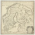
 Homann Scandinavia.jpg 3,000 × 2,780; 3.32 MB
-
 Island19x1024.jpg 1,024 × 786; 130 KB
-
 Jezioro ancylusowe001.jpg 349 × 372; 34 KB
-

-

-
 Kart over Jernbaner i Norge, Sverige og Danmark. 10de oplag - btv1b8445664q.jpg 7,104 × 9,419; 9.72 MB
-
 Karta över Skandinavien från 1700-talet - Skoklosters slott - 98005.tif 4,690 × 3,744; 50.26 MB
-
 La Scandinavie et … - no-nb krt 00477.jpg 4,126 × 3,934; 5.7 MB
-
 LA2-Anders-Bure.jpg 1,983 × 1,704; 616 KB
-

-
 Les Trois Courones du Nord.jpg 3,914 × 3,392; 3.52 MB
-
 Map of the Northern Realms Including the Kingdoms of Denmark, Sweden, Norway WDL1206.png 1,243 × 1,024; 2.56 MB
-
 Münsters skandinaviakart (24957076285).jpg 4,233 × 3,311; 7.61 MB
-
 Nativus, Sueciae adiacenti umque regnorum typus - Kungliga Biblioteket - 11308411-thumb.png 10,361 × 8,249; 407.1 MB
-
 Nativus, Sueciae adiacenti umque regnorum typus - Kungliga Biblioteket - 11308411.tif 10,361 × 8,249, 2 pages; 489.08 MB
-
 Norra sverige och finland under unionstiden.jpg 793 × 808; 339 KB
-

-
 Norvège et Suède. Carte des pluies. (Moyenne de l'année) - d'après Mohn - btv1b8439254x.jpg 4,080 × 5,217; 2.33 MB
-
 Nouvelle carte de Scandinavie.jpg 3,543 × 2,739; 2.8 MB
-
 The Northern States, comprehending the Kingdoms of Denmark, Norway and Sweden; with their divisions (NYPL b13919861-5207405).tiff 10,326 × 7,758, 2 pages; 229.46 MB
-
 Swedland and Norway (NYPL b14428893-1503431).jpg 6,299 × 5,096; 6.87 MB
-
 Old german map Scandinavia and Baltic States.jpg 947 × 1,451; 551 KB
-
 Old Norway map.png 1,243 × 1,024; 2.52 MB
-
 Pieni 3 0727.jpg 2,542 × 3,399; 3.07 MB
-
 Pontanus 1611 Arctic Map.jpg 2,852 × 2,142; 802 KB
-
 Regni Sueciae.jpg 3,486 × 3,069; 2.84 MB
-
 Ruotsi-Suomen kartta.jpg 1,451 × 909; 651 KB
-

-
 Scandinavia complectens Sueciæ, Daniæ et Norvegiæ regna – ex tabulis - Kungliga Biblioteket - 10348309.tif 10,126 × 7,774, 2 pages; 450.47 MB
-
-

-
 Svecia Dania et Norvegia - no-nb krt 00590.jpg 8,653 × 6,801; 23.26 MB
-
 Svecia Dania et Norvegia - no-nb krt 00636.jpg 8,586 × 6,809; 23.2 MB
-
 Svecia et Norvegia - no-nb krt 00509.jpg 4,692 × 3,607; 7.8 MB
-
 Svecia et Norvegia - no-nb krt 00608.jpg 7,889 × 5,964; 18.26 MB
-
 Svecia et Norvegia cum confinijs - Kungliga Biblioteket - 10377574-thumb.png 9,793 × 7,542; 354.27 MB
-
 Svecia et Norvegia cum confinijs - Kungliga Biblioteket - 10377574.tif 9,793 × 7,542, 2 pages; 422.65 MB
-
 Svecia, Dania et Norvegia, Regna Europæ Septentrionalia.jpg 4,310 × 3,476; 10.17 MB
-
 Svecia, Dania et Norvegia.jpg 2,022 × 1,657; 2.33 MB
-
 Sweden, Denmark, Norway and Finland, from the best authorities. NYPL1404020.tiff 6,299 × 5,248; 94.6 MB
-
 Swedland and Norway. NYPL1503431.tiff 6,299 × 5,096; 91.86 MB
-

-
 UBBasel Map 1570 Kartenslg AA 91.tif 11,527 × 9,763, 2 pages; 322 MB


%27_(11184523193).jpg)

.jpg)
%27_(11176004453).jpg)
%27_(11184806384).jpg)
.jpg)
%27_(11118679764).jpg)
.jpg)

.jpg)


.jpg)

.jpg)


_p_093.jpg)


_door_Willem_Barendsz_(titel_op_object),_NG-800.jpg)


_(14595973787).jpg)


.jpg)


_-_d%27apr%C3%A8s_Mohn_-_btv1b8439254x.jpg)

.jpg)


_(14749424482).jpg)