Category:17th-century maps of Scandinavia
Jump to navigation
Jump to search
Media in category "17th-century maps of Scandinavia"
The following 30 files are in this category, out of 30 total.
-
Gerardus Mercator, Russia cum confinijs (FL36378838 2603188).jpg 12,679 × 9,229; 177.97 MB
-
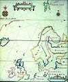
Map of Scandinavia (1600) North east.jpg 800 × 600; 156 KB
-
Map of Scandinavia (1600) South east.jpg 800 × 600; 153 KB
-
Map of Scandinavia (1600).jpg 800 × 600; 151 KB
-
102 of 'Kuvallinen Suomen historia vanhimmista ajoista nykyaikaan saakka' (11227495286).jpg 1,574 × 2,462; 1.16 MB
-
Si0151x1024.jpg 1,024 × 759; 227 KB
-
Russia cum confinijs - per Gerardum Mercatorem - btv1b53041158t (1 of 2).jpg 6,116 × 5,121; 6.09 MB
-
Tabula hydrographica - no-nb krt 00479.jpg 7,795 × 10,157; 22.03 MB
-
1624 Zuijderdeel vd Belt Blaeu Rare.jpg 1,603 × 1,230; 2.32 MB
-
Orbis Arctoi nova et accurata delineatio Anders Bure 1626.jpg 1,172 × 1,020; 452 KB
-
Atlas ou Representation du Monde Universel t. 1. 1633 (109104388).jpg 16,997 × 11,732; 39.1 MB
-
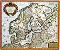
1646 Sveciæ &c Janssonius.jpg 4,953 × 4,233; 19.78 MB
-
A-3-37-52-Scandinavia.jpg 3,000 × 2,262; 578 KB
-
"Lapponia - Auct. Andrea Bureo Sueco." (22245501592).jpg 3,943 × 3,131; 2.1 MB
-
1664 Svecia+ Blaeu HR.JPG 5,500 × 4,416; 2.95 MB
-
Comberford, The Northern Navigation.jpg 1,504 × 1,805; 1.26 MB
-
Svecia Regnvm - Atlas Maior, vol 2, map 2 - Joan Blaeu, 1667 - BL 114.h(star).2.(2).jpg 4,000 × 3,346; 2.38 MB
-
Map of ancient Scandinavia, 1685.jpg 694 × 900; 439 KB
-
Accuratissima regnorum Sueciae, Daniae et Norvegiae tabula - CBT 5871280.jpg 5,462 × 4,726; 9.14 MB
-
Cartouche in a Scandinavia map by Danckers.jpg 1,823 × 1,119; 1.07 MB
-
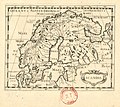
Scandia - btv1b5963824d.jpg 2,408 × 2,152; 851 KB


