Category:Maps of Scandinavia
Jump to navigation
Jump to search
Dansk: Kort over Skandinavien
Deutsch: Karten von Skandinavien
English: Maps of Scandinavia
Français : Cartes de la Scandinavie
Norsk bokmål: Kart over Skandinavia
Polski: Mapy Skandynawii
Svenska: Kartor över Skandinavien
Wikimedia category | |||||
| Upload media | |||||
| Instance of | |||||
|---|---|---|---|---|---|
| Category combines topics | |||||
| Scandinavia | |||||
region in Northern Europe | |||||
| Instance of | |||||
| Part of | |||||
| Location |
| ||||
| Located in or next to body of water | |||||
| Has part(s) | |||||
| Different from | |||||
 | |||||
Subcategories
This category has the following 5 subcategories, out of 5 total.
Media in category "Maps of Scandinavia"
The following 74 files are in this category, out of 74 total.
-
009 huuhta-vuoma.jpg 1,200 × 1,165; 147 KB
-
013 huuhta evolution.jpg 1,200 × 1,203; 457 KB
-
16th century map of Scandinavia.jpg 5,212 × 3,804; 6.72 MB
-
19 of 'The Land of the Midnight Sun ... New edition' (11251888785).jpg 4,157 × 5,441; 4.55 MB
-
23 0024234 Convair Negative Image.jpg 1,600 × 1,172; 722 KB
-
Annales des Sciences Naturelles Botaniques (18403363652).jpg 1,666 × 2,520; 1.17 MB
-
Brethren Historic Sites in Scandanavia.png 757 × 681; 534 KB
-
Bulletin scientifique (1840) (20501171215).jpg 3,728 × 2,758; 1.61 MB
-
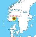
Carte de Swedenborg.jpg 591 × 601; 193 KB
-
Coop Norden map.png 1,236 × 1,245; 78 KB
-
Distribution - Colias werdandi.png 400 × 425; 193 KB
-
Distribution-sv.png 1,650 × 1,950; 419 KB
-
Eskandinaviakohirukomuga.png 901 × 795; 200 KB
-
Fennoscandia rus.png 612 × 668; 72 KB
-
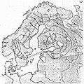
Fennoscandia.jpg 615 × 627; 176 KB
-
Fennoscandia.png 612 × 668; 24 KB
-
Fennoskandia kartta.png 607 × 666; 79 KB
-
Finland map.gif 324 × 709; 24 KB
-
Fjord line route map.png 581 × 531; 56 KB
-
Fjord line route map.svg 580 × 530; 401 KB
-
Holgersson arlanda.jpg 1,590 × 1,193; 465 KB
-
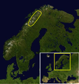
Kart nordkalotten.png 300 × 189; 8 KB
-
Karta över skandinavien - Skoklosters slott - 85940.tif 3,471 × 5,037; 100.11 MB
-
Koppen-Geiger Map Northern Europe future.svg 1,816 × 850; 4.35 MB
-
Kurtzke map of MS in Scandinavia.jpeg 1,344 × 1,980; 682 KB
-
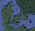
Location of läsö in Scandinavia.jpg 728 × 702; 105 KB
-
LocationSapmi (cropped).png 500 × 500; 7 KB
-
LocationSapmi.png 811 × 789; 45 KB
-
Map of Auðun's Travels in Auðun's Tale.png 1,580 × 1,286; 738 KB
-
Map of Nordic Battlegroup countries.PNG 741 × 289; 14 KB
-
Mer du Nord-vierge.png 1,076 × 1,217; 96 KB
-
Mor Keltek Libelys.png 1,058 × 1,188; 161 KB
-
Nordkalotte.gif 650 × 388; 53 KB
-
Nordsee Wirtschaftszonen.png 619 × 720; 342 KB
-
Original meaning of Scandinavia.svg 376 × 294; 501 KB
-
PAT - Scandinavia.gif 1,500 × 2,000; 664 KB
-
PSM V11 D426 Lemming migration path in sweden.jpg 1,211 × 1,787; 280 KB
-
Rastyper-karta03.jpg 450 × 581; 281 KB
-
Sami Language Recognition.jpg 2,455 × 1,737; 1.23 MB
-
Scand+Baltic.png 6,207 × 4,087; 4.69 MB
-
Scandinavia (orthographic projection).svg 553 × 553; 358 KB
-
Scandinavia - DPLA - 576e8554c3802943f70425423e8d7d0a.jpg 2,406 × 3,122; 5.98 MB
-
Scandinavia LCC admin map.svg 539 × 757; 5.02 MB
-
Scandinavia LCC topographic map.svg 539 × 757; 7.88 MB
-
Scandinavia Terrain and Transportation - DPLA - 6db7f02126a3602c95fda8899edd23ec.jpg 5,592 × 7,879; 5.76 MB
-
Scandinavia.svg 2,045 × 1,720; 2.67 MB
-
Scandinavian Peninsula Bul Map.png 2,891 × 4,500; 1.49 MB
-
SK sas scandinavian 2004 nordic baltic routes.jpg 1,540 × 1,600; 663 KB
-
South-West Scandinavia location map.svg 437 × 462; 807 KB
-
Suur-Suomi.png 1,447 × 953; 282 KB
-
Svenska språkets utbredning.png 398 × 599; 65 KB
-
Treriksröset 01NL.png 901 × 795; 226 KB
-
Upper Scandinavia - Treriksrosett.JPG 788 × 411; 27 KB
-
Viking towns of Scandinavia.jpg 945 × 998; 95 KB
-
Wollstonecraftlettersmap.png 500 × 500; 126 KB
-
Скандинавия Швеция Норвегия Дания.png 985 × 1,350; 76 KB
-
Скандинавия.PNG 1,007 × 1,515; 349 KB
-
Фенноскандия.png 615 × 627; 645 KB


