
Category:Old maps of New Jersey
States of the United States: Alabama · Alaska · Arizona · Arkansas · California · Colorado · Connecticut · Delaware · Florida · Georgia · Hawaii · Idaho · Illinois · Indiana · Iowa · Kansas · Kentucky · Louisiana · Maine · Maryland · Massachusetts · Michigan · Minnesota · Mississippi · Missouri · Montana · Nebraska · Nevada · New Hampshire · New Jersey · New Mexico · New York · North Carolina · North Dakota · Ohio · Oklahoma · Oregon · Pennsylvania · Rhode Island · South Carolina · South Dakota · Tennessee · Texas · Utah · Vermont · Virginia · Washington · West Virginia · Wisconsin · Wyoming – District of Columbia: Washington, D.C.
Guam · Northern Mariana Islands · Puerto Rico
Guam · Northern Mariana Islands · Puerto Rico
Subcategories
This category has the following 23 subcategories, out of 23 total.
B
D
G
M
P
S
Pages in category "Old maps of New Jersey"
This category contains only the following page.
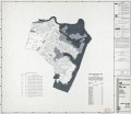
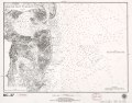
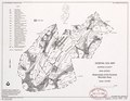
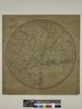
Media in category "Old maps of New Jersey"
The following 200 files are in this category, out of 427 total.
(previous page) (next page)-
 (Amboy to Elizabethtown. LOC gm71002222.jpg 3,254 × 7,409; 2.59 MB
-
 (Arlington, N.J. LOC 75694712.jpg 8,144 × 4,928; 12.86 MB
-

-

-
 (Map of the coast of New Jersey from Barnegat Inlet to Cape May. LOC 73691635.jpg 4,176 × 2,680; 1.19 MB
-
 (Map of the coast of New Jersey from Barnegat Inlet to Cape May. LOC 73691635.tif 4,176 × 2,680; 32.02 MB
-
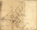
 (Map showing roads to Morristown) LOC gm71002202.jpg 2,095 × 2,620; 596 KB
-
 (Map showing roads to Morristown) LOC gm71002202.tif 2,095 × 2,620; 15.7 MB
-
 (New York Island and East Jersey. Unfinished. LOC gm71002311.jpg 13,586 × 11,000; 16.83 MB
-
 (New York Island and East Jersey. Unfinished. LOC gm71002311.tif 13,586 × 11,000; 427.57 MB
-
 (Plan of Paulus's Hook and fortifications. LOC gm71002213.jpg 7,636 × 6,835; 4.92 MB
-
 (Plan of Paulus's Hook and fortifications. LOC gm71002213.tif 7,636 × 6,835; 149.32 MB
-

-
 1698PhilipLeaPANJmap.jpg 723 × 600; 282 KB
-

-
 1872 Beers Map of Newark, New Jersey - Geographicus - Newark-beers-1872.jpg 5,000 × 3,511; 4.41 MB
-

-
 (King1893NYC) pg012 DUTCH MAP OF NEW YORK, 1656.jpg 1,245 × 1,981; 1.32 MB
-
 1913 U.S.G.S. New York ^ New Jersey Atlas - Geographicus - NYAtlas-usgs-1815.jpg 1,860 × 2,082; 508 KB
-
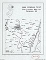 1995 census test site locator map for Paterson, NJ LOC 97681581.jpg 2,514 × 3,264; 921 KB
-
 1995 census test site locator map for Paterson, NJ LOC 97681581.tif 2,514 × 3,264; 23.48 MB
-
 279 of 'Cassell's History of the United States ... Illustrated' (11103903596).jpg 1,901 × 2,126; 807 KB
-
 A map of Rariton River, Milstone River, South River ... (1685) LOC 97683564.tif 8,368 × 7,152; 171.23 MB
-
 A map of the counties of Salem and Gloucester, New Jersey - from actual surveys LOC 2012586902.jpg 17,080 × 11,507; 26.48 MB
-
 A map of the counties of Salem and Gloucester, New Jersey - from actual surveys LOC 2012586902.tif 17,080 × 11,507; 562.3 MB
-
 A Map of the Trenton and New-Brunswick Turnpike-road. LOC 73691816.jpg 9,368 × 3,232; 3.46 MB
-
 A Map of the Trenton and New-Brunswick Turnpike-road. LOC 73691816.tif 9,368 × 3,232; 86.62 MB
-
 A mapp of New Jersey in America (8642358759).jpg 800 × 639; 140 KB
-
 A mapp of New Jersey in America. NYPL484193.tiff 5,094 × 4,389; 63.97 MB
-
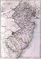
 A new and accurate map of New Jersey, from the best authorities. LOC 97683600.jpg 7,361 × 4,338; 3.78 MB
-
 A new and accurate map of New Jersey, from the best authorities. LOC 97683600.tif 7,361 × 4,338; 91.36 MB
-

-

-
-

-

-
 Acidic substrata potential map - (Burlington County, New Jersey) LOC 89694173.jpg 7,376 × 8,994; 10.27 MB
-
 Acidic substrata potential map - (Camden County, New Jersey) LOC 89696690.jpg 6,163 × 7,082; 5.11 MB
-
 Acidic substrata potential map - (Camden County, New Jersey) LOC 89696690.tif 6,163 × 7,082; 124.87 MB
-
 Acidic substrata potential map - (Mercer County, New Jersey) LOC 89696692.jpg 5,597 × 6,466; 4.48 MB
-
 Acidic substrata potential map - (Mercer County, New Jersey) LOC 89696692.tif 5,597 × 6,466; 103.54 MB
-
 Acidic substrata potential map - (Middlesex County, New Jersey) LOC 89696691.jpg 6,218 × 6,777; 5.55 MB
-
 Acidic substrata potential map - (Middlesex County, New Jersey) LOC 89696691.tif 6,218 × 6,777; 120.56 MB
-
 Acidic substrata potential map - (Monmouth County, New Jersey) LOC 89696689.jpg 6,645 × 7,751; 7 MB
-
 Acidic substrata potential map - (Monmouth County, New Jersey) LOC 89696689.tif 6,645 × 7,751; 147.36 MB
-
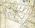
 AcquackanonkTownshipNewJersey1872.JPG 500 × 700; 120 KB
-
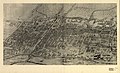
 Aero view of Atlantic City, New Jersey 1909. LOC 75694720.jpg 11,312 × 6,496; 11.72 MB
-
 Aero view of Atlantic City, New Jersey 1909. LOC 75694720.tif 11,312 × 6,496; 210.24 MB
-
 Aero view of Atlantic City, New Jersey 1910. LOC gm71005368.jpg 13,936 × 6,768; 16.71 MB
-
 Aero view of Atlantic City, New Jersey 1910. LOC gm71005368.tif 13,936 × 6,768; 269.85 MB
-
 Aero view of Egg Harbor City, New Jersey. LOC 75694723.jpg 11,296 × 6,432; 13.82 MB
-
 Aero view of Egg Harbor City, New Jersey. LOC 75694723.tif 11,296 × 6,432; 207.87 MB
-
 Aero view of Hammonton, New Jersey 1926. LOC 75694725.jpg 9,888 × 8,176; 12.29 MB
-
 Aero view of Hammonton, New Jersey 1926. LOC 75694725.tif 9,888 × 8,176; 231.3 MB
-
 Aero view of Hammonton, New Jersey 1926.jpg 2,472 × 2,044; 1.12 MB
-
 Aero-view of Absecon, New Jersey 1924. LOC 75694711.jpg 11,296 × 7,920; 13.05 MB
-
 Aero-view of Absecon, New Jersey 1924. LOC 75694711.tif 11,296 × 7,920; 255.96 MB
-
 Aero-view of Somers-Point 1925, New Jersey. LOC 75694737.jpg 10,720 × 7,712; 14.06 MB
-
 Aero-view of Somers-Point 1925, New Jersey. LOC 75694737.tif 10,720 × 7,712; 236.53 MB
-
 Aero-view of Westfield, N.J. 1929. LOC 75694739.jpg 9,984 × 8,320; 15.49 MB
-

-

-
 Aeroview of Margate City, New Jersey 1925. LOC 75694729.jpg 10,896 × 6,688; 11.92 MB
-
 Aeroview of Margate City, New Jersey 1925. LOC 75694729.tif 10,896 × 6,688; 208.49 MB
-
 Aeroview of Westwood, New Jersey 1924. LOC 76693065.jpg 10,784 × 6,976; 17.65 MB
-
 Aeroview of Westwood, New Jersey 1924. LOC 76693065.tif 10,784 × 6,976; 215.23 MB
-
 Area two, New Jersey LOC 87694289.jpg 6,920 × 8,456; 8.69 MB
-
 Asbury Park, Ocean Grove and vicinity, New Jersey 1897. LOC 75694715.jpg 12,592 × 10,016; 30.34 MB
-
 Asbury Park, Ocean Grove and vicinity, New Jersey 1897. LOC 75694715.tif 12,592 × 10,016; 360.84 MB
-
 Atlantic City, New Jersey. LOC 76693066.jpg 16,688 × 12,000; 36.84 MB
-
 Atlantic Highlands, New Jersey 1894. LOC 75694718.jpg 9,936 × 6,992; 19.31 MB
-
 The State of New Jersey (NYPL b13872853-484212).jpg 4,048 × 6,123; 3.4 MB
-
 Bergen and Buyten Town map.jpg 594 × 617; 50 KB
-
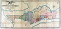
 Bergen County, New Jersey LOC 87694285.jpg 4,645 × 6,070; 3.01 MB
-
 Bergen County, New Jersey LOC 87694285.tif 4,645 × 6,070; 80.67 MB
-
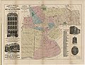
 Bergen County1896.jpg 2,700 × 3,718; 1.51 MB
-
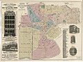
 Bergen Passaic 1872.jpg 3,491 × 2,325; 1.48 MB
-
 Bird's eye view of Morristown, Morris Co., New Jersey LOC 2009584332.jpg 11,997 × 8,782; 16.62 MB
-

-

-
 Bird's-eye-view of Maplewood, N.J. LOC 75694728.jpg 4,512 × 3,632; 5.71 MB
-
 Bird's-eye-view of Maplewood, N.J. LOC 75694728.tif 4,512 × 3,632; 46.89 MB
-
 Birds eye view of Egg Harbor City, N.J. LOC 75694721.jpg 8,512 × 6,768; 14.13 MB
-
 Birds eye view of Egg Harbor City, N.J. LOC 75694721.tif 8,512 × 6,768; 164.82 MB
-
 Birds eye view of Garfield, New Jersey 1909 LOC gm71005354.jpg 9,040 × 6,432; 12.9 MB
-
 Birds eye view of Garfield, New Jersey 1909 LOC gm71005354.tif 9,040 × 6,432; 166.36 MB
-
 Blairstown, New Jersey (2674316961).jpg 2,000 × 1,561; 2.1 MB
-
 Britannica New Jersey.jpg 1,924 × 2,755; 2.06 MB
-
 Burlington County, New Jersey LOC 87694231.jpg 7,370 × 9,001; 7.14 MB
-
 Burlington County, New Jersey LOC 87694231.tif 7,370 × 9,001; 189.79 MB
-
 Camden County, New Jersey LOC 85695370.jpg 4,804 × 6,833; 3.6 MB
-
 Camden County, New Jersey LOC 85695370.tif 4,804 × 6,833; 93.92 MB
-
 Cape May County, New Jersey LOC 87694229.tif 6,172 × 7,741; 136.69 MB
-

-
 City of Bridgeton, New Jersey, 1886. LOC 2005626673.jpg 7,774 × 7,094; 9.89 MB
-
 City of Hoboken, New Jersey 1904. LOC 75694727.jpg 10,592 × 8,352; 21.73 MB
-
 City of Hoboken, New Jersey 1904. LOC 75694727.tif 10,592 × 8,352; 253.1 MB
-
 Colton's road map of Union and Essex counties, New Jersey LOC 2019585057.jpg 6,008 × 6,999; 7.25 MB
-
 Cumberland County, New Jersey LOC 85695371.jpg 6,792 × 6,447; 5.88 MB
-
 Cumberland County, New Jersey LOC 85695371.tif 6,792 × 6,447; 125.28 MB
-
 Cumberland County, New Jersey LOC 87694258.jpg 6,891 × 6,525; 5.63 MB
-
 Cumberland County, New Jersey LOC 87694258.tif 6,891 × 6,525; 128.64 MB
-

-

-
 Digital revision of USGS 1-500,000-scale New Jersey state base map LOC 94684172.tif 27,455 × 9,491; 745.51 MB
-
 Draft of roads in New Jersey. LOC gm71005450.jpg 6,330 × 5,187; 3.88 MB
-
 Draft of roads in New Jersey. LOC gm71005450.tif 6,330 × 5,187; 93.94 MB
-
 Draught of an intrenched camp proposed to be erected near Elisabeth Town. LOC gm71002201.jpg 4,602 × 3,559; 1.66 MB
-
 Draught of an intrenched camp proposed to be erected near Elisabeth Town. LOC gm71002201.tif 4,602 × 3,559; 46.86 MB
-
 EB9 New Jersey.jpg 2,675 × 3,827; 1.99 MB
-
 Edison National Historic Site, West Orange, New Jersey. May 1957. LOC 75692104.jpg 6,564 × 3,532; 2.63 MB
-
 Edison National Historic Site, West Orange, New Jersey. May 1957. LOC 75692104.tif 6,564 × 3,532; 66.33 MB
-
 Edwin B. Forsythe National Wildlife Refuge LOC 2005626596.jpg 12,767 × 6,646; 6.66 MB
-
 Edwin B. Forsythe National Wildlife Refuge LOC 2005626596.tif 12,767 × 6,646; 242.76 MB
-
 Elizabeth, N.J. 1898. LOC 75694724.tif 14,272 × 9,856; 402.45 MB
-
 Essex County, New Jersey LOC 87694290.jpg 4,641 × 4,168; 2.18 MB
-
 Essex County, New Jersey LOC 87694290.tif 4,641 × 4,168; 55.34 MB
-

-
-
 From New Inlet to Absecon Inlet. LOC 79695319.jpg 5,161 × 4,070; 3.19 MB
-
 From New Inlet to Absecon Inlet. LOC 79695319.tif 5,161 × 4,070; 60.1 MB
-
 General soil map, Burlington County, New Jersey LOC 82693147.jpg 3,250 × 4,662; 2.37 MB
-
 General soil map, Burlington County, New Jersey LOC 82693147.tif 3,250 × 4,662; 43.35 MB
-
 General soil map, Jackson Brook watershed, Morris County, New Jersey LOC 90683494.jpg 4,958 × 3,189; 1.68 MB
-

-
-
 Gloucester County, New Jersey LOC 85695368.jpg 6,929 × 6,542; 4.92 MB
-
 Gloucester County, New Jersey LOC 85695368.tif 6,929 × 6,542; 129.69 MB
-
 Gloucester County, New Jersey LOC 87694259.jpg 6,346 × 6,103; 3.08 MB
-
 Gloucester County, New Jersey LOC 87694259.tif 6,346 × 6,103; 110.81 MB
-
 Guide map of Essex County, New Jersey LOC 2012593676.jpg 8,259 × 7,227; 8.67 MB
-
 Guide map of Essex County, New Jersey LOC 2012593676.tif 8,259 × 7,227; 170.77 MB
-
 Hackensack, New Jersey LOC 80693464.jpg 10,032 × 7,152; 19.32 MB
-
-
 Halcyon Park from 1906 Atlas.jpg 1,000 × 801; 570 KB
-
 Hand book and guide for the city of Newark, New Jersey (1872) (14773415351).jpg 3,284 × 3,012; 1.57 MB
-
 Historical sketch of Westfield Friends Meeting site map.jpg 444 × 584; 50 KB
-
 Holbrook's map of the city of Newark, New Jersey. LOC 2011593693.jpg 7,958 × 5,621; 8.25 MB
-
 Holbrook's map of the city of Newark, New Jersey. LOC 2011593693.tif 7,958 × 5,621; 127.98 MB
-
 Holbrook's map of the city of Newark, New Jersey. LOC 2011593694.jpg 8,410 × 6,438; 8.44 MB
-
 Holbrook's map of the city of Newark, New Jersey. LOC 2011593694.tif 8,410 × 6,438; 154.91 MB
-
 Holbrook's map of the city of Newark, New Jersey. LOC 2011593696.jpg 7,154 × 5,751; 7.01 MB
-
 Holbrook's map of the city of Newark, New Jersey. LOC 2011593696.tif 7,154 × 5,751; 117.71 MB
-
 Holbrook's map of the city of Newark, New Jersey. LOC 2011593697.jpg 7,780 × 5,786; 8.17 MB
-
 Holbrook's map of the city of Newark, New Jersey. LOC 2011593697.tif 7,780 × 5,786; 128.79 MB
-
 Hudson County, New Jersey LOC 87694291.jpg 4,641 × 3,409; 1.54 MB
-
 Hudson County, New Jersey LOC 87694291.tif 4,641 × 3,409; 45.26 MB
-
 HudsonCounty1868map.jpg 4,484 × 2,172; 1.94 MB
-
 HudsonCountyMap1872.jpg 640 × 530; 128 KB
-
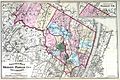
 Hunterdon County, New Jersey LOC 87694267.jpg 5,699 × 7,302; 4.72 MB
-
 Hunterdon County, New Jersey LOC 87694267.tif 5,699 × 7,302; 119.06 MB
-
 Hydrologic unit map-1974, State of New Jersey. LOC 76695071.jpg 7,618 × 7,960; 8.08 MB
-
 Hydrologic unit map-1974, State of New Jersey. LOC 76695071.tif 7,618 × 7,960; 173.49 MB
-
 J. H. Colton's School Atlas, 1860 - DPLA - 9afa4d40de861bb7b2a7e024bba61c0e (page 15).jpg 4,093 × 4,953; 2.49 MB
-
 Land use and zoning map, Jackson Brook watershed, Morris County, New Jersey LOC 90683495.jpg 4,906 × 3,182; 2.05 MB
-

-

-

-

-

-

-

-

-

-
 Map of a group of iron mines in Morris County LOC 2019585055.tif 7,195 × 14,360; 295.6 MB
-
 Map of a part of the campus of Princeton University LOC 80695243.jpg 17,286 × 8,880; 25.4 MB
-
 Map of a part of the campus of Princeton University LOC 80695243.tif 17,286 × 8,880; 439.17 MB
-

-

-
 Map of Burlington County LOC 2012586251.jpg 19,864 × 10,194; 24.54 MB
-
 Map of Cumberland Co., New Jersey - from actual surveys LOC 2010592714.tif 16,806 × 18,300; 879.91 MB
-
-

-
 Map of Essex County, New Jersey - 1874 LOC 2012593675.jpg 17,959 × 19,361; 39.7 MB
-
 Map of Hudson's River, with the adjacent country. LOC 2017585989.jpg 3,096 × 4,311; 1.59 MB
-
 Map of Hudson's River, with the adjacent country. LOC 2017585989.tif 3,096 × 4,311; 38.19 MB
-
 Map of Mercer County, New Jersey LOC 2004629246.jpg 12,507 × 9,611; 17.95 MB
-
 Map of Monmouth County, New Jersey - from actual surveys LOC 2012593678.jpg 17,608 × 12,419; 27.86 MB
-
 Map of Monmouth County, New Jersey - from actual surveys LOC 2012593678.tif 17,608 × 12,419; 625.63 MB
-
 Map of Morris County, New Jersey. LOC 2019585056.tif 6,717 × 5,464; 105 MB
-

-

-

-
 Map of Newark and East Newark, N.J. from the most authentic surveys. LOC gm71002268.jpg 10,906 × 8,013; 8.67 MB
-
 Map of Newark and East Newark, N.J. from the most authentic surveys. LOC gm71002268.tif 10,906 × 8,013; 250.02 MB
-
 Map of Roselle, N.J. - from actual surveys LOC 2012590178.jpg 10,004 × 13,568; 13.16 MB
-
 Map of Roselle, N.J. - from actual surveys LOC 2012590178.tif 10,004 × 13,568; 388.34 MB
-
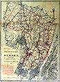
 Map of Sussex Co., New Jersey - from actual surveys & records LOC 2012593681.jpg 15,096 × 16,534; 34.7 MB
-
 Map of Sussex Co., New Jersey - from actual surveys & records LOC 2012593681.tif 15,096 × 16,534; 714.1 MB
-
 Map of the borough of Woodbury, N.J. LOC 2014585738.jpg 7,995 × 10,850; 10.42 MB
-
 Map of the borough of Woodbury, N.J. LOC 2014585738.tif 7,995 × 10,850; 248.18 MB
-

-
 Map of the city of Newark, state of New Jersey LOC 2011593692.jpg 3,347 × 2,904; 1.42 MB
-
 Map of the city of Newark, state of New Jersey LOC 2011593692.tif 3,347 × 2,904; 27.81 MB
-
 Map of the city of Paterson, N.J. LOC 2011593644.jpg 5,657 × 10,052; 6.82 MB
-
 Map of the city of Paterson, N.J. LOC 2011593644.tif 5,657 × 10,052; 162.69 MB
-
 Map of the city of Paterson, N.J. LOC 2011593649.jpg 7,301 × 6,070; 5.18 MB
-
 Map of the city of Paterson, N.J. LOC 2011593649.tif 7,301 × 6,070; 126.79 MB
-
 Map of the city of Perth Amboy, N.J. - February 1836 LOC 2006625921.jpg 7,153 × 10,702; 7.57 MB
-
 Map of the city of Perth Amboy, N.J. - February 1836 LOC 2006625921.tif 7,153 × 10,702; 219.02 MB


_LOC_2012592357.jpg)

_LOC_gm71002202.jpg)


.jpg)


_pg012_DUTCH_MAP_OF_NEW_YORK,_1656.jpg)


.jpg)

.jpg)


_(14580458869).jpg)
_LOC_89694173.jpg)
_LOC_89696690.jpg)
_LOC_89696692.jpg)
_LOC_89696691.jpg)
_LOC_89696689.jpg)


.jpg)


.jpg)


.jpg)


_(14756238254).jpg)
_(14757938782).jpg)


_(14773415351).jpg)


.jpg)


)_(17537226074).jpg)


.jpg)