Category:Old maps of Delaware
Jump to navigation
Jump to search
States of the United States: Alabama · Alaska · Arizona · Arkansas · California · Colorado · Connecticut · Delaware · Florida · Georgia · Hawaii · Idaho · Illinois · Indiana · Iowa · Kansas · Kentucky · Louisiana · Maine · Maryland · Massachusetts · Michigan · Minnesota · Mississippi · Missouri · Montana · Nebraska · Nevada · New Hampshire · New Jersey · New Mexico · New York · North Carolina · North Dakota · Ohio · Oklahoma · Oregon · Pennsylvania · Rhode Island · South Carolina · South Dakota · Tennessee · Texas · Utah · Vermont · Virginia · Washington · West Virginia · Wisconsin · Wyoming – District of Columbia: Washington, D.C.
Guam · Northern Mariana Islands · Puerto Rico
Guam · Northern Mariana Islands · Puerto Rico
Subcategories
This category has the following 7 subcategories, out of 7 total.
D
Media in category "Old maps of Delaware"
The following 134 files are in this category, out of 134 total.
-
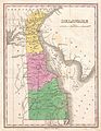 1827 Finley Map of Delaware - Geographicus - Delaware-finley-1827.jpg 2,323 × 3,000; 1.66 MB
-
 279 of 'Historiskt Bibliotek, utgifvet af C. Silfverstolpe' (11108524193).jpg 1,682 × 2,512; 733 KB
-

-

-
 A chart of Delaware Bay and River - from the original LOC 2013593289.tif 3,130 × 2,479; 22.2 MB
-
 A draught of Delaware Bay. LOC gm72003568.jpg 13,657 × 6,637; 9.71 MB
-
 A draught of Delaware Bay. LOC gm72003568.tif 13,657 × 6,637; 259.33 MB
-
 Admiralty Chart No 266 Barnegat Inlet to Chesapeake Bay, Published 1923. Large Corrections 1935.jpg 11,061 × 16,214; 44.87 MB
-
 Auto tour, Bombay Hook National Wildlife Refuge, Smyrna, Delaware LOC 2001622611.jpg 12,099 × 2,723; 4.06 MB
-
 Auto tour, Bombay Hook National Wildlife Refuge, Smyrna, Delaware LOC 2001622611.tif 12,099 × 2,723; 94.26 MB
-

-
 Bombay Hook National Wildlife Refuge LOC 2016585152.jpg 12,164 × 5,292; 7.52 MB
-
 Bombay Hook National Wildlife Refuge LOC 2016585152.tif 12,164 × 5,292; 184.17 MB
-
 Bombay Hook National Wildlife Refuge, Delaware LOC 93686708.jpg 9,084 × 2,741; 3.08 MB
-
 Bombay Hook National Wildlife Refuge, Delaware LOC 93686708.tif 9,084 × 2,741; 71.24 MB
-

-
 Bombay Hook National Wildlife Refuge, Kent County, Delaware, public tour route. LOC 95682952.tif 5,170 × 3,307; 48.92 MB
-
 Bombay Hook National Wildlife Refuge, Smyrna, Delaware LOC 94684302.jpg 9,622 × 2,724; 3.05 MB
-
 Bombay Hook National Wildlife Refuge, Smyrna, Delaware LOC 94684302.tif 9,622 × 2,724; 74.99 MB
-
 Bombay Hook National Wildlife Refuge, Smyrna, Delaware LOC 95682971.jpg 9,614 × 2,741; 3.36 MB
-
 Bombay Hook National Wildlife Refuge, Smyrna, Delaware LOC 95682971.tif 9,614 × 2,741; 75.39 MB
-
 Bombay Hook National Wildlife Refuge, Smyrna, Delaware LOC 95682972.jpg 9,600 × 2,746; 3.17 MB
-
 Bombay Hook National Wildlife Refuge, Smyrna, Delaware LOC 95682972.tif 9,600 × 2,746; 75.42 MB
-
 Bombay Hook National Wildlife Refuge, Smyrna, Delaware LOC 99447983.jpg 9,633 × 2,724; 3.15 MB
-
 Bombay Hook National Wildlife Refuge, Smyrna, Delaware LOC 99447983.tif 9,633 × 2,724; 75.07 MB
-
 Cape Henlopen and the Delaware Breakwater LOC 79695317.jpg 8,420 × 6,742; 7.28 MB
-
 Cape Henlopen and the Delaware Breakwater LOC 79695317.tif 8,420 × 6,742; 162.41 MB
-

-

-

-

-
 Chesapeake & Delaware Canal, topographical view LOC 80690709.jpg 3,234 × 2,582; 898 KB
-
 Chesapeake & Delaware Canal, topographical view LOC 80690709.tif 3,234 × 2,582; 23.89 MB
-
 Chesapeake & Delaware Canal, topographical view LOC 80690710.jpg 3,240 × 2,661; 1.15 MB
-
 Chesapeake & Delaware Canal, topographical view LOC 80690710.tif 3,240 × 2,661; 24.67 MB
-
 Christian River (Christiana to Christiana Acres vicinity). LOC gm69002795.jpg 8,520 × 5,230; 3.51 MB
-
 Christian River (Christiana to Christiana Acres vicinity). LOC gm69002795.tif 8,520 × 5,230; 127.49 MB
-
 CoochsBridge1777.jpg 2,516 × 2,072; 1.13 MB
-
 Delaware - drawn by F. Lucas, Jr.; engraved by G.W. Boynton. NYPL976314.tiff 4,832 × 6,075; 83.99 MB
-
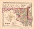
 Delaware and Maryland. LOC 2017593561.tif 5,689 × 4,710; 76.66 MB
-
 Delaware and Maryland. LOC 2017593564.tif 9,528 × 5,107; 139.22 MB
-
 Delaware and Maryland. LOC 2017593569.tif 2,128 × 1,770; 10.78 MB
-
 Delaware from the best authorities. LOC 2018590121.jpg 3,069 × 5,187; 2.38 MB
-
 Delaware from the best authorities. LOC 2018590121.tif 3,069 × 5,187; 45.54 MB
-
 Delaware LOC 2017593558.tif 4,056 × 4,908; 56.95 MB
-
 Delaware LOC 2018590116.tif 2,739 × 3,327; 26.07 MB
-
 Delaware LOC 2018590117.tif 2,286 × 2,603; 17.02 MB
-
 Delaware LOC 2018590119.tif 2,136 × 2,469; 15.09 MB
-
 Delaware, District of Columbia, and Maryland LOC 83692121.tif 11,370 × 6,546; 212.94 MB
-
 Delaware, from the best authorities (3045317185).jpg 1,794 × 2,000; 2.99 MB
-
 Delaware, from the best authorities (4584051570).jpg 1,669 × 2,000; 3.1 MB
-
 Delaware, from the best authorities - W. Barker sculp., Philada. NYPL976305.tiff 4,832 × 5,475; 75.69 MB
-
 Delaware, from the best authorities - W. Barker, sculp., Philada. NYPL465076.tiff 4,226 × 4,688; 56.69 MB
-
 Delaware, from the best authorities. NYPL434456.tiff 3,656 × 4,900; 51.26 MB
-

-
 Delaware-1787 LOC 2017593518.tif 3,768 × 5,588; 60.24 MB
-
 Delaware. LOC 2018590118.jpg 2,712 × 3,159; 1.27 MB
-
 Delaware. LOC 2018590118.tif 2,712 × 3,159; 24.51 MB
-
 Delaware. LOC 2018590120.jpg 2,174 × 2,626; 787 KB
-
 Delaware. LOC 2018590120.tif 2,174 × 2,626; 16.33 MB
-
 Delaware1895.jpg 680 × 1,197; 151 KB
-
 Delaware; county subdivisions, census county divisions and places. 1970. LOC gm72003039.jpg 2,740 × 5,230; 1.02 MB
-

-

-
 Hurricane evacuation routes - (Delaware) LOC 97684909.tif 10,405 × 6,651; 197.99 MB
-
 Hurricane evacuation routes - (Delaware) LOC 98688299.jpg 10,344 × 6,612; 8.47 MB
-
 Hurricane evacuation routes - (Delaware) LOC 98688299.tif 10,344 × 6,612; 195.68 MB
-
 J. H. Colton's School Atlas, 1860 - DPLA - 9afa4d40de861bb7b2a7e024bba61c0e (page 15).jpg 4,093 × 4,953; 2.49 MB
-
 Johnson's Pennsylvania, Virginia, Delaware, and Maryland LOC lva0000024.jpg 9,578 × 6,649; 17.12 MB
-
 Johnson's Pennsylvania, Virginia, Delaware, and Maryland LOC lva0000024.tif 9,578 × 6,649; 182.2 MB
-
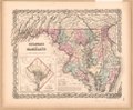
 Johnsons Virginia, Delaware, Maryland & West Virginia (8347522484).jpg 799 × 540; 134 KB
-
 Land use map, Kent County, Delaware LOC 89696685.jpg 6,384 × 8,732; 9.38 MB
-
 Land use map, Kent County, Delaware LOC 89696685.tif 6,384 × 8,732; 159.49 MB
-
 Land use map, New Castle County, Delaware LOC 89696686.jpg 6,480 × 8,824; 7.71 MB
-
 Land use map, New Castle County, Delaware LOC 89696686.tif 6,480 × 8,824; 163.59 MB
-
 Land use map, Sussex County, Delaware LOC 89696684.tif 8,560 × 7,296; 178.68 MB
-
 Map of Delaware Bay in vicinity of Cape May (8957937613).jpg 5,215 × 6,657; 2.96 MB
-
 Map of New Castle County, Delaware - from original surveys LOC 2013593084.jpg 10,802 × 15,122; 26.83 MB
-
 Map of part of Virginia, Maryland and Delaware from the best authorities (5960833219).jpg 1,486 × 2,000; 2.89 MB
-
 Map of the country contiguous to the Chesapeake & Delaware Canal LOC 80695657.jpg 3,243 × 2,593; 1.34 MB
-
 Map of the country contiguous to the Chesapeake & Delaware Canal LOC 80695657.tif 3,243 × 2,593; 24.06 MB
-
 Map of the country contiguous to the Chesapeake & Delaware Canal LOC 80695659.jpg 3,217 × 2,560; 1.31 MB
-
 Map of the country contiguous to the Chesapeake & Delaware Canal LOC 80695659.tif 3,217 × 2,560; 23.56 MB
-
 Map of the district of Delaware in Ohio (4231299165).jpg 1,518 × 2,000; 3.04 MB
-
 Map of the South River in New Netherland WDL10085.png 1,444 × 1,024; 3.05 MB
-
 Map of the state of Virginia LOC lva0000099.jpg 10,945 × 7,265; 19.45 MB
-
 Map of the state of Virginia LOC lva0000099.tif 10,945 × 7,265; 227.5 MB
-

-
 Map of Virginia, Maryland and Delaware WDL9595.png 1,379 × 1,024; 2.38 MB
-

-
-
-
 Murderkill watershed, Kent County, Delaware LOC 82696214.tif 4,612 × 3,372; 44.49 MB
-
 New Castle County, Delaware LOC 81690013.tif 4,032 × 7,004; 80.8 MB
-

-
 Delaware and Mary-Land (NYPL b14963774-434663).jpg 4,832 × 4,376; 5.12 MB
-
 Carte de la Virginie, du Maryland et de l'etat de Delaware (NYPL b15070724-433716).jpg 4,718 × 2,935; 2.39 MB
-
 Delaware (NYPL b15278424-976311).jpg 5,360 × 4,592; 5.26 MB
-
 Delaware (NYPL b15287609-976309).jpg 4,304 × 5,120; 3.63 MB
-
 Delaware (NYPL b15317384-976314).jpg 4,832 × 6,064; 4.33 MB
-
 Delaware, from the best authorities (NYPL b15370040-976305).jpg 4,832 × 5,472; 4.76 MB
-
 Virginia, Maryland, and Delaware (NYPL b15376687-434442).jpg 5,219 × 4,304; 4.98 MB
-
 Delaware (NYPL b15377766-433673).jpg 2,752 × 4,030; 2.04 MB
-
 The states of Maryland and Delaware, from the latest surveys, 1795 (NYPL b15384227-434452).tiff 5,579 × 4,672; 74.58 MB
-
-

-

-
 Plano de Philadelphia. LOC 74691685.tif 8,769 × 6,288; 157.76 MB
-
 Prime Hook National Wildlife Refuge, canoe trail LOC 2016585156.jpg 7,488 × 5,172; 4.36 MB
-
 Prime Hook National Wildlife Refuge, canoe trail LOC 2016585156.tif 7,488 × 5,172; 110.8 MB
-
 Prime Hook National Wildlife Refuge, Delaware LOC 93686709.jpg 9,090 × 2,738; 3.23 MB
-
 Prime Hook National Wildlife Refuge, Delaware LOC 93686709.tif 9,090 × 2,738; 71.21 MB
-
 Prime Hook NWR, public use area. LOC 2016585166.jpg 5,968 × 3,320; 2.22 MB
-
 Prime Hook NWR, public use area. LOC 2016585166.tif 5,968 × 3,320; 56.69 MB
-
 Reconnaissance erosion survey of the States of Maryland and Delaware - btv1b53189486k.jpg 10,720 × 6,494; 5.99 MB
-
 Sussex County, Delaware LOC 81690014.jpg 6,184 × 7,292; 6.67 MB
-
 Sussex County, Delaware LOC 81690014.tif 6,184 × 7,292; 129.01 MB
-

-
 The states of Maryland and Delaware, from the latest surveys (4583423113).jpg 2,000 × 1,654; 3.36 MB
-

-

-

-
 Transportation map of Delaware, Maryland, and Virginia. LOC 77694822.jpg 6,528 × 4,952; 4.1 MB
-
 Transportation map of Delaware, Maryland, and Virginia. LOC 77694822.tif 6,528 × 4,952; 92.49 MB
-
 Virginia, Maryland and Delaware. NYPL434029.tiff 4,690 × 4,080; 54.78 MB
-
 Virginia, Maryland, and Delaware - by H.S. Tanner. NYPL434442.tiff 5,219 × 4,304; 64.27 MB
-
 Water-resources investigations in Delaware, 1976 LOC 83692065.jpg 12,009 × 6,335; 6.65 MB
-
 Water-resources investigations in Delaware, 1976 LOC 83692065.tif 12,009 × 6,335; 217.66 MB
-
 Watershed progress map (PL-566), Delaware LOC 81690130.jpg 3,288 × 6,744; 2.81 MB
-
 Watershed progress map (PL-566), Delaware LOC 81690130.tif 3,288 × 6,744; 63.44 MB
-
 Watershed progress map (PL-566), Delaware LOC 81693345.jpg 3,360 × 6,728; 2.45 MB
-
 Watershed progress map (PL-566), Delaware LOC 81693345.tif 3,360 × 6,728; 64.68 MB
-
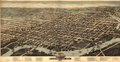
 Wilmington, Del. 1874. LOC 75693172.jpg 11,648 × 6,016; 14.36 MB
-
 Wilmington, Del. 1874. LOC 75693172.tif 11,648 × 6,016; 200.48 MB

.jpg)
%27_(11186341845).jpg)


._LOC_gm69002795.jpg)


.jpg)
.jpg)


_LOC_98688299.jpg)
.jpg)

.jpg)


.jpg)

.jpg)


.jpg)


.jpg)


.jpg)
.jpg)
.jpg)
.jpg)
.jpg)
.jpg)
.jpg)
.jpg)
.jpg)
.jpg)


.jpg)
.jpg)


,_Delaware_LOC_81690130.jpg)
,_Delaware_LOC_81693345.jpg)

%27_(11014091245).jpg)