Category:Old maps of Guatemala
Jump to navigation
Jump to search
Countries of North America: Antigua and Barbuda · The Bahamas · Barbados · Belize · Canada · Costa Rica · Cuba · Dominica · Dominican Republic · El Salvador · Grenada · Guatemala · Haiti · Honduras · Jamaica · Mexico · Nicaragua · Panama · Saint Kitts and Nevis · Saint Lucia · Saint Vincent and the Grenadines · Trinidad and Tobago‡ · United States of America‡
Other territories: Bermuda · Florida Keys · Greenland · Guadeloupe · Martinique · Montserrat · Puerto Rico · Saint Barthélemy · Saint-Martin · Saint Pierre and Miquelon
‡: partly located in North America
Other territories: Bermuda · Florida Keys · Greenland · Guadeloupe · Martinique · Montserrat · Puerto Rico · Saint Barthélemy · Saint-Martin · Saint Pierre and Miquelon
‡: partly located in North America
Subcategories
This category has the following 6 subcategories, out of 6 total.
Media in category "Old maps of Guatemala"
The following 19 files are in this category, out of 19 total.
-

-
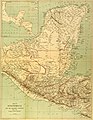 A glimpse of Guatemala - Map of Guatemala.jpg 2,612 × 3,382; 2.19 MB
-
 Admiralty Chart No 2988 Puerto Cortes, Published 1972.jpg 8,241 × 11,247; 13.74 MB
-
 AGTM D356 Border map of Chiapas and Guatemala.png 987 × 1,032; 291 KB
-
 Antigua Guatemala location map.JPG 721 × 1,129; 255 KB
-
 Carta náutica de América Central (1790) Capitanía General de Guatemala.pdf 11,631 × 7,541; 2.82 MB
-

-
 Guatemala - DPLA - 2702a9f14ccabe4fc3120a3e26f893d6.jpg 2,554 × 3,274; 6.37 MB
-
 Guatemala - DPLA - 5cb033f2fc8fdf7c3a7f4ef1da5a75b6.jpg 8,464 × 7,563; 5.59 MB
-
 Guatemala - DPLA - b2520d5a2591ed2923ba2ffc9860bcfa.jpg 2,558 × 3,278; 6.92 MB
-
 Guatemala - DPLA - e019405dfdd9199744c619877f57cda8.jpg 2,550 × 3,274; 6.13 MB
-
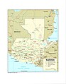
 Guatemalahonduras.jpg 816 × 584; 167 KB
-
 Mapa Normal.jpg 905 × 593; 156 KB
-
 MapaSM.jpg 4,290 × 6,524; 2.45 MB
-
 Mary Recinos, daughter of the Minister of Guatemala and Senora de Recinos LCCN2016874610.jpg 7,951 × 10,012; 8.82 MB
-
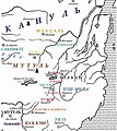 MutalMapeCenter1.jpg 1,060 × 1,192; 249 KB
-

-

-
.jpg)


_(14576916720).jpg)
.jpg)
.jpg)