Category:Old maps of Saint Kitts and Nevis
Jump to navigation
Jump to search
Countries of North America: Antigua and Barbuda · The Bahamas · Barbados · Belize · Canada · Costa Rica · Cuba · Dominica · Dominican Republic · El Salvador · Grenada · Guatemala · Haiti · Honduras · Jamaica · Mexico · Nicaragua · Panama · Saint Kitts and Nevis · Saint Lucia · Saint Vincent and the Grenadines · Trinidad and Tobago‡ · United States of America‡
Other territories: Bermuda · Florida Keys · Greenland · Guadeloupe · Martinique · Montserrat · Puerto Rico · Saint Barthélemy · Saint-Martin · Saint Pierre and Miquelon
‡: partly located in North America
Other territories: Bermuda · Florida Keys · Greenland · Guadeloupe · Martinique · Montserrat · Puerto Rico · Saint Barthélemy · Saint-Martin · Saint Pierre and Miquelon
‡: partly located in North America
Subcategories
This category has the following 5 subcategories, out of 5 total.
Media in category "Old maps of Saint Kitts and Nevis"
The following 15 files are in this category, out of 15 total.
-
-

-

-

-

-
 East Saint Kitts map.png 571 × 746; 289 KB
-
 Ile de Nièves - btv1b84404365.jpg 9,166 × 7,104; 7.13 MB
-
 Isle de Cayenne & Isle de Saint-Christophe,1667.png 2,840 × 3,928; 8.19 MB
-
 Isle de Nieve - Beauvilliers - btv1b531037274.jpg 7,128 × 5,457; 4.75 MB
-
 Saint Christopher topo map by William McMahon 1828-West.jpg 11,000 × 16,000; 16.29 MB
-
 Saint Kitts historical map - 01.jpg 9,765 × 7,375; 44.32 MB
-
 St. Christopher antique map.jpg 1,583 × 1,213; 2.73 MB
-
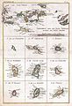
 St. Christophers or St. Kitts (4586548305).jpg 2,000 × 1,537; 2.91 MB
-
 St. Christophers or St. Kitts (9474463704).jpg 800 × 616; 112 KB
-
 West Saint Kitts map.png 505 × 758; 260 KB

%27_(11251598306).jpg)
.jpg)
.jpg)


.jpg)
.jpg)
