Category:Old maps of Central America
Jump to navigation
Jump to search
Use the appropriate category for maps showing all or a large part of Central America. See subcategories for smaller areas:
| If the map shows | Category to use |
|---|---|
| Central America on a recently created map | Category:Maps of Central America or its subcategories |
| Central America on a map created more than 70 years ago | Category:Old maps of Central America or its subcategories |
| the history of Central America on a recently created map | Category:Maps of the history of Central America or its subcategories |
| the history of Central America on a map created more than 70 years ago | Category:Old maps of the history of Central America or its subcategories |
Subcategories
This category has the following 15 subcategories, out of 15 total.
*
+
B
C
E
G
H
N
P
Media in category "Old maps of Central America"
The following 97 files are in this category, out of 97 total.
-
 (Map showing Caribbean coast of Central America from Belize to Nicaragua). LOC 90683518.jpg 7,950 × 5,941; 4.74 MB
-
 (Map showing Caribbean coast of Central America from Belize to Nicaragua). LOC 90683518.tif 7,950 × 5,941; 135.13 MB
-
 (Map showing Caribbean coast of Central America from Yucatan to Nicaragua) LOC 90683532.jpg 7,614 × 5,227; 4.32 MB
-
 (Map showing Caribbean coast of Central America from Yucatan to Nicaragua) LOC 90683532.tif 7,614 × 5,227; 113.86 MB
-

-

-

-
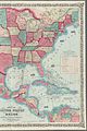
 Central America.jpg 319 × 450; 97 KB
-

-

-

-

-

-

-

-

-
 A New Survey of the West Indies - p14.png 2,775 × 3,816; 2.09 MB
-
 A New Survey of the West Indies - p15.png 2,816 × 3,800; 1.72 MB
-
 Admiralty Chart No 786 Cape Horn to Cape Corrientes, Published 1876, New Edition 1922.jpg 11,430 × 20,177; 67.92 MB
-
 Amerika (8346517369).jpg 661 × 800; 133 KB
-
 América decolonial.jpg 736 × 589; 222 KB
-
-

-
 Arbuckle Bros. Coffee Co. (3093836326).jpg 799 × 482; 331 KB
-
 AtlasMiller BNF NegrosEnCentroamerica.jpg 884 × 734; 134 KB
-
 Carte du Mexique et des Etats Unis dAmérique, partie meridionale (4072642408).jpg 2,000 × 1,496; 3.18 MB
-
 Central America and the Caribbean. LOC 00559564.tif 4,025 × 3,052; 35.15 MB
-
 Central America and the Caribbean. LOC 2001631039.jpg 4,080 × 3,260; 1.75 MB
-
 Central America and the Caribbean. LOC 2001631039.tif 4,080 × 3,260; 38.05 MB
-
 Central America and the Caribbean. LOC 99443235.jpg 3,996 × 3,264; 2.13 MB
-
 Central America and the Caribbean. LOC 99443235.tif 3,996 × 3,264; 37.32 MB
-
 Central America. LOC 2003627053.jpg 5,832 × 3,974; 3.52 MB
-
 Central America. LOC 2003627053.tif 5,832 × 3,974; 66.31 MB
-
 Central America. LOC 2003627061.jpg 4,128 × 3,264; 2.09 MB
-
 Central America. LOC 2003627061.tif 4,128 × 3,264; 38.55 MB
-
 Central America. LOC 2011586138.jpg 4,006 × 3,157; 1.5 MB
-
 Central America. LOC 2011586138.tif 4,006 × 3,157; 36.18 MB
-
 Central---- america.jpg 111 × 120; 6 KB
-
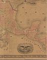
 CentralAmerica1860MapSmall.jpg 374 × 403; 54 KB
-
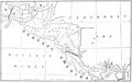
 CentralAmericaMap1856.jpg 312 × 358; 211 KB
-

-

-

-
 Costa de tierra firme desde el Cabo Gracias a Dios hasta la Ysla Cosumuel LOC 90683545.jpg 7,626 × 5,876; 4.89 MB
-
 Costa de tierra firme desde el Cabo Gracias a Dios hasta la Ysla Cosumuel LOC 90683545.tif 7,626 × 5,876; 128.2 MB
-
 FMIB 49243 Relief map of the sea and land.jpeg 1,087 × 596; 228 KB
-
 Impossible Black Tulip-World map, Gulf of Mexico, Florida.jpg 825 × 550; 156 KB
-
 Insulae Americanae in Oceano Septentrionale. NYPL2020760.tiff 6,451 × 4,770, 2 pages; 88.1 MB
-
 Karte des betraechtlichsten Theils von Mittel-America oder Westindien.jpg 7,639 × 6,621; 13.59 MB
-
 L'America settentrionale (14166704239).jpg 2,500 × 1,865; 1.9 MB
-
 L'Amerique Septentrionale divisée en ses principaux etats (14251116379).jpg 2,363 × 2,000; 2.16 MB
-
 Linguistic map Central America.jpg 4,432 × 3,243; 7.24 MB
-
 Map of Antilles Isles. Wellcome L0002630EA.jpg 1,617 × 1,092; 959 KB
-
 Map showing Caribbean coast of Central America from Belize to Honduras. LOC 90683504.jpg 8,622 × 6,417; 4.93 MB
-
 Map showing Caribbean coast of Central America from Belize to Honduras. LOC 90683504.tif 8,622 × 6,417; 158.29 MB
-
 Map showing Caribbean coast of Central America from Yucatan to Honduras. LOC 90683517.jpg 9,548 × 6,899; 6.17 MB
-
 Map showing Caribbean coast of Central America from Yucatan to Honduras. LOC 90683517.tif 9,548 × 6,899; 188.46 MB
-

-
 Mosquito Coast.jpg 720 × 960; 517 KB
-
 NIC 1985 MiNr27042705 st pm B002.jpg 3,081 × 1,048; 1.83 MB
-

-
-
-
-

-

-

-

-

-
 Mexico, or, New Spain (NYPL b15481883-465065).jpg 1,698 × 2,848; 1.36 MB
-
 Pascaerte van Westindien - de vaste kusten en de Eylanden (NYPL b15501969-1030132).tiff 5,531 × 4,568; 72.29 MB
-
 Map of the United States and Mexico (NYPL b16040665-5437619).jpg 6,742 × 10,130; 71.77 MB
-
 Carte contenant le royaume du Mexique et la Floride (NYPL b20292772-5476418).jpg 7,882 × 6,249; 45.44 MB
-
 A map of Mexico, Louisiana, and the Missouri territory (NYPL b20643846-5404030).jpg 9,909 × 7,623; 67.99 MB
-
 A map of Mexico, Louisiana, and the Missouri territory (NYPL b20643846-5404030).tiff 10,328 × 7,760, 2 pages; 229.57 MB
-
 Mitchell's new national map exhibiting the United States (NYPL b20643856-5476462).jpg 6,295 × 9,528; 61.75 MB
-

-

-

-
-
-
 Colton's new illustrated & embellished county map of the republics of North America (NYPL b20732974-5404016).tiff 7,760 × 10,328, 2 pages; 229.57 MB
-
 Amerikanisch-Spanischer kriegsschauplatz (NYPL b20764809-5452682).tiff 7,760 × 10,328, 2 pages; 229.61 MB
-
 P119 - N° 543. Isthmes de l’Amérique centrale. - Liv4-Ch06.png 1,438 × 1,654; 715 KB
-
 Panama, the isthmus and the canal (1912) (14741756796).jpg 2,256 × 1,314; 514 KB
-
 PSM V16 D402 Proposed canal routes between the two oceans.jpg 2,919 × 1,821; 468 KB
-

-

-
 Révai nagy lexikona; az ismeretek enciklopédiája (1911) (14580061927).jpg 3,104 × 1,846; 1.32 MB
-
 Révai nagy lexikona; az ismeretek enciklopédiája (1911) (14766200782).jpg 1,825 × 2,728; 1 MB
-
 Sketch of the Isthmus of Chiriqui. LOC 2003627008.jpg 6,199 × 5,629; 4.65 MB
-
 Sketch of the Isthmus of Chiriqui. LOC 2003627008.tif 6,199 × 5,629; 99.83 MB
-
 Terra Firma et novum regnum Granatense et Popayan (8342790893).jpg 800 × 652; 128 KB
-
 Terra firma et novum regnum Granatense et Popayan (8431021648).jpg 800 × 713; 131 KB
-

-
 The Matthews-Northrup handy map of Central America. LOC 2003627004.jpg 3,406 × 2,580; 944 KB
-
 The Matthews-Northrup handy map of Central America. LOC 2003627004.tif 3,406 × 2,580; 25.14 MB
._LOC_90683518.jpg)
_LOC_90683532.jpg)


.jpg)

.jpg)
.jpg)
.jpg)
.jpg)
.jpg)
.jpg)


.jpg)

_(14579433078).jpg)
_(14756419046).jpg)
.jpg)

.jpg)


.jpg)
.jpg)
_(20502714020).jpg)


.jpg)
.jpg)


.jpg)
.jpg)
.jpg)
.jpg)
.jpg)
.jpg)
.jpg)
.jpg)
.jpg)
.jpg)
.jpg)
.jpg)
.jpg)

_(14741756796).jpg)

_(14758816334).jpg)
_(14761565661).jpg)
_(14580061927).jpg)
_(14766200782).jpg)

.jpg)
.jpg)


.jpg)