Category:Old maps of the Maghreb
Jump to navigation
Jump to search
Subcategories
This category has the following 2 subcategories, out of 2 total.
B
Media in category "Old maps of the Maghreb"
The following 18 files are in this category, out of 18 total.
-
 Africa - Joanne Baptista Nicolosio S. T. D. sic describente - btv1b8468854h (4 of 4).jpg 8,818 × 7,008; 8.37 MB
-
 Barbariae et Biledulgerid, Nova Descriptio.jpg 12,777 × 8,739; 16.31 MB
-
 Antiquorum Africae episcopatuum geographica descriptio - btv1b531968206 (2 of 3).jpg 6,045 × 4,469; 5.11 MB
-
 UBBasel Map Maghreb 1695 Kartenslg Mappe 252-33.tif 10,836 × 8,314, 2 pages; 257.78 MB
-
 Le Coste di Barbaria (Antonio Zatta 1794, twelve small maps).jpg 556 × 379; 83 KB
-
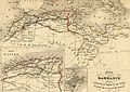
 Maghreb 1816.jpg 415 × 311; 122 KB
-
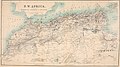
 Carte Maghreb Vuillemin 1843.jpg 3,325 × 2,352; 3.37 MB
-

-

-
-

-
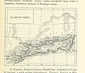
 Cook's practical guide to Algeria and Tunisia (1908) (14586642948).jpg 3,138 × 1,764; 724 KB
-
 The Harmsworth atlas and Gazetter 1908 (135850529).jpg 12,558 × 9,574; 115.27 MB
-

-
 59 of 'La France et les Colonies. (Illustrated.)' (11191699963).jpg 3,024 × 2,066; 1.3 MB
-
 Barbarie - 1806.jpg 3,000 × 2,400; 1.91 MB
-
 Béni Imloul 2.jpg 368 × 514; 55 KB
-
 Maghreb central.jpg 752 × 956; 550 KB
.jpg)

.jpg)
.jpg)


.jpg)
_oszt%C3%A1ly_sz%C3%A1mara_..._t%C3%A9rk%C3%A9ppel%27_(11295685694).jpg)
_(14796570333).jpg)
_(14586642948).jpg)
.jpg)
_oszt%C3%A1ly_sz%C3%A1mara._(With_maps.)%27_(11294323464).jpg)
%27_(11191699963).jpg)


.jpg)