Category:Occupation bridges
Jump to navigation
Jump to search

Occupation bridges are those built to give access to land which would otherwise be inaccessible due to engineering works, and are typically associated with railways or canals.
Subcategories
This category has the following 16 subcategories, out of 16 total.
C
- Crosbys bridge, Halewood (2 F)
- Cubbins Green footbridge (4 F)
D
E
- Evans bridge, Spital (3 F)
F
- Farr Hall Drive bridge (7 F)
H
L
- Lanfranc Way bridge (9 F)
- Links bridge, Caldy (3 F)
M
N
- New Hutte Lane bridge (4 F)
R
S
- Simon's Bridge, Caldy (4 F)
- Spital occupation bridge (2 F)
T
Media in category "Occupation bridges"
The following 38 files are in this category, out of 38 total.
-
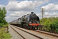 30777 Sir Lamiel on the Quorn Straight.jpg 3,456 × 2,304; 1.54 MB
-
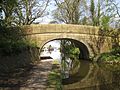 Bridge 117, Lancaster Canal.jpg 4,608 × 3,456; 6.66 MB
-

-
 Bridge over the Bonet River - geograph.org.uk - 799292.jpg 640 × 480; 82 KB
-
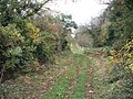
 Bridge over the Great Northern Trail - geograph.org.uk - 1496749.jpg 640 × 480; 103 KB
-
 Bridge over the railway - geograph.org.uk - 1566496.jpg 640 × 480; 58 KB
-
 Brusselton Incline east - geograph.org.uk - 1586142.jpg 640 × 479; 163 KB
-
 Cambrian line at Ynyshir - geograph.org.uk - 583505.jpg 1,000 × 750; 402 KB
-
 Cholsey down the line - geograph.org.uk - 1154015.jpg 640 × 426; 59 KB
-
 D5401 and D5185 Great Central Railway.jpg 3,456 × 2,304; 1.35 MB
-
 Daresbury George Gleave's Bridge.jpg 2,592 × 1,944; 1.1 MB
-
 Double Bridge - geograph.org.uk - 1345306.jpg 640 × 480; 97 KB
-
 Eggesford - FGW 153369 150249.jpg 1,024 × 683; 462 KB
-
 Footpath looking west - geograph.org.uk - 1566540.jpg 640 × 480; 138 KB
-
 Footpaths meet - geograph.org.uk - 1565398.jpg 640 × 480; 99 KB
-
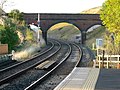 Kirkby Stephen Station - geograph.org.uk - 1528496.jpg 640 × 480; 109 KB
-
 Lime kiln at God's Bridge - geograph.org.uk - 1658594.jpg 640 × 510; 109 KB
-
 Occupation Bridge - geograph.org.uk - 1225462.jpg 640 × 469; 112 KB
-
 Occupation Bridge - geograph.org.uk - 1225465.jpg 640 × 480; 136 KB
-
 Occupation bridge - geograph.org.uk - 1671706.jpg 4,000 × 3,000; 1.67 MB
-
 Occupation bridge - geograph.org.uk - 744582.jpg 640 × 426; 98 KB
-
 Occupation bridge - geograph.org.uk - 855539.jpg 640 × 426; 169 KB
-
 Occupation Bridge - geograph.org.uk - 878869.jpg 640 × 480; 130 KB
-
 Occupation Bridge near Moor End Farm. - geograph.org.uk - 1702788.jpg 4,000 × 3,000; 4.29 MB
-

-

-

-
 Occupation Bridge, Sayscourt Farm. - panoramio.jpg 2,657 × 1,849; 1.98 MB
-

-
 Remains of bridge - geograph.org.uk - 1628256.jpg 640 × 480; 132 KB
-
 Trewsbury Bridge - geograph.org.uk - 1208048.jpg 640 × 480; 115 KB
-
 Bridge from the cutting - geograph.org.uk - 1660460.jpg 640 × 427; 109 KB
-
 Upwey occupation bridge.jpg 1,024 × 768; 359 KB
-
 Bridge over Perth - Glasgow line - geograph.org.uk - 369047.jpg 640 × 480; 158 KB
-
 Copleys Occupation Bridge - geograph.org.uk - 336194.jpg 640 × 480; 90 KB
-
 Looking North towards Moreton-in-Marsh - geograph.org.uk - 234040.jpg 640 × 480; 117 KB
-
 Occupation Bridge from Fen Lane - geograph.org.uk - 118027.jpg 640 × 427; 96 KB
-
 Westfield Bridge - geograph.org.uk - 384501.jpg 640 × 327; 77 KB


