Category:Torridge Estuary
Jump to navigation
Jump to search
Subcategories
This category has the following 2 subcategories, out of 2 total.
B
- Bideford Long Bridge (67 F)
T
- Torridge Bridge (21 F)
Media in category "Torridge Estuary"
The following 200 files are in this category, out of 241 total.
(previous page) (next page)-
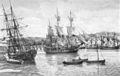 A painting of 18th Century ships on the River Torridge.jpg 800 × 504; 89 KB
-
 A slipway on the River Torridge which leads from Newquay Street (geograph 3360145).jpg 1,063 × 1,600; 544 KB
-
 A view of the South of Bideford - geograph.org.uk - 1588243.jpg 640 × 480; 57 KB
-
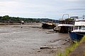
 Abandoned boats near Appledore - geograph.org.uk - 1354833.jpg 640 × 480; 71 KB
-
 Abandoned boats on the River Torridge - geograph.org.uk - 1359428.jpg 640 × 480; 112 KB
-
 Abandoned boats on the Torridge - geograph.org.uk - 1359442.jpg 640 × 480; 114 KB
-
 An anchor at Appledore - geograph.org.uk - 1354801.jpg 640 × 480; 86 KB
-
 An anchor in Appledore - geograph.org.uk - 1354781.jpg 640 × 480; 73 KB
-
 An ice breaker and a Thames tug moored at Bideford.jpg 800 × 533; 78 KB
-
 Angling by the stream outflow - geograph.org.uk - 1009505.jpg 480 × 640; 127 KB
-
 Appledore - panoramio (1).jpg 1,024 × 494; 407 KB
-
 Appledore - River Torridge (geograph 4018715).jpg 4,288 × 2,848; 5.28 MB
-
 Appledore - River Torridge (geograph 4018717).jpg 4,288 × 2,848; 6.27 MB
-
 Appledore - River Torridge (geograph 4018726).jpg 4,205 × 2,793; 6.65 MB
-
 Appledore - The Quay & River Torridge (geograph 4018724).jpg 4,266 × 2,834; 4.74 MB
-
 Appledore across the water from Instow Sands - August 2011 - panoramio.jpg 2,288 × 1,712; 793 KB
-
 Appledore and Instow - geograph.org.uk - 713470.jpg 640 × 480; 52 KB
-
 Appledore from Instow Sands - August 2011 - panoramio.jpg 2,288 × 1,712; 783 KB
-
 Appledore from Instow.jpg 3,348 × 2,579; 3.05 MB
-
 Appledore Quay (geograph 3950367).jpg 1,280 × 851; 220 KB
-
 Appledore Quay - geograph.org.uk - 1392947.jpg 640 × 416; 59 KB
-
 Appledore Quay - geograph.org.uk - 1394261.jpg 640 × 427; 65 KB
-
 Appledore riverfront (geograph 4436068).jpg 800 × 531; 88 KB
-
 Appledore riverfrontage (geograph 4436071).jpg 800 × 531; 108 KB
-
 Appledore Royal George at sunset - geograph.org.uk - 1482276.jpg 640 × 480; 54 KB
-
 Appledore shipbuilding yard - geograph.org.uk - 749971.jpg 640 × 339; 48 KB
-
 Appledore shipyard 800.jpg 800 × 513; 96 KB
-
 Appledore Shipyard from Instow Sands - Aug 2011 - panoramio.jpg 2,288 × 1,712; 798 KB
-

-
 Appledore shipyard.jpg 3,864 × 2,744; 4.26 MB
-
 Appledore waterfront - geograph.org.uk - 1742561.jpg 640 × 480; 65 KB
-
 Appledore, Devon - geograph.org.uk - 43094.jpg 640 × 427; 63 KB
-
 Appledore-shipyard.jpg 640 × 369; 42 KB
-
 Bideford - panoramio.jpg 3,072 × 2,304; 1.15 MB
-

-
 Bideford bridges from Upcott Hill - geograph.org.uk - 867952.jpg 640 × 427; 64 KB
-
 Bideford from East-The-Water - geograph.org.uk - 1387497.jpg 640 × 414; 40 KB
-
 Bideford from East-The-Water - geograph.org.uk - 1392868.jpg 640 × 427; 80 KB
-
 Bideford from East-the-Water 1 - geograph.org.uk - 749952.jpg 640 × 480; 54 KB
-
 Bideford from East-the-Water 2 - geograph.org.uk - 749955.jpg 640 × 480; 43 KB
-
 Bideford from East-the-Water 3 - geograph.org.uk - 749957.jpg 640 × 480; 38 KB
-
 Bideford from Seven Oaks.jpg 3,780 × 2,702; 3.62 MB
-
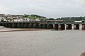
 Bideford Long Bridge - geograph.org.uk - 1324514.jpg 640 × 480; 128 KB
-
 Bideford Long Bridge - geograph.org.uk - 1611804.jpg 640 × 480; 47 KB
-
 Bideford Long Bridge - geograph.org.uk - 726342.jpg 640 × 480; 101 KB
-

-
 Bideford Long Bridge at low tide - geograph.org.uk - 1392878.jpg 640 × 420; 73 KB
-
 Bideford Long Bridge at low tide - geograph.org.uk - 1392883.jpg 640 × 427; 51 KB
-
 Bideford long bridge pan 1200.jpg 1,200 × 437; 180 KB
-
-
 Bideford old bridge - geograph.org.uk - 1478494.jpg 640 × 427; 50 KB
-
 Bideford Old Bridge - geograph.org.uk - 36235.jpg 640 × 426; 113 KB
-
 Bideford Quay 1 - geograph.org.uk - 1160266.jpg 640 × 482; 181 KB
-
 Bideford Quay 2 - geograph.org.uk - 1160269.jpg 577 × 640; 253 KB
-
 Bideford Quay 3 - geograph.org.uk - 1160272.jpg 640 × 480; 172 KB
-
 Bideford Quay from East-The-Water - geograph.org.uk - 1392875.jpg 640 × 415; 70 KB
-
 Bideford Quay from East-The-Water - geograph.org.uk - 1392877.jpg 640 × 427; 77 KB
-
 Bideford viewed across the Torridge - geograph.org.uk - 1359450.jpg 640 × 480; 105 KB
-
 Bideford waterfront - geograph.org.uk - 1036043.jpg 640 × 358; 54 KB
-
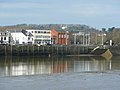
 Bideford, the Torridge - geograph.org.uk - 590899.jpg 640 × 427; 152 KB
-
 Bideford, towards East-the-Water - geograph.org.uk - 590902.jpg 640 × 427; 152 KB
-
 Bideford-Devon.jpg 640 × 359; 60 KB
-
 Boats at Instow - geograph.org.uk - 1355650.jpg 640 × 480; 68 KB
-
-

-
 Boats on the sand at Appledore - geograph.org.uk - 1394259.jpg 640 × 427; 55 KB
-
 Braunton Burrows from Instow - geograph.org.uk - 1420605.jpg 640 × 295; 53 KB
-
 Bridge repairs - geograph.org.uk - 1325394.jpg 640 × 480; 69 KB
-

-
 BWH&AR Locomotive crossing Bideford Bridge 1917.jpg 3,664 × 2,416; 836 KB
-

-
 Crane on Instow jetty - geograph.org.uk - 749988.jpg 640 × 480; 64 KB
-
 Crane on the quayside - geograph.org.uk - 1317963.jpg 480 × 640; 93 KB
-
 Dawn on The Torridge. - panoramio.jpg 3,648 × 2,736; 1.8 MB
-
 December in sunglasses - geograph.org.uk - 92136.jpg 640 × 480; 63 KB
-
 Depth gauge on the quayside - geograph.org.uk - 1324112.jpg 640 × 483; 104 KB
-
 Detritus, natural and man-made - geograph.org.uk - 1324073.jpg 640 × 480; 125 KB
-
 Dockyard, Appledore (geograph 3040566).jpg 640 × 460; 52 KB
-
 Dunes, Instow - geograph.org.uk - 941932.jpg 640 × 480; 128 KB
-
 Early morning in Appledore - geograph.org.uk - 959768.jpg 640 × 427; 57 KB
-
 East the Water, Bideford. - geograph.org.uk - 1353320.jpg 640 × 480; 70 KB
-
 East-The-River from Bideford Quay - geograph.org.uk - 1392921.jpg 640 × 427; 42 KB
-
 East-the-Water - geograph.org.uk - 1324498.jpg 640 × 480; 85 KB
-
 East-The-Water from Bideford Quay - geograph.org.uk - 1392919.jpg 640 × 427; 50 KB
-
-
 Fishing off the quay at Appledore - geograph.org.uk - 1595437.jpg 640 × 480; 28 KB
-
 Frith Bideford.jpg 4,332 × 2,868; 13.58 MB
-
 Grass land above Hallspill - geograph.org.uk - 749912.jpg 640 × 480; 48 KB
-
 Grounded boats at Appledore - geograph.org.uk - 1392945.jpg 640 × 402; 67 KB
-
 Gulls in Bideford - geograph.org.uk - 1357017.jpg 640 × 480; 40 KB
-
 HalfpennyBridgeAnnery RiverTorridgeDevon.jpg 1,280 × 960; 358 KB
-

-
 Herring Gull, Bideford - geograph.org.uk - 1611806.jpg 640 × 480; 48 KB
-

-

-
 Hulk in the Torridge 1 - geograph.org.uk - 1160280.jpg 640 × 481; 180 KB
-
 Hulk in the Torridge 2 - geograph.org.uk - 1160284.jpg 639 × 640; 254 KB
-
 Hulk in the Torridge 3 - geograph.org.uk - 1160287.jpg 640 × 480; 192 KB
-
 Hulk in the Torridge 4 - geograph.org.uk - 1160289.jpg 640 × 480; 177 KB
-
 Hulks in the Torridge.jpg 2,992 × 2,328; 2.65 MB
-
 Incoming tide, Instow - geograph.org.uk - 701181.jpg 640 × 425; 61 KB
-
 Instow - geograph.org.uk - 1595982.jpg 640 × 452; 61 KB
-
 Instow - geograph.org.uk - 222181.jpg 640 × 408; 71 KB
-
 Instow - geograph.org.uk - 31614.jpg 640 × 257; 30 KB
-
 Instow and the Torridge.jpg 3,827 × 2,800; 3.4 MB
-
 Instow Beach - geograph.org.uk - 315653.jpg 640 × 428; 81 KB
-
 Instow beach - geograph.org.uk - 749995.jpg 640 × 480; 57 KB
-
 Instow Beach overlooking Appledore.jpg 2,024 × 751; 220 KB
-
 Instow Beach Panoramic.jpg 2,350 × 357; 119 KB
-
 Instow Beach.jpg 2,272 × 1,704; 1.41 MB
-
 Instow Commodore Hotel 2.jpg 2,272 × 1,704; 1.73 MB
-
 Instow Commodore Hotel.jpg 2,272 × 1,704; 1.76 MB
-
 Instow from Appledore - geograph.org.uk - 292676.jpg 640 × 427; 93 KB
-
 Instow from Appledore quay - geograph.org.uk - 228045.jpg 640 × 480; 86 KB
-
 Instow harbour - geograph.org.uk - 878386.jpg 640 × 427; 77 KB
-
 Instow Quay - geograph.org.uk - 750001.jpg 640 × 480; 80 KB
-
 Instow quay - geograph.org.uk - 878383.jpg 640 × 427; 79 KB
-
 Instow quay - geograph.org.uk - 878400.jpg 640 × 427; 73 KB
-
 Instow Sands - geograph.org.uk - 1324081.jpg 480 × 640; 79 KB
-
 Instow Sands - geograph.org.uk - 1355659.jpg 640 × 480; 38 KB
-
 Instow Sands - geograph.org.uk - 1492722.jpg 640 × 417; 46 KB
-
 Instow Sands - geograph.org.uk - 1492723.jpg 640 × 416; 44 KB
-
 Instow Waterfront - geograph.org.uk - 749996.jpg 640 × 480; 50 KB
-
 Instow Yacht Club - geograph.org.uk - 1595991.jpg 640 × 407; 55 KB
-
 Instow, Devon - geograph.org.uk - 43093.jpg 640 × 427; 76 KB
-
 Kathleen and May in Bideford.jpg 3,208 × 2,512; 2.98 MB
-
 Kathleen and May01.jpg 800 × 533; 92 KB
-
 Landcross, near Bideford - geograph.org.uk - 43099.jpg 640 × 427; 62 KB
-
 Landing craft at Instow.jpg 3,800 × 2,736; 4.9 MB
-
-
 Low tide at Instow - geograph.org.uk - 878398.jpg 640 × 427; 79 KB
-
 Low tide on the River Torridge - geograph.org.uk - 1321698.jpg 640 × 480; 60 KB
-
 Low tide on the river Torridge - geograph.org.uk - 414005.jpg 640 × 426; 133 KB
-
 Low tide on the Taw-Torridge estuary - geograph.org.uk - 1323024.jpg 640 × 480; 169 KB
-
-
 Marshland in the Torridge estuary - geograph.org.uk - 1355608.jpg 640 × 480; 115 KB
-

-
 Moored Up - geograph.org.uk - 1278709.jpg 640 × 480; 71 KB
-

-
 MS Oldenburg at Bideford - geograph.org.uk - 1392924.jpg 640 × 427; 54 KB
-
 Mud at Instow - geograph.org.uk - 941915.jpg 640 × 480; 99 KB
-
 Mud by the Dart - geograph.org.uk - 1032836.jpg 640 × 606; 95 KB
-
 Mud-flats of the Torridge - geograph.org.uk - 1160298.jpg 640 × 480; 155 KB
-
 North Devon , River Taw ^ Torridge Estuary - geograph.org.uk - 4271191.jpg 4,288 × 2,848; 4.26 MB
-
 North Devon , River Taw ^ Torridge Estuary - geograph.org.uk - 4271235.jpg 4,288 × 2,848; 7.93 MB
-
 Old wreck in the Torridge - geograph.org.uk - 749949.jpg 640 × 480; 66 KB
-

-
 Quayside steps, Bideford - geograph.org.uk - 1317896.jpg 640 × 480; 107 KB
-
 Reed beds beside the River Torridge - geograph.org.uk - 413978.jpg 640 × 426; 118 KB
-
 Renovation project - geograph.org.uk - 1324537.jpg 640 × 450; 130 KB
-
 River beach at Instow - geograph.org.uk - 1345350.jpg 640 × 480; 154 KB
-
 River Torridge - downstream - geograph.org.uk - 749925.jpg 640 × 480; 60 KB
-
 River Torridge - geograph.org.uk - 1126383.jpg 640 × 480; 96 KB
-
 River Torridge - geograph.org.uk - 1126393.jpg 640 × 480; 114 KB
-
 River Torridge - geograph.org.uk - 749916.jpg 640 × 480; 56 KB
-
 River Torridge - upstream - geograph.org.uk - 749921.jpg 640 × 480; 73 KB
-

-

-
 River Torridge at Bideford - geograph.org.uk - 1357036.jpg 640 × 480; 76 KB
-
 River Torridge at Instow - geograph.org.uk - 878392.jpg 640 × 427; 87 KB
-
 River torridge from Instow beach - geograph.org.uk - 1482278.jpg 640 × 480; 49 KB
-
 River Torridge from Landcross viaduct - geograph.org.uk - 101563.jpg 568 × 425; 65 KB
-
 River Torridge near Annery Kiln - geograph.org.uk - 307575.jpg 640 × 426; 137 KB
-
 River Torridge, Bideford - geograph.org.uk - 1324106.jpg 640 × 474; 94 KB
-
 Rivers Taw and Torridge meet - geograph.org.uk - 1323014.jpg 640 × 480; 134 KB
-
 Riverside apartments, East-the-Water - geograph.org.uk - 1160295.jpg 640 × 480; 214 KB
-

-
 Royal Marines' Base, Instow - geograph.org.uk - 717805.jpg 640 × 349; 241 KB
-
 Rusting (3562074221).jpg 2,923 × 1,807; 1.98 MB
-
 Sculpture by Tarka Trail - geograph.org.uk - 37946.jpg 640 × 512; 98 KB
-

-
 Ship moored on the Torridge - geograph.org.uk - 1478518.jpg 640 × 427; 68 KB
-
 Ships at Bideford.jpg 4,192 × 2,768; 5.65 MB
-
 Slipway, Appledore Lifeboat Station - geograph.org.uk - 1360007.jpg 640 × 480; 59 KB
-
 St Mary's Church, Appledore - geograph.org.uk - 740953.jpg 640 × 426; 85 KB
-
 Steps by the River Torridge - geograph.org.uk - 1800652.jpg 480 × 640; 72 KB
-
 Still Standing - geograph.org.uk - 92128.jpg 640 × 480; 86 KB
-
 Stream enters the Torridge Estuary - geograph.org.uk - 1323012.jpg 640 × 469; 109 KB
-
 Tantons Hotel in Bideford - geograph.org.uk - 1392863.jpg 640 × 427; 73 KB
-

-
 Taw and Torridge converge - geograph.org.uk - 1324076.jpg 640 × 418; 77 KB
-
 Taw and Torridge meeting at low tide - geograph.org.uk - 1377883.jpg 640 × 480; 168 KB
-
 Taw estuary from Appledore - geograph.org.uk - 1742764.jpg 640 × 433; 45 KB
-
 The A39 Torridge Bridge - geograph.org.uk - 623389.jpg 640 × 480; 85 KB
-

-
 The beach at Instow - geograph.org.uk - 1595989.jpg 640 × 380; 32 KB
-
 The Long Bridge at Bideford - geograph.org.uk - 987909.jpg 640 × 480; 53 KB
-
 The Quay at Appledore - geograph.org.uk - 1394273.jpg 640 × 418; 60 KB
-
 The Quay, Bideford - geograph.org.uk - 1324590.jpg 640 × 480; 112 KB
-
 The Quay, Bideford - geograph.org.uk - 1589700.jpg 640 × 356; 67 KB
-
 The quayside in Appledore - geograph.org.uk - 1359716.jpg 480 × 640; 76 KB
-
 The rain is not far away - geograph.org.uk - 1478505.jpg 640 × 427; 47 KB
-
 The River Torridge - geograph.org.uk - 1363228.jpg 640 × 480; 58 KB
-
 The River Torridge - geograph.org.uk - 1800657.jpg 640 × 480; 51 KB
-
 The River Torridge at Appledore - geograph.org.uk - 1394263.jpg 640 × 427; 48 KB
-
 The River Torridge at Appledore - geograph.org.uk - 1394265.jpg 640 × 420; 39 KB
-
 The River Torridge at Appledore - geograph.org.uk - 1394271.jpg 640 × 406; 50 KB
-
 The River Torridge at Bideford - geograph.org.uk - 1355689.jpg 640 × 480; 103 KB
-
 The River Torridge at Bideford - geograph.org.uk - 1392931.jpg 640 × 420; 49 KB
-
 The River Torridge at Bideford - geograph.org.uk - 1392933.jpg 640 × 427; 67 KB

.jpg)


.jpg)
.jpg)
.jpg)
.jpg)
.jpg)


.jpg)


.jpg)
.jpg)


.jpg)


.jpg)


.jpg)


