Category:Maps showing 1865
Jump to navigation
Jump to search
| ← 1860 1861 1862 1863 1864 1865 1866 1867 1868 1869→ |
English: Maps showing the year 1865 (i.e. history maps)
See also category: 1865 maps. and 1860s maps for more maps showing this year usually created not long after the given year.
See also category: 1865 maps. and 1860s maps for more maps showing this year usually created not long after the given year.
Subcategories
This category has only the following subcategory.
Media in category "Maps showing 1865"
The following 9 files are in this category, out of 9 total.
-
 1865 New Jersey gubernatorial election results map by county.svg 810 × 810; 31 KB
-
 1865 South Carolina gubernatorial election results map by county.svg 799 × 637; 612 KB
-
 Americana Civil War in America - Map 6.jpg 1,657 × 1,027; 180 KB
-
 Brunei territories (1865).jpg 1,920 × 960; 399 KB
-
 Brunei territories (1865).png 1,920 × 960; 286 KB
-
 CSS Shenandoah world travels 1865.png 3,830 × 2,218; 278 KB
-
 The assassination of Abraham Lincoln (1865) (14574406507).jpg 2,688 × 1,480; 520 KB
-
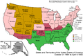 United States 1864-10-1865.png 1,000 × 677; 126 KB
-
 United States 1865-1866.png 1,000 × 677; 112 KB


.jpg)
.png)

_(14574406507).jpg)

