
Category:Maps related to the Beagle conflict
Media in category "Maps related to the Beagle conflict"
The following 70 files are in this category, out of 70 total.
-
-
 1977 Beagle Channel arbitration.svg 1,355 × 772; 1.13 MB
-
 54°S-MP0001298.pdf 4,466 × 3,197; 2.14 MB
-
 55°S-MP0001261.pdf 4,470 × 3,206; 652 KB
-
 Alejandro-Bertrand.jpg 4,570 × 3,386; 1.96 MB
-
 AlgunasIslasAlSurDelCanalBeagle.png 429 × 363; 66 KB
-
 AlgunasIslasAlSurDelCanalBeagleConLímite hu.png 858 × 726; 401 KB
-
 AlgunasIslasAlSurDelCanalBeagleConLímite.png 429 × 363; 44 KB
-
 Anuario.Oficial.Argentina.1912.jpg 2,528 × 3,712; 1.38 MB
-
 Arbitration1898-1902.jpg 4,832 × 3,280; 1.9 MB
-
 Argentina.informe-final-dictadura.1983.png 679 × 532; 128 KB
-
 ArgentinayChile1929.TouringclubitalianoMilano.djvu 3,949 × 6,655; 4.39 MB
-
 Atlante.mondiale.hoepli.1899.jpg 4,080 × 5,361; 3.2 MB
-
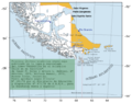
 Beagle conflict.svg 1,355 × 772; 2.29 MB
-
 Cabodehornos.es.png 645 × 503; 164 KB
-
 Carolus.Streit.1913.jpg 4,000 × 3,000; 3.95 MB
-
 Chile.CarlosPrieto.1881.jpg 4,754 × 3,456; 1.93 MB
-
 Chile.Pissis-O-islanavarino.djvu 6,425 × 4,466; 3.99 MB
-
 Conflicto del Beagle entre Argentina y Chile.svg 771 × 419; 1.9 MB
-
 Conflicto del Beagle.svg 1,355 × 772; 1.9 MB
-
 Direccion.general.de.obras.publicas.Chile.jpg 1,500 × 1,184; 339 KB
-
 Douclot-Nolte.1889.jpg 4,944 × 3,576; 2.7 MB
-
 Géographie de la République Argentine-1890.pdf 1,693 × 2,793; 2.48 MB
-
 Headline.clarin.belgrano3.png 482 × 376; 93 KB
-
 Informe-Diego-Barros-Arana.1890.jpg 4,009 × 3,518; 1.34 MB
-
 Kingsaward.1902.jpg 4,816 × 3,470; 2.12 MB
-
 La Cuestion Chilena - NARA - 5675669.jpg 3,045 × 2,299; 7.24 MB
-
 LA2-Blitz-0379.jpg 2,816 × 3,695; 3 MB
-
 Lagrandeencyclopedie.1890.jpg 1,000 × 1,953; 426 KB
-
 LaIlustracionArgentina.jpg 4,635 × 3,576; 2.29 MB
-
 Latzina Map of Argentina 1882.jpg 2,194 × 3,404; 5.84 MB
-
 Latzina1888.jpg 3,190 × 5,403; 3.32 MB
-
 Laudo arbitral de 1977.svg 1,355 × 772; 1.35 MB
-
 Leyenda1.PNG 976 × 669; 872 KB
-
 Londres1888.jpg 4,132 × 2,909; 1.85 MB
-
 Luis.Brackebusch-2.jpg 2,038 × 3,096; 4.69 MB
-
 Luis.Brackebusch.1891.jpg 4,545 × 3,692; 1.86 MB
-
 Magallanes.Ost.png 306 × 411; 29 KB
-
 Map of Argentina by Francisco Latzina, 1882.jpg 1,355 × 2,000; 2.59 MB
-
 Map of South America (Stieler's Hand Atlas, 1889).jpg 4,379 × 6,517; 5.11 MB
-
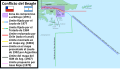
 Map of the Beagle conflict between Argentina & Chile.svg 771 × 419; 1.89 MB
-
 Map.rep.arg.1883.jpg 4,413 × 3,569; 1.94 MB
-
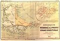
 Mapa Canal del Beagle, 1888.jpg 797 × 418; 119 KB
-
 Mapa Canal del Beagle, 1888.orografico.jpg 1,608 × 928; 467 KB
-
-
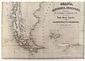
 Mapa de Tierra del Fuego y Malvinas, 1888.jpg 409 × 604; 63 KB
-
 Mapa geográfico de la Repùblica Argentina, 1882.jpg 3,341 × 4,868; 2.07 MB
-

-
 MinisterioDeAgriculturaDeArgentina.1910.jpg 600 × 454; 37 KB
-
 Misiones.Salesianas.1916.jpg 2,392 × 2,739; 994 KB
-
 Moreno-Olascoaga.1886.jpg 4,993 × 2,811; 1.96 MB
-
 MPazSoldan.1888-2xChile.djvu 3,744 × 6,096; 3.72 MB
-
 MPazSoldan.1888-3xChile.djvu 3,689 × 6,042; 4.19 MB
-
 Nuevo mapa de la Republica Argentina (1914).djvu 4,719 × 7,535; 8.57 MB
-
 Nuevo mapa de la Republica Argentina (1914).jpg 4,719 × 7,535; 14.85 MB
-
 Nuevo mapa de la Republica Argentina (1914).png 4,719 × 7,535; 51.97 MB
-
 Oficina.de.demarcacion.Chile.jpg 4,845 × 3,579; 2.17 MB
-
 PazSoldan-Bayer-Block.1887.jpg 4,966 × 3,314; 2.08 MB
-
 PazSoldan.jpg 3,532 × 5,210; 2.87 MB
-
 Pelliza.gif 826 × 836; 133 KB
-
 Regiones.militares.arg.1905.jpg 2,332 × 3,453; 1,003 KB
-
 Seelstrang.1875-full-version.jpg 592 × 1,050; 89 KB
-
 Seelstrang.1875-section.jpg 1,936 × 1,176; 466 KB
-
 Seelstrang.1875.jpg 4,979 × 3,621; 2.49 MB
-
 Seelstrang1886.jpg 4,954 × 3,368; 10.6 MB
-
 Stielers Handatlas 1891 94.jpg 5,100 × 4,450; 5.36 MB
-
 Territorio nac 1962 16-10-2023 20-16-48.jpg 1,067 × 768; 167 KB
-
 Torti.png 887 × 800; 251 KB
-
 Ushuaia.igm.arg.1967.png 866 × 977; 267 KB
-
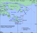
 Ushuaia.igm.arg.1967.svg 824 × 1,052; 16 KB
.jpg)


.jpg)


.jpg)


.jpg)
.png)


